Woodpecker Loop Trail
check with the trail manager for updated details before visiting.
Woodpecker Loop Trail
U.S. Fish and Wildlife Service
Backcountry Trail
- Length
1.1 miles
- Elevation Gain
--
- Route Type
out & back
(1 review)
- Length
1.1 miles - Elevation Gain
-- - Route Type
out & back
This is an excellent trail for bird watching.


Location: William L. Finley National Wildlife Refuge
- States: Oregon
- Counties: Benton
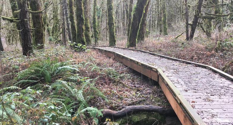
This loop trail begins and ends at the trailhead parking lot. An interpretive brochure for this hike is available at the trailhead. The trail begins in an oak woodland habitat and then climbs slightly to an overlook that allows exceptional views of the Willamette Valley and the Cascade Range. Here you also get a good view of Bald Top, which is a native oak savanna habitat. The trail continues into a forest dominated by Douglas fir. As the trail drops down you start to see mature maples and evidence of past logging. Interpretive signs along the trail provide information about different animals and their habitats. This is an excellent trail for bird watching and is enjoyable in the summertime because most of the trail is under the forest canopy.
Accessibility Information
No text provided.
Reviews
A fine walk
We visited the wildlife refuge on a cold winter day and had a fine time walking the entire woodpecker loop. Portions of the trail were muddy due to recent, heavy rain and poor drainage. Nothing too special about the trail, but a fine walk in a mixed conifer and oak forest. Many nice nearby walking paths for viewing wildlife, too.
Allowed Uses:
Hiking/WalkingOther Activities
- Wildlife viewing / observation
Public Contact
Chantel Jimenez[email protected]
Contact the trail manager for current maps and visiting details.
More Details
- Elevation (low): 350
- Elevation (high): 400
- Elevation (cumulative): --
- Part of a Trail System? No
- Surface (primary): Soil
- Surfaces (additional): --
- Tread Width (average): 60"
- Tread Width (minimum): --
- Running length (minimum): --
- Tread Grade (average, percent): 10
- Tread Grade (maximum): 20
- Running length (maximum): --
- Cross-slope (average, percent): --
- Cross-slope (maximum): --
- Running length (maximum): --
- Certified as an NRT
Jun 3, 2005