Wolf River Greenway Trail
check with the trail manager for updated details before visiting.
Wolf River Greenway Trail
City, Town, or County
Frontcountry Trail
- Length
1.67 miles
- Elevation Gain
--
- Route Type
Loop
- Length
1.67 miles - Elevation Gain
-- - Route Type
Loop
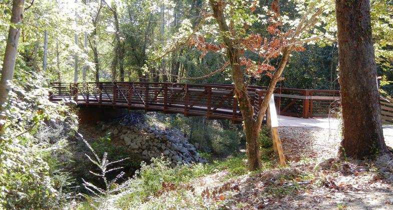
Opened in Dec 2010, the Wolf River Greenway Trail is a 1.67-mile-long paved, accessible trail that parallels the Wolf River. It provides pedestrians and bikers with views of the river and several ponds, ample wildlife, and lush timberlands.
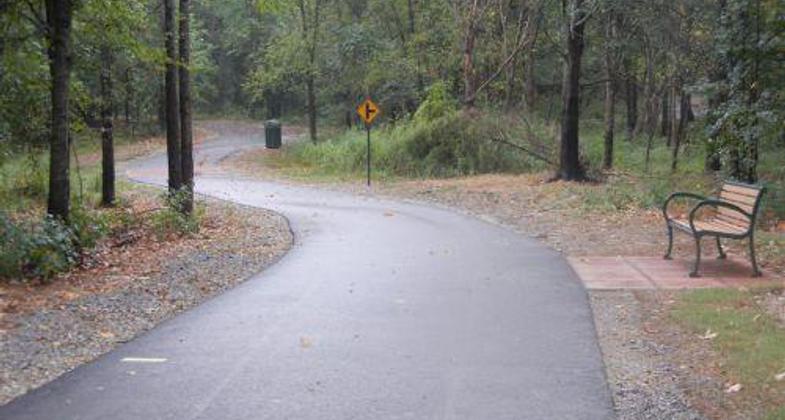
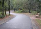
Curve in Trail. Photo by Cathy Justus

MCS Service Project

Solo Biker
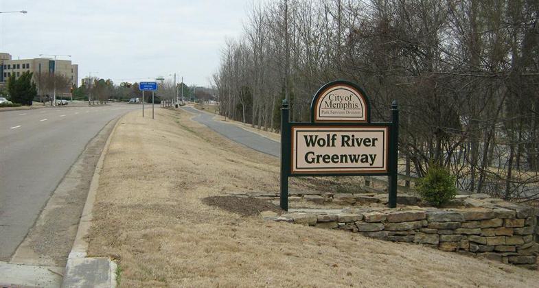
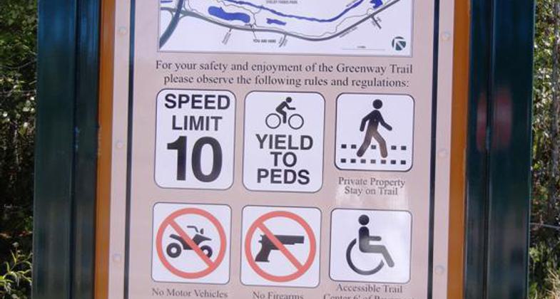
Greenway Sign
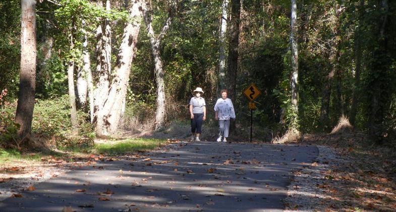
Two Walkers
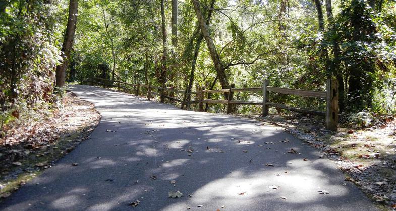
Wood Fence
Small Bridge
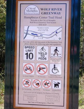
Trailhead Sign
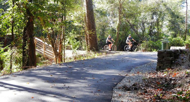
Two Bikers
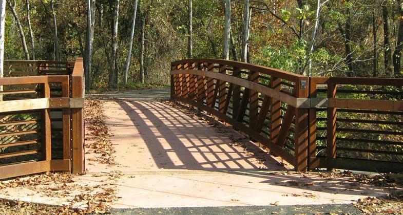
Crossover Bridge
Location: Trail runs along the Wolf River in Eastern Shelby County and is connected to the Lucius Burch Natural Area and Shelby Farms Park via a pedestrian bridge over the Wolf River
- States: Tennessee
- Counties: Shelby
- Cities/Townships: Memphis, Germantown
The Wolf River Greenway Trail is a 1.67-mile-long shaded trail that parallels the Wolf River, offering pedestrians and bikers views of the river and several ponds, ample wildlife, and lush timberlands. The paved trail which opened in December 2010 is accessible for persons with disabilities. The trail is located between the Wolf River and Humphrey's Boulevard from Walnut Grove Rd. to Shady Grove Road. There are two trailheads one located at Walnut Grove and the second along Humphrey's Blvd. The trail connects by way of a pedestrian bridge over the Wolf River with multi-use trails in the 2,900-acre Shelby Farms Park, the 6.5-mile Shelby Farms Greenline, and to adjacent neighborhoods via bike lanes. The trail has been well-received and heavily used by the community. It is enjoyed by walkers, runners, cyclists, rollerbladers, and dog walkers; by neighbors and employees of businesses in the vicinity of the trail, like Baptist Hospital, and by individuals who travel by car and bicycle from outside of the immediate trail and surrounding area to use the facility.
The development of the Wolf River Greenway Trail is a partnership comprised of the City of Memphis Division of Park Services, the Wolf River Conservancy, and the Hyde Family Foundations. The trail is managed by the City of Memphis Division of Park Services. The first trail segment was constructed on land owned by Boyle Investment Company, a locally owned real estate company. The Wolf River Conservancy has used the trail for education classes on the environment and for service projects with Memphis City Schools. On September 24, 2011, the first annual "Dinner on the Greenway" was held with over 300 people enjoying good music and food on a perfect fall evening. The trail was designed by ETI Corporation, a Memphis-based engineering firm, and The Greenway Team from Denver, CO was the consultant. The trail survived two floods one during construction and one in the Spring of 2011 without any significant damage.
The Wolf River runs for 90 miles from Baker's Pond in Benton County, MS thru Fayette and Shelby County, TN. The "Urban" Wolf runs thru the City of Memphis for over 20 miles but most Memphians have never seen the river. The Wolf River Greenway Trail is significant because it's the first place in the City where people can connect with the river in a peaceful, natural setting. Upon its completion, the Wolf River Greenway Trail will extend for 22 miles connecting public greenways and recreational trails for residents and user groups as well as adjoining conservation wetlands and wildlife habitats from the Mississippi River east to Shelby Farms Park.
Accessibility Information
No text provided.
Allowed Uses:
Bicycling Boating, human-powered Dogs, on leash Hiking/WalkingOther Activities
- Wildlife viewing / observation
Public Contact
Keith ColeWolf River Conservancy
PO Box 11031
Memphis, TN 38111
[email protected] • 901-452-6500
Contact the trail manager for current maps and visiting details.
More Details
- Elevation (low): 248
- Elevation (high): 257
- Elevation (cumulative): --
- Part of a Trail System? No
- Surface (primary): Paved
- Surfaces (additional): --
- Tread Width (average): 120"
- Tread Width (minimum): 120
- Running length (minimum): --
- Tread Grade (average, percent): 1
- Tread Grade (maximum): 4
- Running length (maximum): --
- Cross-slope (average, percent): 0
- Cross-slope (maximum): --
- Running length (maximum): --
- Certified as an NRT
May 29, 2012