Wise River Snowmobile Trail
This information is a public record of the 1981 NRT application and may be out of date if it has not been updated by a trail manager --
check with the trail manager for updated details before visiting.
check with the trail manager for updated details before visiting.
Wise River Snowmobile Trail
USDA Forest Service
Backcountry Trail
- Length
23 miles
- Elevation Gain
--
- Route Type
out & back
- Length
23 miles - Elevation Gain
-- - Route Type
out & back
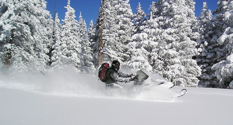
Location: 7 miles south of Wise River, MT. on the Pioneer Mountains National By-way.
- States: Montana
- Counties: Beaverhead
This trail is part of a cooperative operation between Montana Fish, Wildlife and Parks, the Beaverhead Sno-Riders Club of Dillon and the Wise River Jackpine Savages Snowmobile Club. The trail is marked and groomed. Maps are available at the Wise River Ranger District Office or the Dillon Ranger District.
Accessibility Information
No text provided.
Allowed Uses:
Motorized vehicles, snowmobiling Snow, cross-country skiing Snow, snowshoeingOther Activities
- Snow, snow play general
Public Contact
Dale McKinightBeaverhead-Deerlodge National Forest
P.O. Box 100
Wise River, MT 59762
[email protected] • (406) 832-3178
Contact the trail manager for current maps and visiting details.
More Details
- Elevation (low): 7000
- Elevation (high): 7840
- Elevation (cumulative): --
- Part of a Trail System? No
- Surface (primary): Snow or ice
- Surfaces (additional): --
- Tread Width (average): 127"
- Tread Width (minimum): --
- Running length (minimum): --
- Tread Grade (average, percent): 2
- Tread Grade (maximum): 6
- Running length (maximum): --
- Cross-slope (average, percent): --
- Cross-slope (maximum): --
- Running length (maximum): --
- Certified as an NRT
Sep 13, 1981