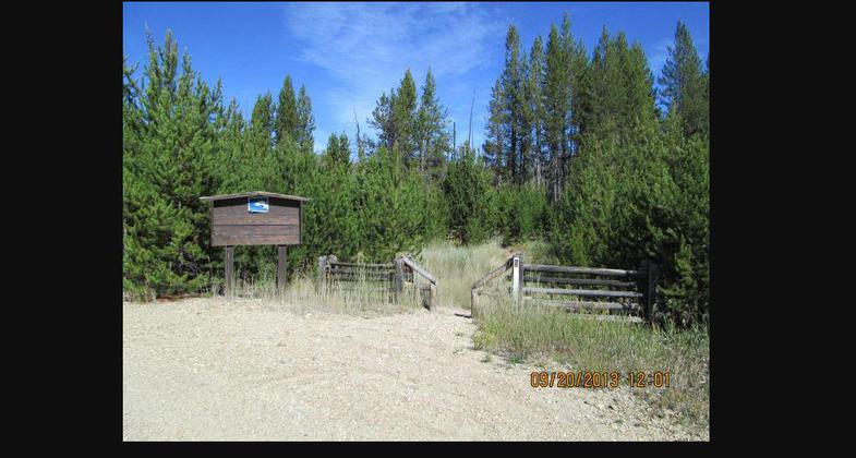
Winom Creek
This information is a public record of the 1979 NRT application and may be out of date if it has not been updated by a trail manager --
check with the trail manager for updated details before visiting.
check with the trail manager for updated details before visiting.
Winom Creek
USDA Forest Service
- Length
4 miles
- Elevation Gain
--
- Route Type
out & back
- Length
4 miles - Elevation Gain
-- - Route Type
out & back
Location: North Fork John Day Ranger District, Umatilla National Forest
- States: Oregon
- Counties: Umatilla
This trail begins at Forest Service Road 52-440 just past the Winom Creek Campground and Trailhead at its junction with Tower Loop Trail #3040 and the beginning of South Winom Creek Trail #3153. The trail is within North Fork John Day Wilderness and travels north for 4.5 miles and ends at Cable Creek Trail #3152.
Accessibility Information
No text provided.
Allowed Uses:
Dogs, on leash Equestrian Hiking/Walking Snow, cross-country skiing Snow, snowshoeingOther Activities
- Camping
- Fishing
- Snow, snow play general
- Wildlife viewing / observation
Public Contact
David GuglielmiUmatilla National Forest
North Fork John Day Ranger District
Ukiah, OR 97880
[email protected] • (541) 427-5326
Contact the trail manager for current maps and visiting details.
More Details
- Elevation (low): 4000
- Elevation (high): 5300
- Elevation (cumulative): --
- Part of a Trail System? No
- National Designations: Wilderness (North Fork John Day)
- Surface (primary): Soil
- Surfaces (additional): Soil
- Tread Width (average): 18"
- Tread Width (minimum): --
- Running length (minimum): --
- Tread Grade (average, percent): 5
- Tread Grade (maximum): 10
- Running length (maximum): --
- Cross-slope (average, percent): --
- Cross-slope (maximum): --
- Running length (maximum): --
- Certified as an NRT
Nov 26, 1979