Window Cliffs Trail
check with the trail manager for updated details before visiting.
Window Cliffs Trail
State
Backcountry Trail
- Length
2.7 miles
- Elevation Gain
--
- Route Type
out & back
- Length
2.7 miles - Elevation Gain
-- - Route Type
out & back
The trail is a 2.7-mile out-and-back trail that traverses through the Cane Creek Gorge to reach some of the most unique rock formations in Tennessee. On this trail, you will need to cross Cane Creek 9 times before being able to ascend to the top of the cliffs where you will get a 360-degree view of the valley. The hike is strenuous at times and water can be fast-moving and deep.
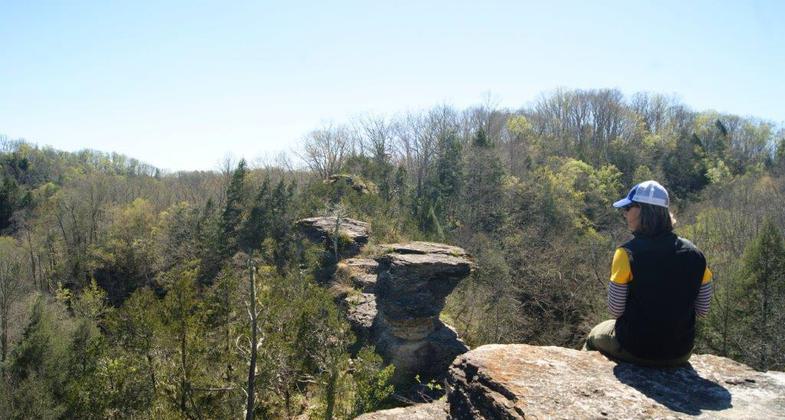
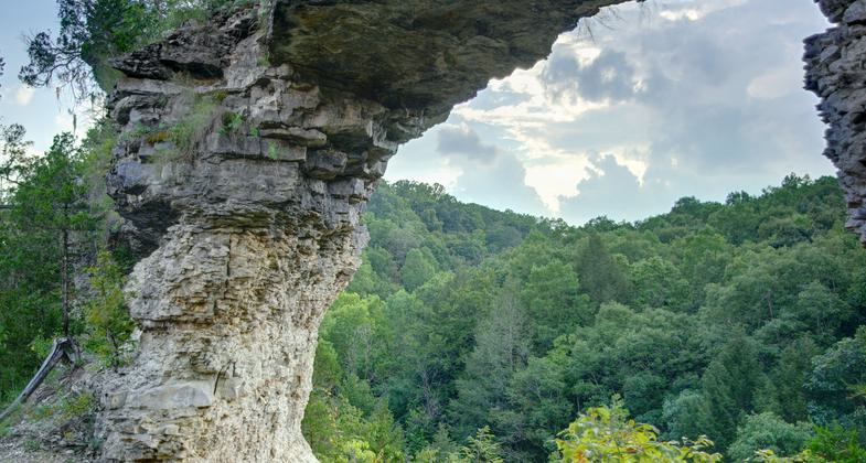
Window Cliffs SNA, Putnam County, Tennessee. Photo by Chuck Sutherland.
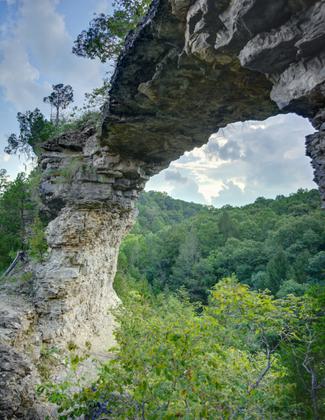
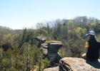
Window Cliffs SNA, Putnam County, Tennessee. Photo by Chuck Sutherland.
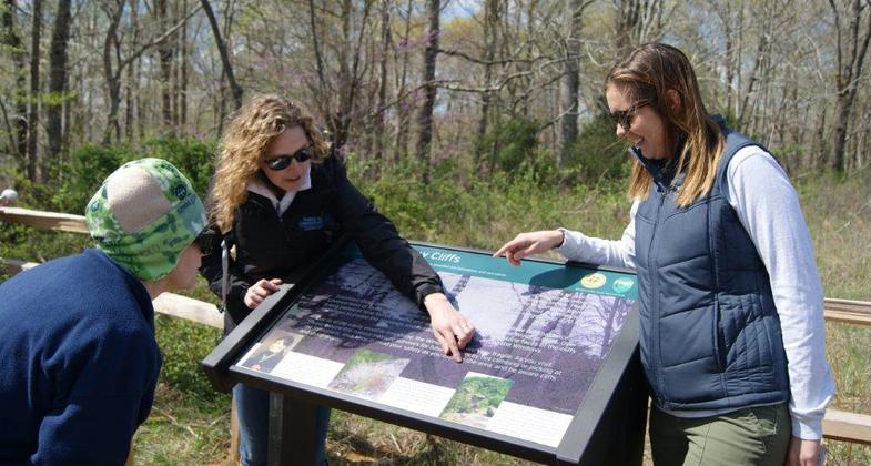
Interpretive sign and map.
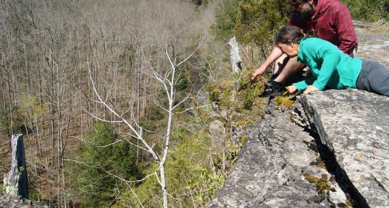
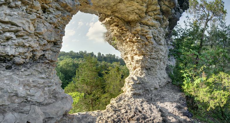
Interpretive Opportunity on top of the Windows.
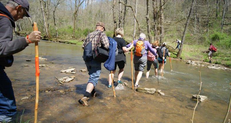
Creek Crossing on Opening Day
Location: Window Cliffs State Natural Area
- States: Tennessee
- Counties: Putnam
- Cities/Townships: N/A
The Window Cliffs Trail is a unique showcase of rare geological features and plant populations placed throughout a challenging but rewarding out-and-back hiking trail. It was first opened to the public as a State Natural Area in April of 2017 but has been popular with local residents for decades. It was first described in the early 19th century by French Naturalist Charles Leseur who named it" Cane Creek Bluff". His sketch of the geologic features referred to as the "windows" is currently displayed in the La Havre Natural History Museum in France. Currently, the trail is a 2.7-mile long out-and-back hike that is open to the public for free 365 days a year, so long as weather is permitting.
The addition of Window Cliffs State Natural Area was made for two reasons: The incredible geologic features found in the Cane Creek gorge, and the rare plants found on those geologic features. At the tightest bend of Cane Creek on the property there is a knife ridge that separates the two sides of the creek. This knife ridge extends 100 feet above the creek banks and forms a thin ridgeline that at the top is less than 10 feet wide. The final vertical 25 feet of this ridgeline is bare limestone with patches of vegetation growing here and there out of cracks and fissures. This limestone ridge is where the Window Cliffs are found. These large "windows" are cut all the way through the ridge, presumably eroded away by past wind and water. The windows can be seen from below at the creek's edge. However, their truly unique beauty does not dawn on a hiker until they reach the culmination of the trail where they are allowed to summit the windows and enjoy the 360-degree view from the top.
The plants found at the cliffs are not just unique to the area but rare to the State of Tennessee. It is home to one of two known locations in the state of the plains muhly grass (Mulenbergia cuspidate), which is a shortgrass prairie species found commonly in the western plains. This species may be a surviving species from times past, though it now only survives on the tops and sides of the windows it can help give a snapshot of the area's vegetative history. In addition to this grass, it is also home to the northern white-cedar tree (Thuja occidentalis). This site is its most western occurrence in the state, and one of the last locations that you can find in the southeast, as it is usually not found outside of sparse populations following the Appalachian Mountains. This tree is found at the base of the cliffs closer to the banks of Cane Creek which bends back on itself sharply at the base of the cliffs.
The trail that ventures out to the window cliffs and back is just over 2.5 miles long and has varied terrain between its start and end. It begins in an old farm field where there is ample trailhead parking and a visitor information kiosk. From the parking area, the trail meanders through a brushy grassland until it meets the woodline, where it begins to move down into the Cane Creek Gorge. The trail moves through a few short switchbacks as it descends into the valley. As the trail meets the bottom of the gorge, hikers encounter Cane Creek for the first time at one of its deepest crossings. Hikers continue on down the trail that winds through the valley as it crosses Cane Creek 8 more times. These crossings can vary between ankle and knee deep during normal weather, but at times can be complete try and at others may be impassable due to seasonal rains. When crossing the final water crossing hikers will notice a waterfall that is over 30 feet tall with a deep pool that is large enough for swimming for a few people. Past the waterfall, the ascent begins up to the window cliffs formation. The trail works its way up the ridge side until rock shelves are met. At this point, visitors may enjoy the view from the rock's edge, or for the ultimate experience they can pull themselves up onto the top of the windows for incredible views of the surrounding gorge. The top of the cliffs makes for a great place for a meal or a snack before returning to the trail and beginning the hike back to the trailhead.
Through property planning and community engagement, we have been able to build a trail that attracts visitors from far and wide to see the incredible things that Window Cliffs State Natural Area has to offer. Our adherence to safety through trail design, signage, and ranger patrols has helped to make this not only a great adventure for guests but one where they can be confident they can get help if it is needed. With Emergency plans and access routes in place our staff is able to respond to any situations should they arise, this includes early and appropriate closures due to weather to prevent any dangerous high water situations when visitors are present. Through our continued management of the site, we hope to preserve it in perpetuity for generations to come.
Accessibility Information
No text provided.
Allowed Uses:
Swimming Hiking/WalkingOther Activities
- Wildlife viewing / observation
Public Contact
Michael MeisterTennessee State Parks
312 Rosa L. Parks Avenue
Nashville, TN 37243
[email protected] • (615) 854-4472
Contact the trail manager for current maps and visiting details.
More Details
- Elevation (low): 660
- Elevation (high): 990
- Elevation (cumulative): --
- Part of a Trail System? No
- Surface (primary): Soil
- Surfaces (additional): Grass or Vegetation, Rock, boulders, Rock, crushed, Rock, smooth, Soil, Water, slow moving
- Tread Width (average): 24"
- Tread Width (minimum): 18
- Running length (minimum): --
- Tread Grade (average, percent): 6
- Tread Grade (maximum): 20
- Running length (maximum): --
- Cross-slope (average, percent): 5
- Cross-slope (maximum): --
- Running length (maximum): --
- Certified as an NRT
Oct 23, 2020