Wind Creek State Park Trail System
check with the trail manager for updated details before visiting.
Wind Creek State Park Trail System
State
Backcountry Trail
- Length
5.8 miles
- Elevation Gain
--
- Route Type
Loop
- Length
5.8 miles - Elevation Gain
-- - Route Type
Loop
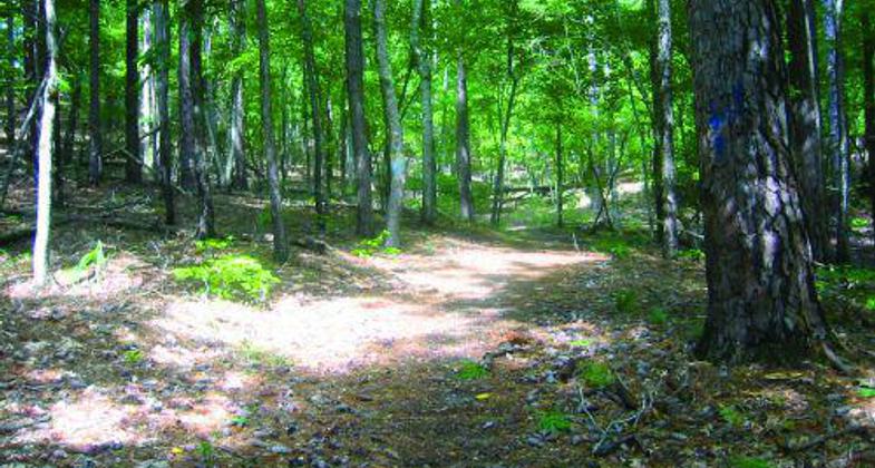
At Wind Creek State Park, two hiking trails offer our guests everything from the beauty of wildflowers and blooming dogwood to white-tailed deer. The trails wind over hardwood ridges and through tall pines down the shoreline, offering spectacular views of Lake Martin. There is also a horse trail, offering riders a scenic view through the hardwoods and tall pines.

Location: Natural surface trail system covering 15.8 miles within Wind Creek State Park near Alexander City, AL, on Lake Martin in
- States: Alabama
- Counties: Tallapoosa
Wind Creek State Park spans 1,445 acres along the shores of scenic Lake Martin, a 41,000-acre clear-water reservoir perfect for fishing, swimming, and boating. Wind Creek boasts the largest state-operated campground in the United States with 626 sites. One hundred eighty-seven sites are waterfront, allowing for fishing, swimming, and boating. Other facilities include a marina, camp store, fishing pier, hiking trails, playground, and picnic areas with tables, grills, and shelters. There are bathhouses throughout the campgrounds and facilities for laundry. Seven camping cabins are now open to the public.
At Wind Creek State Park, two hiking trails offer our guests everything from the beauty of wildflowers and blooming dogwood to white-tailed deer. The trails wind over hardwood ridges and through tall pines down the shoreline, offering spectacular views of Lake Martin. There is also a horse trail, offering riders a scenic view through the hardwoods and tall pines.
Campfire Trail
This trail begins and ends in the northern section of the park. Rated primarily moderate with several steep areas, this trail is approximately 1.8 miles in length and marked by a yellow trail blaze. The three connectors, blue, white, and orange, are approximately 1/5 mile each. During the spring, white dogwood, buckeye, and oak leaf-hydrangea paint the hardwood ridges with brilliant color. This trail traverses both mixed hardwood forest and intermittent pine. Midway up the trail, a series of rock outcroppings occur bordered by an abundance of ferns. Toward the end of the trail, a small stream bisects the path leading south.
Alabama Reunion Trail
This moderate to difficult trail is approximately 3.8 miles in length and traverses both hardwood bottoms and pine forests. The trail is bisected by Highway 128 and marked with red blaze its entire length. The trail is actually a loop with its beginning and end in close proximity. Several natural features can be noted, which include an old home site on the northern half, picturesque hardwood bottoms, stands of pine, beds of fern, and an abundance of bird and animal life. The North Side is approximately 1.95 miles and the South Side is 1.8 miles.
Jeff Reed Horse Trail
Approximately 10 miles long offering multiple views of wildlife, the Jeff Reed Horse Trail takes riders through a vast forest of mixed hardwood, pines, and ferns, along a stream and views of Lake Martin. For visitors that are horse camping, an additional 16 camping sites are available in our overflow area. Please call and check for overnight availability.
Accessibility Information
No text provided.
Allowed Uses:
Swimming Dogs, on leash Equestrian Hiking/WalkingOther Activities
- Wildlife viewing / observation
Public Contact
Jimmy ShiversCity of Alexander City
4325 Alabama Highway 128
Alexander City, AL 35010
[email protected] • (256) 329-0845
Contact the trail manager for current maps and visiting details.
More Details
- Elevation (low): 432
- Elevation (high): 566
- Elevation (cumulative): --
- Part of a Trail System? No
- Surface (primary): Soil
- Surfaces (additional): Rock, crushed, Soil
- Tread Width (average): 48"
- Tread Width (minimum): 24
- Running length (minimum): --
- Tread Grade (average, percent): 10
- Tread Grade (maximum): 20
- Running length (maximum): --
- Cross-slope (average, percent): 10
- Cross-slope (maximum): --
- Running length (maximum): --
- Certified as an NRT
May 19, 2011