William Pogue
check with the trail manager for updated details before visiting.
William Pogue
USDA Forest Service
Backcountry Trail
- Length
18 miles
- Elevation Gain
--
- Route Type
out & back
- Length
18 miles - Elevation Gain
-- - Route Type
out & back
Location: Boise National Forest
- States: Idaho
- Counties: Elmore
NOTE: a significant portion of this trial has been closed due to storm damage. Before hiking, check with the BOISE NATIONAL FOREST for updated information.
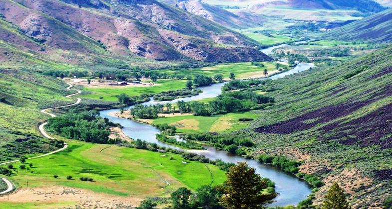
The trail crosses through Sheep Creek Roadless Area, about 60,000 acres of land which lies in the Sheep Creek and Roaring River drainages). The lower elevations consist of grasses and scattered stands of ponderosa pine and cottonwood. As the trail winds higher, Douglas fir and sub-alpine fir species become dominant. The trail passes through areas rich in wildlife. The visitor might see mule deer, black bears, elk, mountain lions, and several species of game birds. The trail follows Sheep Creek for a number of miles and along the way, there are scenic vistas and dramatic rock formations. The lower end of this trail opens in April and is a popular spring outing. Portions of the trail were burned during the 1992 Foothills fire. The William Pogue Trail was severely damaged due to this fire and repair work to the trail is still ongoing.
Accessibility Information
No text provided.
Allowed Uses:
Bicycling Dogs, on leash Equestrian Motorized vehicles, motorcycling Motorized vehicles, snowmobiling Snow, cross-country skiing Snow, snowshoeingOther Activities
- Camping
- Snow, snow play general
- Wildlife viewing / observation
Public Contact
Mountain Home Ranger District3080 Industrial Way
Mountain Home, ID 83647
(208) 587-7961
www.fs.usda.gov/recarea/boise/recarea/?recid=5028
Contact the trail manager for current maps and visiting details.
More Details
- Elevation (low): 3400
- Elevation (high): 6700
- Elevation (cumulative): --
- Part of a Trail System? No
- Surface (primary): Soil
- Surfaces (additional): Soil
- Tread Width (average): 20"
- Tread Width (minimum): --
- Running length (minimum): --
- Tread Grade (average, percent): 15
- Tread Grade (maximum): 30
- Running length (maximum): --
- Cross-slope (average, percent): --
- Cross-slope (maximum): --
- Running length (maximum): --
- Certified as an NRT
Sep 13, 1979