William Bartram Trail
This information is a public record of the 1977 NRT application and may be out of date if it has not been updated by a trail manager --
check with the trail manager for updated details before visiting.
check with the trail manager for updated details before visiting.
William Bartram Trail
USDA Forest Service
Backcountry Trail
Frontcountry Trail
- Length
37 miles
- Elevation Gain
--
- Route Type
out & back
- Length
37 miles - Elevation Gain
-- - Route Type
out & back

Location: Chattahoochee-Oconee National Forest
- States: Georgia
- Counties: Rabun
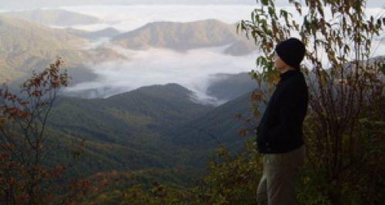
Follows a ridge line to Rabun Bald Mt., along the Tennessee Valley Divide (beautiful views of surrounding Blue Ridge Mts.) then takes side of creeks, along the wild and scenic designated Chattooga River.
Accessibility Information
No text provided.
Allowed Uses:
Dogs, on leash Hiking/WalkingOther Activities
- Camping
Public Contact
Allen SmithChattahoochee-Oconee National Forest
P.O. Box 438
Clayton, GA 30525
[email protected] • (706) 782-3320
www.fs.fed.us/conf
Contact the trail manager for current maps and visiting details.
More Details
- Elevation (low): 3280
- Elevation (high): 4692
- Elevation (cumulative): --
- Part of a Trail System? No
- Surface (primary): Soil
- Surfaces (additional): Soil
- Tread Width (average): 16"
- Tread Width (minimum): --
- Running length (minimum): --
- Tread Grade (average, percent): 12
- Tread Grade (maximum): 20
- Running length (maximum): --
- Cross-slope (average, percent): --
- Cross-slope (maximum): --
- Running length (maximum): --
- Certified as an NRT
Nov 22, 1977