Wildwood Pathway
This information is a public record of the 1980 NRT application and may be out of date if it has not been updated by a trail manager --
check with the trail manager for updated details before visiting.
check with the trail manager for updated details before visiting.
Wildwood Pathway
City, Town, or County
Backcountry Trail
- Length
2.8 miles
- Elevation Gain
--
- Route Type
out & back
- Length
2.8 miles - Elevation Gain
-- - Route Type
out & back

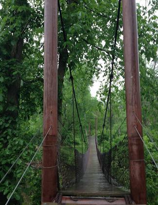
Swinging Bridge at Deerfield Nature Park. Photo by Carol Cushman.
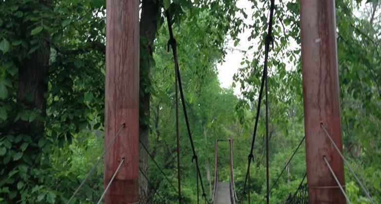
Swinging bridge in the nature park. Photo by Isabella Parks and Rec.
Location: Rural
- States: Michigan
Located in 590-acre Deerfield Nature Park - a small part of a 7-mile trail system with two swinging bridges, a covered bridge, and 2 miles of river frontage on the Chippewa River.
Accessibility Information
No text provided.
Allowed Uses:
Bicycling Boating, human-powered Swimming Dogs, on leash Hiking/WalkingOther Activities
- Camping
- Fishing
- Snow, snow play general
Public Contact
Isabella Parks and Recreation Department200 North Main
Mt. Pleasant, MI 48858
(517) 772-0911 ext. 2
Contact the trail manager for current maps and visiting details.
More Details
- Elevation (low): --
- Elevation (high): --
- Elevation (cumulative): --
- Part of a Trail System? No
- Surface (primary): --
- Surfaces (additional): --
- Tread Width (average): 72"
- Tread Width (minimum): --
- Running length (minimum): --
- Tread Grade (average, percent): --
- Tread Grade (maximum):
- Running length (maximum): --
- Cross-slope (average, percent): --
- Cross-slope (maximum): --
- Running length (maximum): --
- Certified as an NRT
Oct 8, 1980