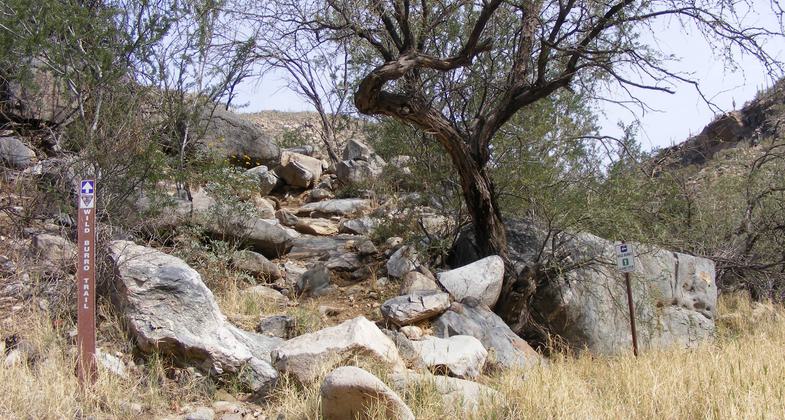
Wild Burro Trail
check with the trail manager for updated details before visiting.
Wild Burro Trail
City, Town, or County
Backcountry Trail
- Length
6.3 miles
- Elevation Gain
--
- Route Type
out & back
- Length
6.3 miles - Elevation Gain
-- - Route Type
out & back
The Wild Burro Trail is the gateway to the Tortolita Mountains Trail system. The trail is 6.3 miles long with access to 29 miles of connecting trails within the system. It is a meandering trail mostly through the canyon with one steep ascent. Wild Burro Trail offers amazing views, historical sites, Cottonwood trees, crested saguaros, beautiful wildflowers, and the opportunity to observe birds, reptiles, and mammals unique to the Sonoran desert.
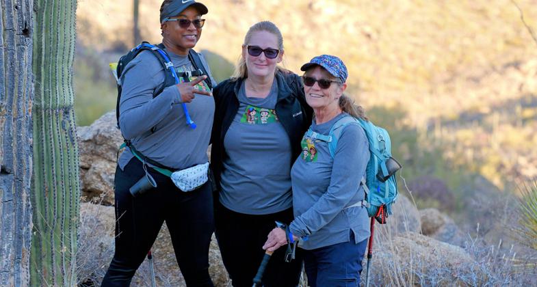
2025 Photo Contest Winner - Hiking and Walking Category. Photo by Jason Grodman

Hiking the Wild Burro Trail

Hiking the Wild Burro Trail - Marana Arizona

Hikers on the Wild Burro Trail

Cush Cayton Cabin at Wild Burro Trail


Location: Tortolita Mountain range within Marana Arizona
- States: Arizona
- Counties: Pima
- Cities/Townships: Marana
Historically the presence of the Hohokam (550 to 1450 A.D.) is evident with the existence of mortar holes, pottery shards, and arrowheads. Petroglyphs dating between 1100 and 1450 A.D. are pecked into rock throughout the range. The first Europeans in the canyon were Spanish adventures seeking precious metals. The mining boom took off in the 1860's miners flocked to the area bringing horses and burros. Some of which escaped or were left to become feral in the area - hence the canyon's name. Homesteaders occupied the canyon, the most colorful being Thomas Jeffords from 1892 to 1914. He was a Blood Brother of Apache leader Cochise and the tribe's first Indian agent. During the Territorial Period (1854 and 1912) the land was open space. Ranchers ran cattle from Oro Valley to Red Rock and those cattle ranged into the Tortolita's. In the 1930s several families took advantage of the revised Homestead Act of 1862. They raised primarily cattle but some had goats and horses as well. Remains of their buildings and water tanks are present. Currently, the Martin and Carpenter Ranches are still active and running cattle.
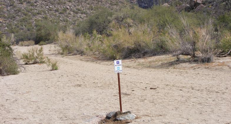
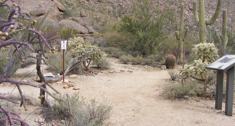
Wild Burro Trail heads north on a graded dirt path for .5 miles, weaving in and out of the nearby wash; you will encounter a kiosk and sign-in station as you continue north on the west side of a sandy wash. The trail gets slightly more rugged as you veer west up the side of the canyon near the ruins of a stone house and water basin that was once used by cattle ranchers. After which, you begin a steep climb. This is the only strenuous climbing on the entire trail. Once you reach the top, there is a dramatic dry waterfall, a large cottonwood tree, and the Alamo Spring well. The remains of another dwelling are viewable behind and to the west of this area. The view from the overlook is impressive. Past Alamo Spring well another 2.3 miles of trail leads to a water tank, windmill, and goat corral near the Pinal County line.
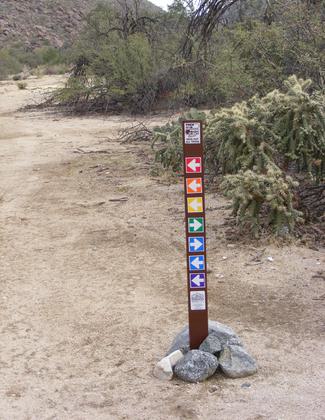
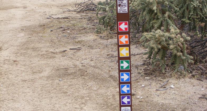
The trails of the Tortolita's construction started in 2004 in a cooperative venture by the Town of Marana, Pima County, and the Arizona State Land Development. Expansion of the system continues today. The trailhead was completed in 2012 offering hikers a stabilized 40-space parking lot, restrooms, drinking fountain, benches, shaded ramada, and table. Local Artist Robin Riley created the photogenic trail entrance "Guests of Nature" which includes two giant cairns made with 55,000 pounds of boulders (granite, azurite), the small stack of approx. 9' high and the large stack is approx. 12' high). The path approaching the wash from the trailhead was an Eagle Scout project. One unique feature of the trail system is that the trails are color coordinated - as such the sign arrows and map line are the same color. Wild Burro trail is purple. The Town of Marana Parks and Recreation Department utilizes the trails for monthly guided hikes (September to May) and special events. The trailhead is located within the property of the Ritz Carlton of Dove Mountain so the resort has guided hikes for guests as well. To date, we have registered visitors from 50 states and 15 countries.
The Tortolitas are located in the Basin and Range Physiographic Province and are part of the metamorphic core complex. Common rocks, hikers will encounter on the trail are 600 million years old or older, metamorphosed granite, as well as younger and harder granites. The Tortolita's support some 600 species of plants including various species of cholla, prickly pear, hedgehog, and barrel cacti. Trees in the range include cottonwood, palo verde, ironwood, and mesquite. Other plants include ocotillo, yucca, sotol, jojoba, bursage, agave, and creosote bush. In the spring the ochre and prickly green landscape will flush with annual and perennial wildflowers" from purple lupine and blue larkspurs pink penstemon, gold poppies, and more. Thousands of species of invertebrates, two species of amphibian, several dozen species of reptiles and 200+ species of resident and migratory birds, and several dozen species of mammals reside in the Tortolita. Some notable creatures include Javelina, Bobcats, Gila Monsters, Jack Rabbits, Desert Tortoise, and Harris Hawks.
Accessibility Information
No text provided.
Allowed Uses:
Bicycling Dogs, on leash EquestrianOther Activities
- Heritage and history
- Wildlife viewing / observation
Public Contact
Jennifer WardTown of Marana -Parks and Recreation
11555 W. Civic Center Dr
Marana, AZ 85653
[email protected] • (520)382-1950
Contact the trail manager for current maps and visiting details.
More Details
- Elevation (low): 2780
- Elevation (high): 3840
- Elevation (cumulative): --
- Part of a Trail System? No
- State Designations: Arizona State Trail System
- Surface (primary): Rock, boulders
- Surfaces (additional): Rock, boulders, Sand, Soil, Soil with stabilizer
- Tread Width (average): 36"
- Tread Width (minimum): 24
- Running length (minimum): --
- Tread Grade (average, percent): 3
- Tread Grade (maximum): 3
- Running length (maximum): --
- Cross-slope (average, percent): 2
- Cross-slope (maximum): --
- Running length (maximum): --
- Certified as an NRT
Jun 2, 2014