Weston and Gauley Bridge Turnpike
check with the trail manager for updated details before visiting.
Weston and Gauley Bridge Turnpike
U.S. Corps of Engineers
- Length
10 miles
- Elevation Gain
--
- Route Type
out & back
- Length
10 miles - Elevation Gain
-- - Route Type
out & back
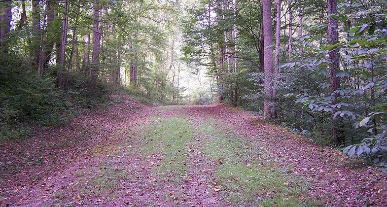
Weston and Gauley Bridge Turnpike Trail is a 10-mile trail located in Braxton County, West Virginia within the Gauley River National Recreation Area.

Location: Access at Bullstown Hist. Area & Millstone Run Parking Area.
- States: West Virginia
- Counties: Braxton
Weston and Gauley Bridge Turnpike is a historic turnpike located at Burnsville, Braxton County, West Virginia. It is a 10-mile long section of trail, approximately 20 feet in width, with an unpaved surface. It is administered by the Army Corps of Engineers. The route was built starting in 1847 to provide access to Sutton for transport of product to grist mills and sawmills and provided access to the Bulltown sawmills. During the American Civil War, the turnpike was used in 1861 by Union troops to move to take control of western Virginia. It was also critical in the movement of troops during the Battle of Bulltown on October 13, 1863. It was listed on the National Register of Historic Places in 1995.
Accessibility Information
No text provided.
Allowed Uses:
Hiking/WalkingPublic Contact
US Army Corps of EngineersBurnsville Lake
Burnsville Lake, WV 26335
[email protected] • (304) 853-2371
Contact the trail manager for current maps and visiting details.
More Details
- Elevation (low): --
- Elevation (high): --
- Elevation (cumulative): --
- Part of a Trail System? No
- National Designations: National Register of Historic Places
- Surface (primary): Grass or Vegetation
- Surfaces (additional): Grass or Vegetation, Soil
- Tread Width (average): 127"
- Tread Width (minimum): --
- Running length (minimum): --
- Tread Grade (average, percent): 23
- Tread Grade (maximum): 50
- Running length (maximum): --
- Cross-slope (average, percent): --
- Cross-slope (maximum): --
- Running length (maximum): --
- Certified as an NRT
May 30, 2001