West Penn Trail
check with the trail manager for updated details before visiting.
West Penn Trail
Nonprofit
Backcountry Trail
Rail Trail
Urban Trail
- Length
17 miles
- Elevation Gain
--
- Route Type
out & back
- Length
17 miles - Elevation Gain
-- - Route Type
out & back
The West Penn Trail is a 17-mile rail trail between the Westinghouse trailhead near Blairsville and Saltsburg. The trail crosses historic bridges and travels through woods, climbing some steep grades before arriving back on a level rail trail along the Conemaugh River to Saltsburg, where it follows the historic path of the Main Line Canal through Saltsburg's National Historic District to the site of Blacklegstown.
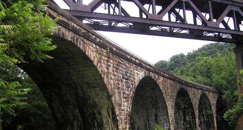
Bridge #4 at the Bow Ridge section of the trail. Photo by Clare Kaczmarek.
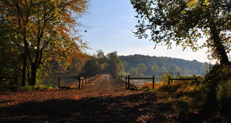
West Penn Trail follows the Conemaugh River from near Blairsville to Saltsburgh, PA. Photo by Mary Shaw
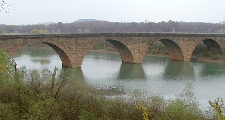
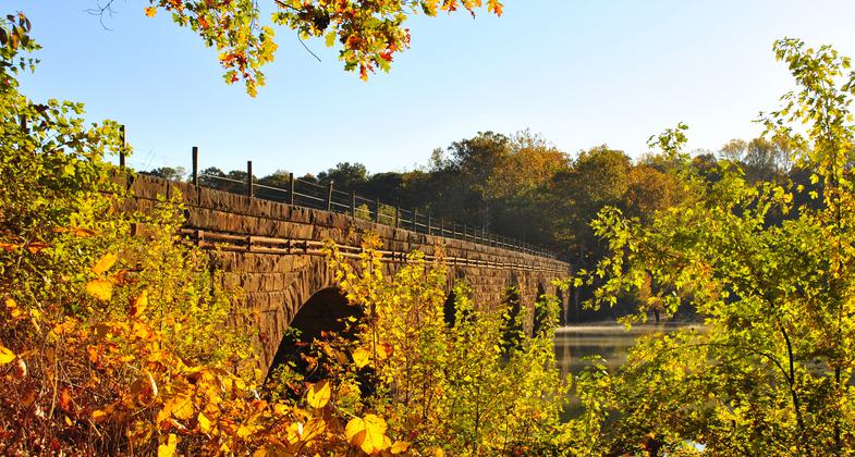
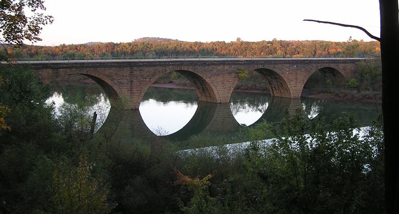
Stone Arches over Conamaugh Lake. Photo by Mary Shaw.
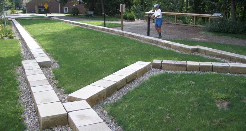
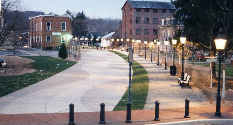
A park in Saltsburg shows where one of the canal locks once was. Photo by Mary Shaw.
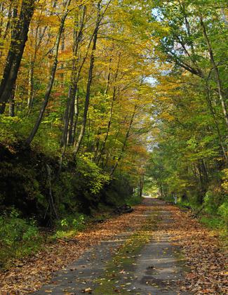
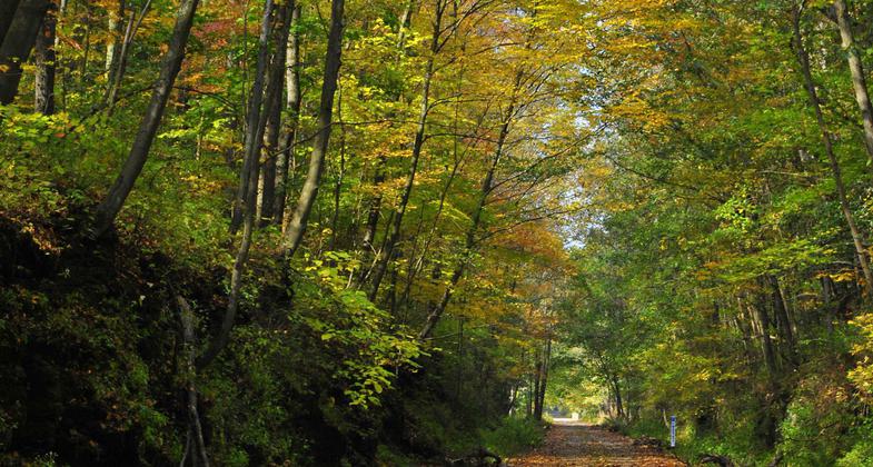
West Penn Trail path. Photo by Clare Kaczmarek.
Bridge #2, Bow Ridge Section. Photo by Clare Kaczmarek.
Bridge #3, also at the Bow Ridge Section. Photo by Clare Kaczmarek.
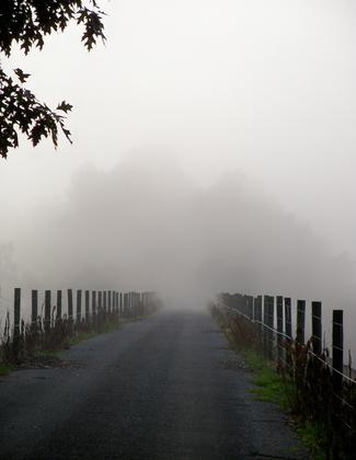
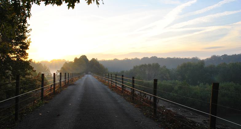
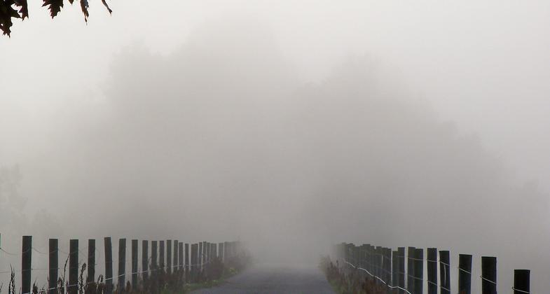
Fog on Bridge 5, Bow Ridge. Photo by Clare Kaczmarek.
Historic stone arch railroad bridge.
The West Penn Trail follows history.
Location: Southwestern Pennsylvania; trailheads at Saltsburg, the Conemaugh Dam, and Livermore.
- States: Pennsylvania
- Counties: Indiana, Westmoreland
- Cities/Townships: Saltsburg Borough, Conemaugh, Black Lick and Derry Townships
The 17-mile West Penn Trail extends from its eastern terminus at Newport Road near Blairsville, over Bow Ridge and past the Conemaugh Dam, through Saltsburg, and on to the site of Blacklegstown, once a Shawnee and Delaware village just down the Kiskiminetas River from Saltsburg. A key section of the Pittsburgh-To-Harrisburg Main Line Canal Greenway the trail follows the alignment of the historic Pennsylvania Main Line Canal for much of its length.
The West Penn Trail offers a unique hiking and biking experience, with several miles of hills and grade changes sandwiched by two sections of rail- trail. The middle portions, Bow Ridge and Dick Mayer sections are an attraction for those seeking a challenging outing, while the rail-trail sections offer an even surface for a more relaxing experience.
Here is a description of each section:
Conemaugh River Lake Section (4.5 miles)
The 4.5-mile trail section extends from Newport Road near Blairsville, across the Q-Span Pedestrian Bridge, and ultimately to the Bow Ridge Tunnel and switchback section of the trail. The trail follows a portion of the Pennsylvania Railroad line that operated along the corridor in the first half of the 19th Century. This section also passes over four spectacular stone arch bridges built in 1907 which offer beautiful views of the route of the Pennsylvania Main Line Canal, which operated in the 1800s.
Bow Ridge Switchback to Conemaugh River Lake (2 miles)
The Bow Ridge Switchback is located at the western end of the West Penn Trail's Conemaugh River Lake section at the old railroad tunnel entrance. A switchback trail has been constructed up the face of Bow Ridge. The switchback grade may be challenging if climbing instead of descending. From the top of the Ridge, the trail proceeds down to the Conemaugh Dam hydropower plant, past two old railroad tunnel entrances from the 1800s, crosses a bridge, and proceeds down to the Tunnelton Main Line Canal Park. Then it's a short trip up the hill to the Conemaugh River Lake Recreation Area featuring a picnic area and playground, visitors center, nature trail, and impressive views of the Conemaugh Dam itself.
West Penn Trail Dick Mayer Section (2 miles)
A trail link between the Conemaugh River Lake and Saltsburg Sections of the West Penn Trail was formally dedicated in the Spring of 2007, and named in honor of former Conemaugh Valley Conservancy President Dick Mayer. The grade along this section can be occasionally challenging, but the trail is not a single track so it is easier to navigate than a typical mountain bike trail.
West Penn Trail-Saltsburg Section (4.5 miles)
The Saltsburg Section proceeds 4.5 miles from the intersection of the Mayer Section into Saltsburg. This section passes through beautiful backwoods that contain visible canal and railroad remnants that hug the Conemaugh River.
Saltsburg to Kiski Section Connection
From the Saltsburg trailhead, the trail extends through Saltsburg's Canal Park and under the Route 286 bridge to the Kiski Section Trailhead.
Kiski Extension
Saltsburg to Blacklegs Creek & Beyond (2 miles). The section proceeds from Saltsburg's Canal Park to Blacklegs Creek where a bridge extends the trail another mile downriver.
Accessibility Information
No text provided.
Allowed Uses:
Bicycling Dogs, on leash Equestrian Hiking/Walking Snow, cross-country skiingOther Activities
- Fishing
- Hunting
- Snow, snow play general
- Wildlife viewing / observation
Public Contact
Jack MaguireConemaugh Valley Conservancy
P.o. Box 502
Hollsopple, PA 15903
(814) 479-7162
www.conemaughvalleyconservancy.org
Contact the trail manager for current maps and visiting details.
More Details
- Elevation (low): 845
- Elevation (high): 1200
- Elevation (cumulative): --
- Part of a Trail System? No
- National Designations: Millenium Legacy Trail
- Surface (primary): Rock, crushed
- Surfaces (additional): --
- Tread Width (average): 96"
- Tread Width (minimum): 36
- Running length (minimum): --
- Tread Grade (average, percent): 2
- Tread Grade (maximum): 12
- Running length (maximum): --
- Cross-slope (average, percent): --
- Cross-slope (maximum): --
- Running length (maximum): --
- Certified as an NRT
May 25, 2009