West Fork Trail
This information is a public record of the 1980 NRT application and may be out of date if it has not been updated by a trail manager --
check with the trail manager for updated details before visiting.
check with the trail manager for updated details before visiting.
West Fork Trail
USDA Forest Service
- Length
6.7 miles
- Elevation Gain
--
- Route Type
out & back
- Length
6.7 miles - Elevation Gain
-- - Route Type
out & back

Location: N of Pasadena in the Angeles NF off SR 39.
- States: California
- Counties: Los Angeles
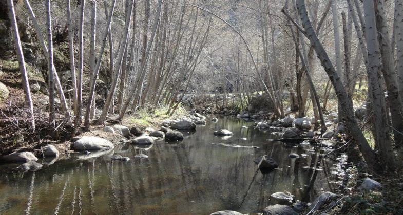
The West Fork of the San Gabriel River is 8 miles above Azusa in the mountains. This trail is a service road that starts from the Highway 39 West Fork bridge and heads 6.5 miles west to a small campground, gaining 450 feet elevation in the process. Just past the campground, the trail rapidly becomes quite steep and eventually reaches the top of the Cogswell Dam. Several trails branch out from that point including the short Devil's Canyon segment and the long continuation of this trail ending at Red Box ranger station, just South of Mount Disappointment.
Accessibility Information
No text provided.
Allowed Uses:
Hiking/WalkingPublic Contact
Jerry SirskiUS Forest Service
110 N. Wabash Ave.
Glendora, CA 91741
[email protected] • (626) 335-1251
Contact the trail manager for current maps and visiting details.
More Details
- Elevation (low): 1600
- Elevation (high): 2385
- Elevation (cumulative): --
- Part of a Trail System? No
- National Designations: National Millenium
- Surface (primary): Paved
- Surfaces (additional): Paved
- Tread Width (average): 120"
- Tread Width (minimum): --
- Running length (minimum): --
- Tread Grade (average, percent): 2
- Tread Grade (maximum): 4
- Running length (maximum): --
- Cross-slope (average, percent): --
- Cross-slope (maximum): --
- Running length (maximum): --
- Certified as an NRT
Dec 3, 1980