Washington and Old Dominion Trail
check with the trail manager for updated details before visiting.
Washington and Old Dominion Trail
City, Town, or County
Rail Trail
- Length
45 miles
- Elevation Gain
--
- Route Type
out & back
(2 reviews)
- Length
45 miles - Elevation Gain
-- - Route Type
out & back
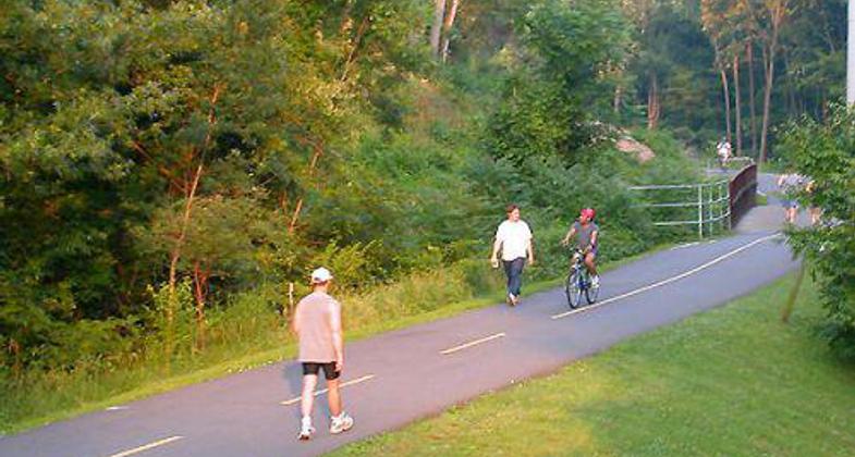
Washington and Old Dominion rail trail in Arlington, Virginia (June 7, 2004).


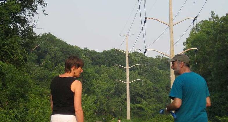
Walking the dog on the W&OD with Christie and Steve. Photo by Stuart Macdonald.

Sunset on the W&OD. Photo by Stuart Macdonald.

Location: Suburban
- States: Virginia
- Counties: Loudoun
The 100-foot-wide Washington and Old Dominion Railroad Regional Park (W&OD) is one of the skinniest parks in the commonwealth of Virginia, but also one of the longest - 45 miles in length. The W&OD takes its name from the railroad whose trains ran along the right-of-way from 1859 until 1968. The entrepreneurs who founded the rail line dreamed of bringing coal and other riches from the Appalachians to the Port of Alexandria, but those dreams were never fully realized. Less than a decade after it was built, the railroad was almost destroyed during the Civil War.
After the war, the railroad was slowly rebuilt and then saw a series of changes in ownership and objectives. The heyday of the W&OD came early in the 20th Century, when it provided service three times daily from Alexandria to Falls Church, Leesburg, and Purcellville, with stops at such hamlets as Dunn Loring, Hunter Station, and Paeonian Springs.
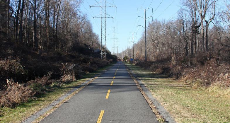
When the W&OD ceased operations in 1968, the Virginia Electric and Power Company (VEPCO, now Virginia Power) bought the right-of-way for its electric power transmission lines. The Northern Virginia Regional Park Authority tried for years to acquire the use of the railroad right-of-way. An agreement was finally reached in 1977 for NVRPA to purchase the right-of-way in stages. The purchase was completed in 1982.
The first segment of the W&OD Trail was opened in 1974 within the City of Falls Church. This portion was built as the result of a special agreement with VEPCO under which the Regional Park Authority was allowed to judge whether a trail of this sort would prove to be popular. It did, and so, after the property was purchased, the trail was built in sections until its completion to Purcellville in 1988. Trail users today may enjoy 45 miles of asphalt trail and 32.5 miles of crushed stone and dirt bridle paths. In 1987, the W&OD was designated a National Recreation Trail by the U.S. Department of the Interior.
Accessibility Information
No text provided.
Reviews
Mike Calabrese
Various Ways & Places to Hike the W&OD
Over the years I have biked and hiked most of the W&OD in sections. Arlington is the urban portion. Falls Church and Fairfax Counties are the suburban portions and Loudoun is the country portion. There are numerous places to park a vehicle, use the restroom and eat a meal along the way. Awhile back I wrote a distance calculator for the W&OD Trail. It is at:
http://www.mikecalabrese.xyz/js/woddist.html
Getting away from the city
There are so many interesting sections of this trail as it winds its way through the suburbs of northern VA. It mostly follows the creek with some side trails to neighborhoods and parks. The huge power lines along the trail are the reason we have this corridor accessible to the public today. It's a valuable green space with miles and miles for hiking, running, biking, or blading.
Allowed Uses:
Bicycling Dogs, on leash Equestrian Hiking/Walking Snow, snowshoeingOther Activities
- Snow, snow play general
Public Contact
Andy KaganowichW&OD Railroad Regional Park
21293 Smiths Switch Rd.
Ashburn, VA 20147
[email protected] • (703) 729-0596
Contact the trail manager for current maps and visiting details.
More Details
- Elevation (low): --
- Elevation (high): --
- Elevation (cumulative): --
- Part of a Trail System? No
- Surface (primary): Paved
- Surfaces (additional): --
- Tread Width (average): 120"
- Tread Width (minimum): --
- Running length (minimum): --
- Tread Grade (average, percent): --
- Tread Grade (maximum):
- Running length (maximum): --
- Cross-slope (average, percent): --
- Cross-slope (maximum): --
- Running length (maximum): --
- Certified as an NRT
Aug 20, 1987