Virgin Falls
check with the trail manager for updated details before visiting.
Virgin Falls
Private
Backcountry Trail
- Length
8 miles
- Elevation Gain
--
- Route Type
out & back
(1 review)
- Length
8 miles - Elevation Gain
-- - Route Type
out & back
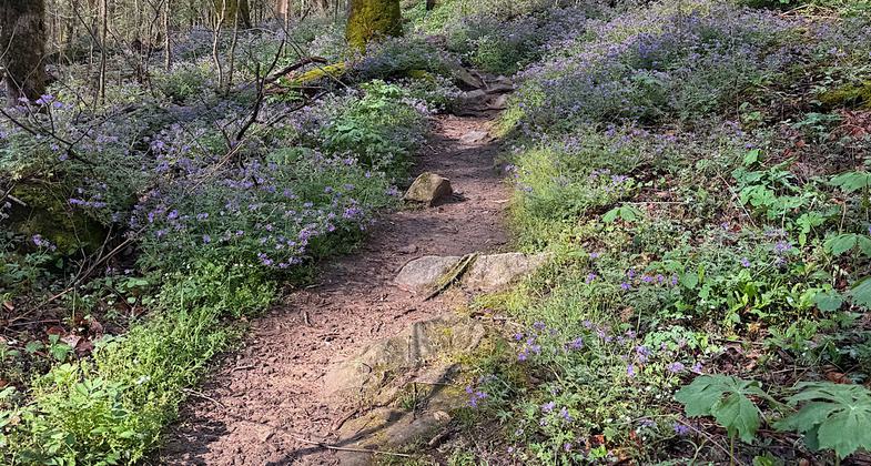
Virgin Falls to Upland Loop trail. Photo by Shannon Ours.


Virgin Falls

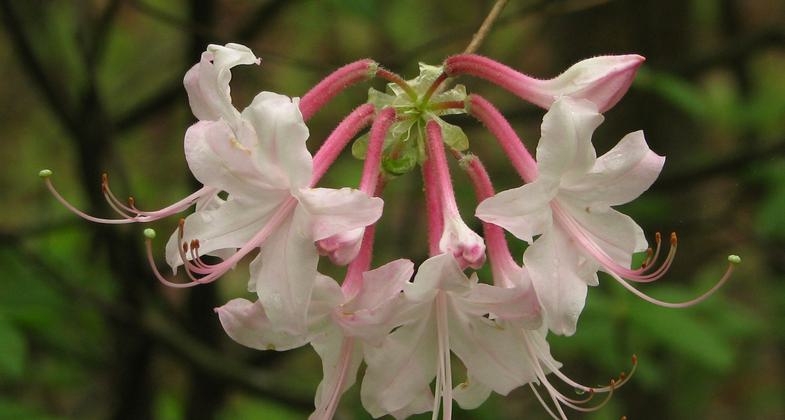
Pale pink Azalea cluster. Photo by Marty Silver.

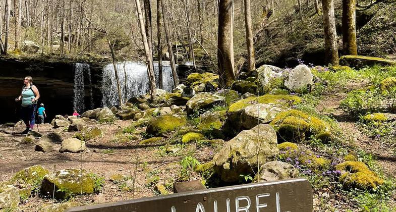
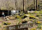
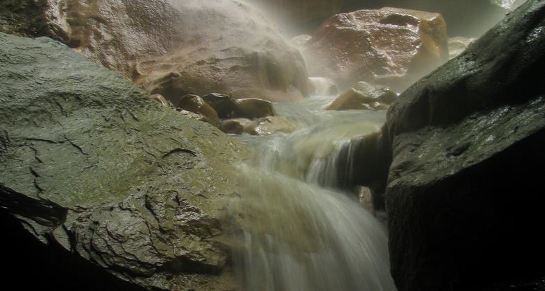
Big Laurel Falls flow to cave. Photo by Marty Silver.

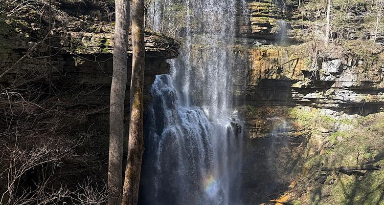
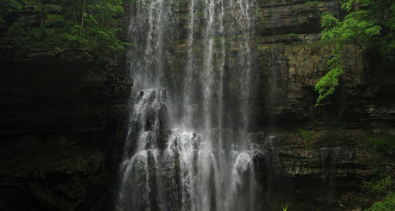
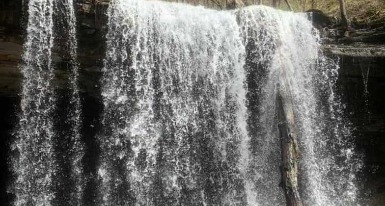
Virgin Falls. Photo by Marty Silver.

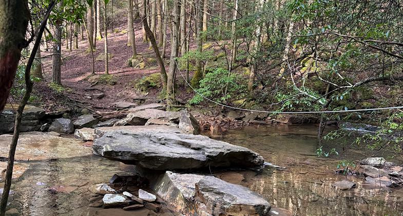
Virgin Falls to Upland Loop trail. Photo by Phetsamay Gleaves.

Virgin Falls to Upland Loop trail. Photo by Phetsamay Gleaves.

Virgin Falls to Upland Loop trail. Photo by Phetsamay Gleaves.
Location: Access c. 8 miles S of De Rossett and US 70.
- States: Tennessee
- Counties: White
Virgin Falls is a 1,157-acre natural area located in White County. The natural area is named for Virgin Falls, which is formed by an underground stream that emerges from a cave, then drops over a 110-foot high cliff before disappearing into another cave at the bottom of the sink. The area is noted for its unique geological features and several (additional) other waterfalls including Big Laurel, Sheep Cave Falls, and Big Branch Falls. The caves at Virgin Falls include Big Laurel, Sheep Cave, and Virgin Falls Cave. The sinkholes at Virgin Falls, such as Virgin Falls Sink and Sheep Cave Sink, are characteristic of karst features found on the Cumberland Plateau. The Caney Fork River and its tributaries drain the area and contribute to the formation of the gorge. The Caney Fork Overlook provides a dramatic view of Scott's Gulf and the Caney Fork River 900 ft below.
Hiking to Virgin Falls and back to the parking area is a five to eight-hour hike depending on your pace and whether you hike to the Caney Fork Overlook and/or the Caney Fork River. The trail leaving the parking area meanders down to the Big Branch of the Big Laurel Creek through an upland oak-hickory/chestnut oak hardwood forest crisscrossing a fern-dominated upland drainage. Upon descending into the gorge the vegetation changes to hemlock and mixed mesophytic forest which includes maples, oaks, tulip poplar, hickories, buckeye, basswood, cherry, yellow birch, sycamore, and many more species. Mountain laurels, magnolia, and several ericaceous shrubs (such as various wild blueberries) are common along the trail. The trials pass by small rock houses, boulder fields, sinks, caves, and waterfalls en route to Virgin Falls where the trail ends. The distance to Virgin Falls is four miles one way. There are designated camping sites off the trail (see map). There is no camping allowed above Virgin Falls. The streams at Virgin Falls are noted for flash flooding, so keep up-to-date on the weather conditions before hiking into the area.
Accessibility Information
No text provided.
Reviews
Patricia Ellis
Beautiful and well-maintained trail
Nice trail, some consecutive steep sections that last for over a mile downhill (over 1000-ft descent) on the way to the falls so save some energy for that long climb back up. Well maintained, lots of blazes and signs. Multiple falls in addition to the main one (Virgin Falls). Lovely woods and wildflowers. 8.6 miles roundtrip. Popular hike so start early. When I got back to the parking lot at noon the cars were overflowing onto the dirt road. Hiked April 2, 2026.
Allowed Uses:
Hiking/WalkingPublic Contact
Bowaters Southern Paper CompanyCalhoun, TN 37309
Contact the trail manager for current maps and visiting details.
More Details
- Elevation (low): --
- Elevation (high): --
- Elevation (cumulative): --
- Part of a Trail System? No
- Surface (primary): --
- Surfaces (additional): --
- Tread Width (average): 0"
- Tread Width (minimum): --
- Running length (minimum): --
- Tread Grade (average, percent): --
- Tread Grade (maximum):
- Running length (maximum): --
- Cross-slope (average, percent): --
- Cross-slope (maximum): --
- Running length (maximum): --
- Certified as an NRT
May 31, 1973