Ventura River Parkway Trail
check with the trail manager for updated details before visiting.
Ventura River Parkway Trail
City, Town, or County
Backcountry Trail
Frontcountry Trail
Rail Trail
Urban Trail
- Length
16.5 miles
- Elevation Gain
--
- Route Type
out & back
(1 review)
- Length
16.5 miles - Elevation Gain
-- - Route Type
out & back
The Ventura River Parkway Trail is a rail trail that provides a contiguous corridor of pedestrian and cycling trails, river crossings, and public access points to reconnect people in city neighborhoods and rural communities to the river while connecting the Ventura River Estuary to the City of Ojai. It includes two major trails: the Ventura River Trail and the Ojai Valley Trail, whose upper six miles are part of the national Rails-to-Trails network.
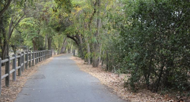
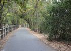
Ventura River Parkway Trail at Foster Park. Photo by Kathy Bremer
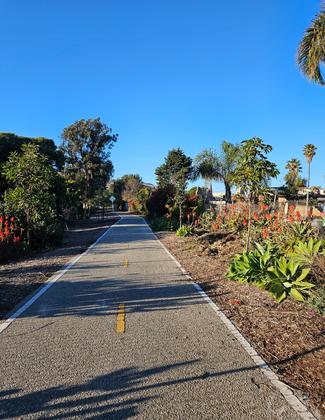
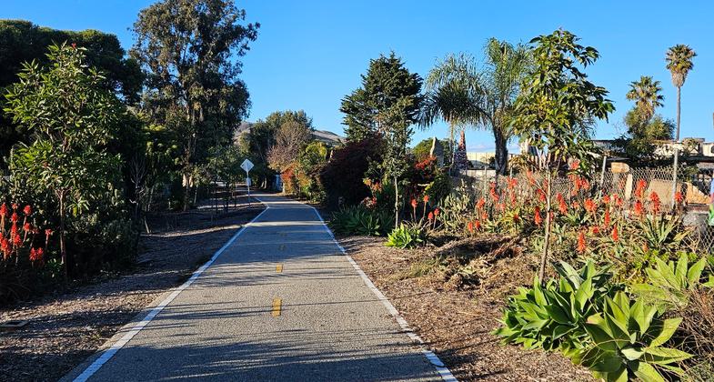
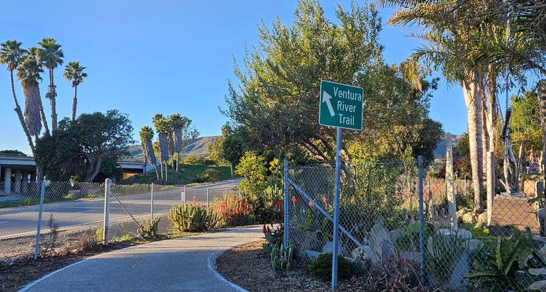
Ventura River Trail at Rex Street Trailhead near Art City stone garden. Photo by Sue Crowe.
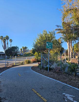
Ventura River Trail at Rex Street Trailhead near Art City stone garden. Photo by Sue Crowe.
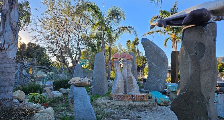
Ventura River Trail at Rex Street Trailhead near Art City stone garden. Photo by Sue Crowe.
Location: Located in Ventura County, CA the Ventura River Parkway Trail is a rail-trail that connects the Ventura River estuary at the Pacific Ocean in the City of Ventura to City of Ojai, traveling along the old Southern Pacific Railroad right-of-way.
- States: California
- Counties: Ventura
- Cities/Townships: Ventura, Casitas Springs, Oakview, Meiners Oaks, Ojai
View a current map of the trail.
NOTE: The City of Ventura manages the portion of the Ventura River Trail up to Foster Park. The County of Ventura manages the Ojai Valley Trail portion from Foster Park, located at 57 Casitas Vista Road, to Fox Steet in the City of Ojai. The County Parks Contact information is:
County of Ventura Parks Department 11201 Riverbank Drive, Ventura, CA 93004 805-654-3822 [email protected]
---
The Ventura River is one of the last natural rivers in Southern California and perhaps the only one that provides all of the freshwater needed by the residents of the watershed. The river sustains a rich array of native wildlife and plants as well as our diverse communities and agriculture. Since the first native Chumash arrived at its banks the river has been an invaluable water source and gathering place for the community.
A coalition of local groups, businesses, city, county, and state agencies, along with a national conservation organization worked together to reclaim the river by creating the Ventura River Parkway to reconnect the people to the river through a continuous network of parks, trails, and natural areas along over 16 miles of river from the estuary in Ventura north toward the Los Padres National Forest to the City of Ojai.
The Ventura River Parkway Trail incorporates two existing trails the Ventura River Trail and the Ojai Valley Trail and connects to the Omer Rains Coastal Trail and the Juan Bautista de Anza National Historic Trail that travel north along the coastline through Emma Wood State Beach.
The Ventura River Trail follows the old Southern Pacific Railroad right-of-way from Main Street to Foster Park 6.3 miles inland. Opened in 1999, this pedestrian and bicycle path connects the Ojai Valley Trail and the coastal Omer Rains Trail for one of the best urban bike rides in Southern California. Many interpretive signs currently exist along the Ventura River Parkway Trail and at the various trailheads.
Visitors exiting the 101 Freeway can begin at the Ventura River estuary (Surfer's Point) by enjoying birdwatching, then travel up the trail encountering art, parks, natural preserves, and historic sites, including trails on Ventura Land Trust's Willoughby Preserve and Big Rock Preserve, County-owned Foster Park, Sulphur Mountain Road, and Ojai Valley Land Conservancy's Steelhead Preserve and Ventura River Preserve. Urban landmarks include historic sites like the Ortega Adobe, Ventura City Hall, Mission San Buenaventura, the Mission aqueduct, Ventura's historic Simpson Tract, Ojai's historic downtown, including Libbey Park (home to the world-famous Ojai Tennis Tournament.)
As the trail traverses the west side of the City of Ventura, known locally as "Art City," users experience a national award-winning art installation funded by Ventura's Public Art Program memorializing the historic industry and environment of the lower watershed. Just below Foster Park trail users can also enjoy mural paintings celebrating the river that local middle-school children helped create with the assistance of a local artist. As they pass by Ventura's historic agricultural/industrial zone they will also discover the natural scenic beauty of the Ventura River Valley.
The Ojai Valley Trail winds through wooded areas from Foster Park to the City of Ojai. A paved trail for bicyclists, walkers, and runners is separated from a dirt bridle path for horseback riders by a post fence.
Above Foster Park, the Ojai Valley Land Conservancy's Steelhead Preserve will soon host a major interpretive center. Further up the trail, OVLC's Ventura River Preserve includes three miles of the Ventura River and over 1,500 acres of the surrounding ridges and canyons. Hiking, horseback and bicycling, dog walking, birdwatching, and photography are among the many recreational activities that this preserve has to offer.
The Ventura Land Trust, in partnership with the Friends of the Ventura River, has hosted annual "Picnic in the River" events to promote the Parkway and raise awareness of the expanding opportunities for outdoor recreation along the river. These events are well attended by residents and all of the numerous community and government groups that joined together to make the Ventura River Parkway Trail a reality.
The Friends of the Ventura River recently completed work with a National Park Service Rivers, Trails and Conservation Assistance grant that created an exceptional Ventura River Parkway Trail guide map that is now widely available in the community. This grant also designed a Spanish-language version of the map for local Spanish-speaking residents.
The goals of the river parkway trail are to preserve the historic Ventura River, protect water quality, conserve streamside and aquatic habitat, recover endangered Steelhead trout, restore sensitive floodplains, and reconnect communities with the river to offer expanded recreational opportunities to residents and visitors alike. The Ventura River Parkway Trail links diverse neighborhoods to nature to give health and fitness benefits like cycling, running, and walking to both our youth and adult populations. The Spanish-language trail guide increases the trail's accessibility to all area communities.
The Ventura River Parkway Trail will continue to evolve, improve, and transform the river corridor into a prime natural asset for all of the communities that line its route. Continued land and easement acquisitions will add new trails and access points to the river as partnerships with federal, state, and local agencies, landowners, businesses, and non-profit groups continue to flourish.
Accessibility Information
No text provided.
Reviews
Jimmy Young
VRPT Nails It!
This trail rocks.
My wife and I ride it from Foster Park to/from Ojai for lunch at least once a month.
Looking forward to hiking more of the trails!
Allowed Uses:
Bicycling Dogs, on leash Equestrian Hiking/WalkingOther Activities
- Heritage and history
- Wildlife viewing / observation
Public Contact
Stacey ZarazuaCity of Ventura Parks & Recreation
501 Poli Street Room 226
Ventura, CA
[email protected] • 805-658-4726
More Details
- Elevation (low): 35
- Elevation (high): 969
- Elevation (cumulative): --
- Part of a Trail System? No
- Surface (primary): Paved
- Surfaces (additional): Soil
- Tread Width (average): 127"
- Tread Width (minimum): 120
- Running length (minimum): --
- Tread Grade (average, percent): 1
- Tread Grade (maximum): 2
- Running length (maximum): --
- Cross-slope (average, percent): 0
- Cross-slope (maximum): --
- Running length (maximum): --
- Certified as an NRT
Jun 2, 2014