The Forever Wild Coldwater Mountain Trail System
check with the trail manager for updated details before visiting.
The Forever Wild Coldwater Mountain Trail System
State
Backcountry Trail
- Length
11.5 miles
- Elevation Gain
--
- Route Type
Loop
- Length
11.5 miles - Elevation Gain
-- - Route Type
Loop
The Forever Wild Coldwater Mountain Doug Ghee Nature Preserve and Recreational Area Trail System is located within the 4,000-acre Forever Wild Coldwater Mountain Doug Ghee Nature Preserve and Recreational Area in Anniston, AL.
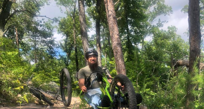
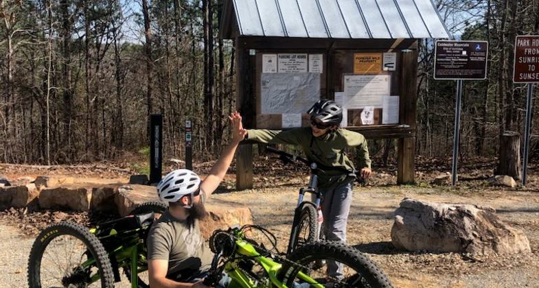
2023 Photo Contest Winner: Accessiblity. Photo by William Boozer

Steven Bryant gets back to trail head from Beers and Gears weekly ride muddy. Photo by William Boozer.

Biker Leaving the Trailhead

Armored Trail Section Being Built by IMBA

Great Scenic Views Along the Trail

Bikers Preparing for the Big Ride

Location: Located within the Forever Wild Coldwater Mountain Doug Ghee Nature Preserve and Recreational Area in Anniston, AL.
- States: Alabama
- Counties: Calhoun
- Cities/Townships: Anniston
The Forever Wild Coldwater Mountain Doug Ghee Nature Preserve and Recreational Area Trail System is located within the 4,000-acre Forever Wild Coldwater Mountain Doug Ghee Nature Preserve and Recreational Area in Anniston, AL.
The Forever Wild Coldwater Mountain Doug Ghee Nature Preserve and Recreational Area Trail System is presently being developed into a world-class destination trail system for mountain bikers, trail runners, and hikers. Sixty miles of trail have been designed by the International Mountain Bicycling Association's Trail Solutions team and will be built in phases over a 3 to 5-year period.
The Grand Opening for Phase I of the trail system was June 1st, 2012. Currently, the trail system offers 11.5 miles of trail for beginner, intermediate, and advanced users to enjoy. The 11.5 miles of trail is a combination of a 1.5-mile beginner green trail and a 10-mile intermediate blue trail which includes optional advanced black diamond features.
The 1.5-mile green beginner trail is wide and welcoming to even first-time riders. It is designed as a gateway trail to introduce beginners and first-timers to mountain biking, providing a positive and fun experience near the trailhead. It contains several rollers that are pump-track-ish and even a spot where the more adventuresome beginner can take an optional line through some rock-armored sections. The green trail also serves to help beginners gain the skills and confidence to be able to ride the intermediate trail if they choose. The longer 10-mile blue (intermediate) loop branches off of the green trail about 0.5 miles in. After some fun rollers and classic winding single track, the trail eventually begins a long relentless climb (not too steep, though----and it is forgiving with several flat spots to give the thighs some reprieve). The top of the climb presently takes you onto an old road for a short distance. This section of single-track is not complete (it will be completed as part of 12-mile Phase II, which will begin in the fall, of 2012). This incomplete section contains what will be one of the signature sections of the trail system---a rock outcropping at the highest point of the mountain with meticulous rock armoring and other stonework that will provide riders about 3 different lines to take through this section (easy line, intermediate line and insane line with drop-offs). Phase II also includes a 5-mile decent trail. The 11.5 miles of trail in use today were developed as a loop system, all begin and end at the same trailhead.
Accessibility Information
No text provided.
Allowed Uses:
Bicycling Hiking/WalkingOther Activities
- Wildlife viewing / observation
Public Contact
Mike PoeNorth East Alabama Bicycle Association
NEABA
Anniston, AL 36202
[email protected] • (256) 435-5710
Contact the trail manager for current maps and visiting details.
More Details
- Elevation (low): 700
- Elevation (high): 1500
- Elevation (cumulative): --
- Part of a Trail System? No
- Surface (primary): Soil
- Surfaces (additional): Grass or Vegetation, Rock, boulders, Rock, crushed, Rock, smooth, Soil
- Tread Width (average): 36"
- Tread Width (minimum): 24
- Running length (minimum): --
- Tread Grade (average, percent): --
- Tread Grade (maximum):
- Running length (maximum): --
- Cross-slope (average, percent): 0
- Cross-slope (maximum): --
- Running length (maximum): --
- Certified as an NRT
May 29, 2013