Miner's Ravine Trail
check with the trail manager for updated details before visiting.
Miner's Ravine Trail
City, Town, or County
Urban Trail
- Length
6.37 miles
- Elevation Gain
115
- Route Type
out & back
- Length
6.37 miles - Elevation Gain
115 - Route Type
out & back
The City of Roseville constructed the Miner's Ravine trail on City property as a transportation and recreational trail giving residents the opportunity to explore nature in their own community. This 6.37 mile trail was named after local gold mining activities that would have taken place in this area during the 1849 Gold Rush. Generally considered an easy route, this is a very popular area for hiking, biking, running, dog-walking or a leisurely stroll where you'll likely encounter other people and wildlife while exploring. The trail is beautiful to visit any season.
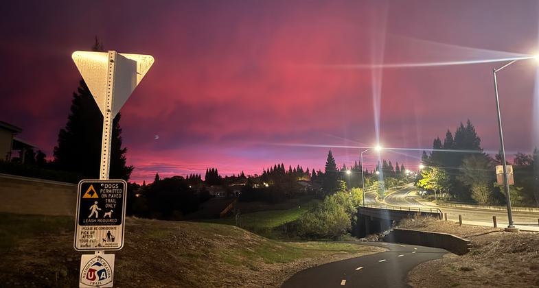
2025 Photo Contest Winner - Urban Trails and Greenways Category. Photo by Suzana Engelke


Location: 6.36-mile continuous trail Sierra College Blvd. to Darling Way.
- States: California
- Counties: Placer
- Cities/Townships: Roseville
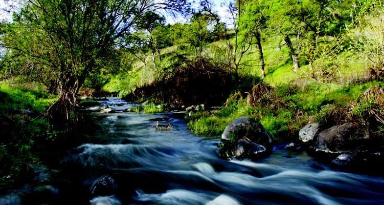
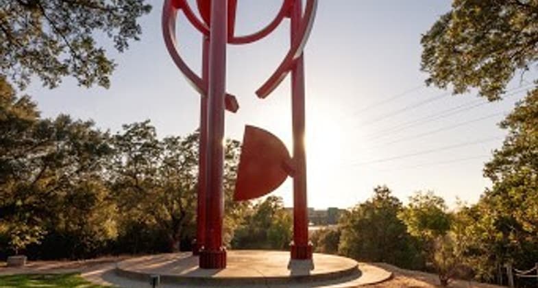
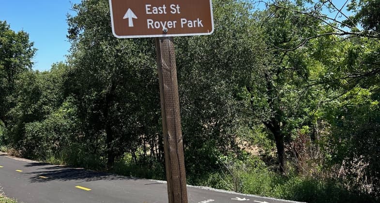
The Miner's Ravine Trail winds its way through the city of Roseville, from the Miner's Ravine Nature Reserve along Dry Creek through a wooded greenway and among suburban neighborhoods into Downtown Roseville. The trail surface is paved asphalt, smooth, and 10-feet wide with 2-foot shoulders on each side. One shoulder is comprised of decompressed granite, perfect for those who like to jog on a smoother surface. There is a painted dividing line along most of the trail allowing separate lanes for pedestrians and bikers; complete with stenciling and signage encouraging safe travel. There are benches along the trail for resting as well as trailheads along the route which offer convenient parking. The trail is unique with interpretive signs and historical sites such as a grinding stone that was used by local Native Americans. Follow the signs to the Sculpture Park to see the art installation Cosmos and look for signs explaining the remnants of the Golden Gate Bridge over creek crossings. The trail connects to several large City Parks which offer their own amenities. This is an excellent trail for bird-watching, spotting spawning salmon, and observing small wildlife. The trail is open year-round and is beautiful to visit anytime, where you can see springtime wildflowers or the fall foliage.
Accessibility Information
There are two designated accessible spaces in the paved parking lot off of Sierra College Boulevard at the east end of the trail. Both of them are van-accessible with striped access aisles. There are four designated accessible spaces in the paved parking lot off of Oak Street at the west end of the trail. All of them are van-accessible with striped access aisles. The whole trail is estimated to be in the mostly gentle (5% or less) grade category. This trail will likely be navigable for most wheelchairs/mobility equipment or stroller users.
Allowed Uses:
Bicycling Bicycling, electric Bicycling, hand powered, recumbents, tricycles Dogs, on leash Electric micro-mobility devices Hiking/Walking Trail runningOther Activities
- Heritage and history
- Wildlife viewing / observation
Public Contact
Suzanne Engelke, Associate Transportation PlannerCity of Roseville
City of Roseville
316 Vernon Street, Ste 150
Roseville, CA 95678
[email protected] • 9167461289
More Details
- Elevation (low): 135
- Elevation (high): 250
- Elevation (cumulative): 115
- Part of a Trail System? Yes
- System Name: Dry Creek Greenway East (currently in construction)
- System Length: 4 miles
- Surface (primary): Paved
- Surfaces (additional): --
- Tread Width (average): 120"
- Tread Width (minimum): 96
- Running length (minimum): 112
- Tread Grade (average, percent): 0.4
- Tread Grade (maximum): 13.2
- Running length (maximum): 170
- Cross-slope (average, percent): 2
- Cross-slope (maximum): --
- Running length (maximum): --
- Certified as an NRT
Jun 8, 2025