Memory Lane
check with the trail manager for updated details before visiting.
Memory Lane
U.S. Corps of Engineers
Backcountry Trail
Urban Trail
- Length
1 mile
- Elevation Gain
--
- Route Type
Loop
(1 review)
- Length
1 mile - Elevation Gain
-- - Route Type
Loop
Located in the Town of Greenville, this 1-mile trail takes visitors down "memory lane" as they walk through the old town of Greenville, one of the sites listed on the National Register of Historic Places. Visitors have the opportunity to tour the sidewalks of Old Greenville on a self guided historic walk. This is a walking trail.
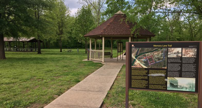
Memory Lane trailhead and gazebo. Photo by Donna Kridelbaugh.

Beautiful sites and plenty of trails
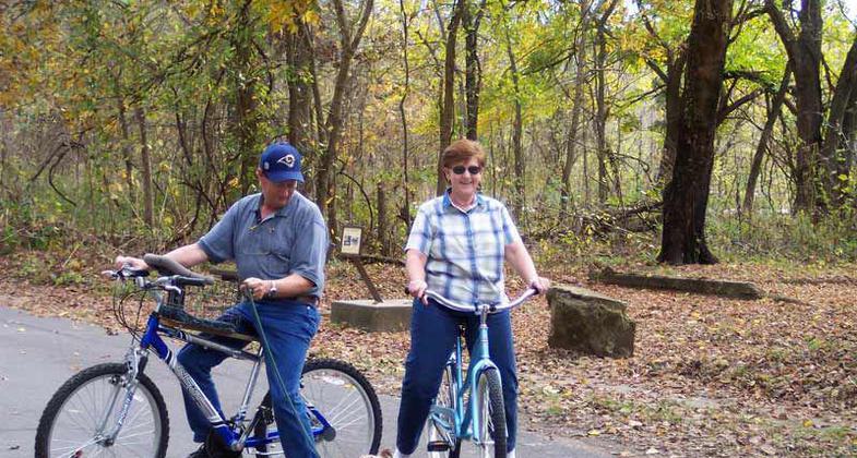
photo by Gary Stilts

The paved trail traces the streets and sidewalks of the historic town of Greenville. Photo by Donna Kridelbaugh.
Location: Off US 67 at Wappapello Lake 30 Miles N of Poplar Bluff.
- States: Missouri
- Counties: Wayne
- Cities/Townships: Greenville, Wappapello,
Located in the Town of Greenville, this 1-mile trail takes visitors down "memory lane" as they walk through the old town of Greenville, one of the sites listed on the National Register of Historic Places. Visitors have the opportunity to tour the sidewalks of Old Greenville on a self-guided historic walk. This is a walking trail.
Because of its archaeological and historic significance, the old town of Greenville has been listed on the National Register of Historic Places since 1990. today this site is commonly referred to as Old Greenville. For a journey through the past, tour the sidewalks of Old Greenville on a self-guided historic walk known as Memory Lane and learn about a town and its people who shaped our nation's history.
Accessibility Information
No text provided.
Reviews
Donna Kridelbaugh
NRT Ambassador Review
Memory Lane is located within the Greenville Campground and Recreation Area of Wappapello Lake, which is on the banks of the St. Francis River. Parking is provided in a large lot across from the trailhead and gazebo, just before you enter the campground.
The paved trail is arranged as city blocks, following a mile of sidewalks and streets of the historic town of Greenville that existed here before being moved to its present location due to flooding issues. To note, please use caution on the trail as weathering of the concrete has caused uneven surfaces and wet spots.
There are a number of interpretive signs at the gazebo and along the trail that describe the history of the town and notable people. Also, see the attached brochure on this webpage for a self-guided tour.
The recreation area contains picnic, playground and restroom facilities. There is a boat ramp at the adjacent Bettis Ford site, which also was a river crossing used in 1838 during the forced removal of the Cherokee people along the Trail of Tears.
There is a nearby trailhead for the Greenville Bike Trail that connects the historic and present-day towns. Additionally, a segment of the Memory Lane trail overlaps with the bike trail and the Trail of Tears National Historic Trail.
It is worth making a trip to this recreation area to learn about the historical significance of the site, and there are abundant outdoor activities for the entire family. Please leave no trace by using provided trash receptacles and being mindful of other folks visiting the area.
Allowed Uses:
Bicycling Dogs, on leash Hiking/WalkingOther Activities
- Heritage and history
Public Contact
Becky HaysUS Army Corps of Engineers
10992 Highway T
Wappapello, MO 63966
[email protected] • (573) 778-5404
Contact the trail manager for current maps and visiting details.
More Details
- Elevation (low): 376
- Elevation (high): --
- Elevation (cumulative): --
- Part of a Trail System? No
- National Designations: National Historic Site
- Surface (primary): Paved
- Surfaces (additional): Paved
- Tread Width (average): 36"
- Tread Width (minimum): --
- Running length (minimum): --
- Tread Grade (average, percent): --
- Tread Grade (maximum):
- Running length (maximum): --
- Cross-slope (average, percent): --
- Cross-slope (maximum): --
- Running length (maximum): --
- Certified as an NRT
Jun 3, 2005