Kankakee River Water Trail
check with the trail manager for updated details before visiting.
Kankakee River Water Trail
Nonprofit
National Water Trail
- Length
133 miles
- Elevation Gain
--
- Route Type
out & back
- Length
133 miles - Elevation Gain
-- - Route Type
out & back
The Kankakee River Water Trail is a 133-mile-long blueway located in rural NW Indiana and NE Illinois which traverses what once was the United State's largest wetlands. Around the turn of the 20th century, the entire Indiana stretch was dredged and channelized until it reaches Illinois where it maintains it natural course. The water trail boasts ample public access sites, thousands of acres of natural areas and preserves, remarkable wildlife, overnight camping for paddlers, many historic sites, and a high-quality sport fishery.
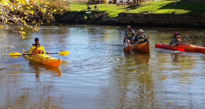
Photo 1 from one of the Sandhill Crane Paddles.

Kankakee south of Momence. Photo by Mollyann Hesser.

Kankakee at Momence. Photo by Mollyann Hesser.

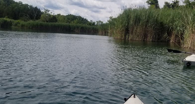
Picture from the Paddlers Camp

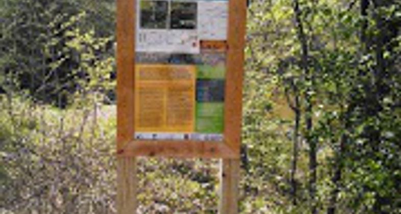
Example of one of the water trail signs

Another campsite photo

Campsite photo

Photo from the Paddlers Campsite

Photo from the LaPorte Leave No Trace paddlers

Sandhill Crane Paddle photo
Location: The Kankakee rises in northwestern Indiana, approximately 5 miles (8 km) southwest of South Bend and flows to the west where it meets the DesPlaines River in Illinois forming the Illinois River.
- States: Indiana
- Counties: St. Joseph, LaPorte, Starke, Newton, Jasper, Porter, Lake
- Cities/Townships: From St. Joseph County, IN, 133 miles to the Des Plaines River in IL. There are many access points along the way.
The Kankakee River Water Trail is a 133-mile-long blueway trail that crosses northwestern Indiana and northeastern Illinois in the United States. At one time, the river drained one of the largest wetlands in North America, known as the Grand Kankakee Marsh, and furnished a significant portage between the Great Lakes and the Mississippi River. The original Kankakee River was significantly altered from its original channel, it flows through a primarily rural farming region of reclaimed cropland in Northwest Indiana. Once crossing into Illinois, it enters the Illinois River, and the river returns to its natural channel, winding its way to Momence, Illinois. This is the last section of the Great Kankakee Swamp that has never been ditched. It is at Momence that the river crosses a 7 miles (11 km) limestone shelf, referred to as the Momence Dam. This natural feature's resistance to erosion created a blockage in the flow of the Kankakee River, backing up water and thereby creating the Great Swamp that once covered 500,000 acres (200,000 ha).
Beyond Momence, the river takes on a more traditional image, flowing across the rolling hills of Kankakee County. The river enters Will County, Illinois, for only a short distance before joining the Des Plaines River. Here, in the Des Plaines Fish and Wildlife Area, the two rivers form the Illinois River for the journey to the Mississippi River. The Kankakee River Basin is an area of high ecological and historic significance and the subject of the PBS Documentary - Everglades of the North - the Story of the Grand Kankakee Marsh. The water trail boasts ample public access sites, thousands of acres of natural areas and preserves, remarkable wildlife, overnight camping for paddlers, many historic sites, and a high-quality sport fishery.
Accessibility Information
No text provided.
Allowed Uses:
Boating, motorized Boating, human-poweredOther Activities
- Camping
- Fishing
- Heritage and history
- Hunting
- Wildlife viewing / observation
Public Contact
Daniel PlathNorthwest Indiana Paddling Association
109 West 700 North,
Valparaiso, IL 46385
[email protected] • 219-971-9559
More Details
- Elevation (low): --
- Elevation (high): --
- Elevation (cumulative): --
- Part of a Trail System? No
- State Designations: Regional Water Trail
- Surface (primary): --
- Surfaces (additional): Rock, boulders, Rock, smooth, Snow or ice, Water, calm
- Tread Width (average): 0"
- Tread Width (minimum): 0
- Running length (minimum): --
- Tread Grade (average, percent): --
- Tread Grade (maximum):
- Running length (maximum): --
- Cross-slope (average, percent): 0
- Cross-slope (maximum): --
- Running length (maximum): --
- Certified as an NRT
Jun 14, 2016