Interloken NRT
check with the trail manager for updated details before visiting.
Interloken NRT
USDA Forest Service
Backcountry Trail
- Length
12 miles
- Elevation Gain
--
- Route Type
out & back
(1 review)
- Length
12 miles - Elevation Gain
-- - Route Type
out & back
The Interloken Trail traverses the Forest north to south and is a branch of the Finger Lakes Trail system.
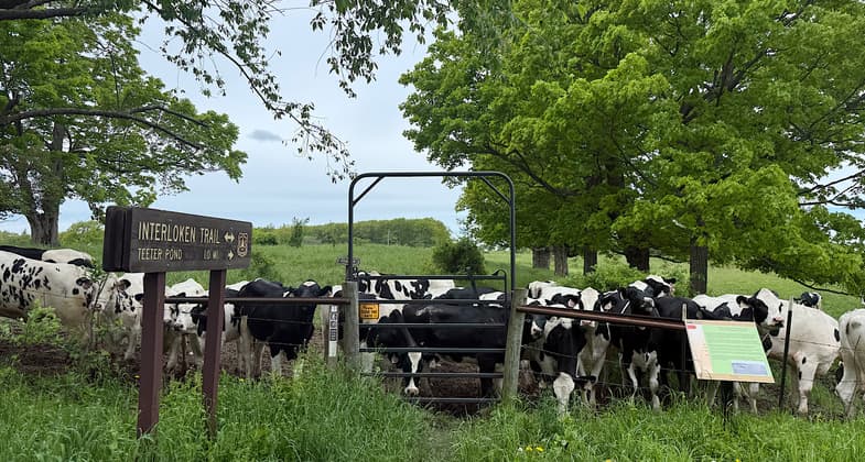
Trail enters a cow pasture. Photo by Patricia Ellis

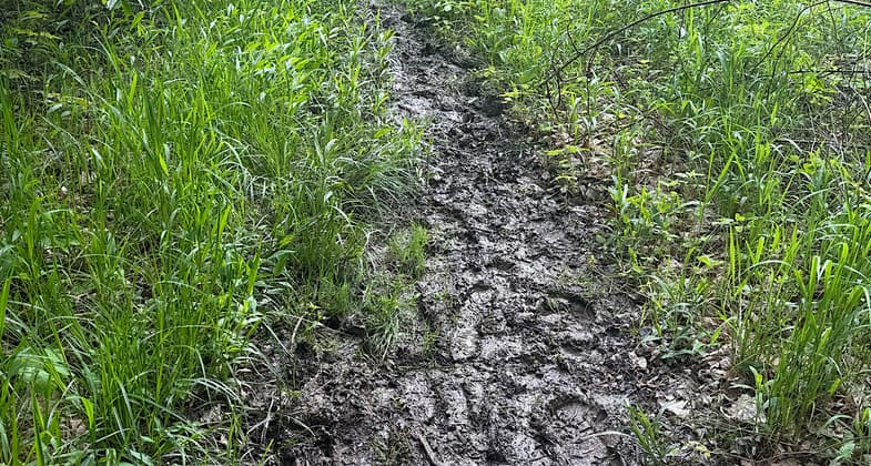
late spring muck

Wayfinding sign on the Interloken Trail in Finger Lakes National Forest. Photo by Edmund Ressler/CNYhiking.com.

Location: Finger Lakes National Forest, Follows the Hector Backbone between Cayuga and Seneca Lake, c. 15 mi. northwest of Ithaca.
- States: New York
- Counties: Seneca, Schuyler
The trail passes through various terrain and vegetation; southern portions are somewhat steeper and more forested; northern portions are flatter and more open through some pastures. Please close the gates behind you. This trail can be wet in the spring and fall. Plan a stop at Foster and Teeter Pond areas, or make a shorter loop hike with one of the several intersecting trails. There are outstanding vistas to the west, including views of Seneca Lake. Please practice Leave No Trace ethics, such as carrying out what you carry in.
Horses are allowed on the trail from the southern end of the trail to the Burnt Hill trail. Mountain bikes and horses are allowed on the north end of the trail between Seneca and Parmenter Rds.
The total length of this trail is 12 miles one way. The max elevation change is 560 feet and the average hike time is about 12 hours round trip.
Camping is available at either the Blueberry Patch Campground for a fee or you can camp anywhere on forest property.
Accessibility Information
No text provided.
Reviews
Patricia Ellis
Severe drainage issues, needs water bars
Attempted May 27, 2025. Wanted to do this as two out-and-backs, first from the north and then from the south. Unfortunately, both ends were horrible. Hiked in a few miles from each side before bailing. This trail needs water bars for drainage. All the water sits in this trail, the result is deep shoe-sucking mud for miles. Throw in horse poop here and there for good measure. I am no stranger to gnarly conditions and mud on trails, but this experience took the cake. Really needs maintenance and water bars. Or tons of bog bridges. Trish Ellis (Janie Walker)
Allowed Uses:
Equestrian Hiking/Walking Motorized vehicles, snowmobiling Snow, cross-country skiing Snow, snowshoeingOther Activities
- Camping
- Fishing
- Snow, snow play general
Public Contact
Green Mountain-Finger Lakes National Forest231 N. Main
Rutland, VT 5701
(802) 747-6700
www.fs.fed.us/r9/gmfl
Contact the trail manager for current maps and visiting details.
More Details
- Elevation (low): 1500
- Elevation (high): 1800
- Elevation (cumulative): --
- Part of a Trail System? No
- Surface (primary): Soil
- Surfaces (additional): Soil
- Tread Width (average): 24"
- Tread Width (minimum): --
- Running length (minimum): --
- Tread Grade (average, percent): 1
- Tread Grade (maximum): 15
- Running length (maximum): --
- Cross-slope (average, percent): --
- Cross-slope (maximum): --
- Running length (maximum): --
- Certified as an NRT
Feb 6, 1979