Guadalupe Ridge Trail (GRT)
check with the trail manager for updated details before visiting.
Guadalupe Ridge Trail (GRT)
National Park Service
Backcountry Trail
- Length
100 miles
- Elevation Gain
--
- Route Type
out & back
(1 review)
- Length
100 miles - Elevation Gain
-- - Route Type
out & back
Challenge yourself and experience the extreme hiking trek of the full 100 miles through the newly designated Guadalupe Ridge trail (GRT) which in places can include equestrian and stock, motorized vehicles, and bikes. The trail traverses the rocky peaks of the highest point in Texas, Guadalupe Peak (8,751'), to the challenging mountainous landscape of the New Mexico Chihuahuan Desert.
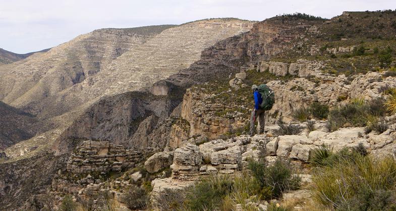
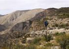
Hiker along McKittrick Canyon along the GRT.
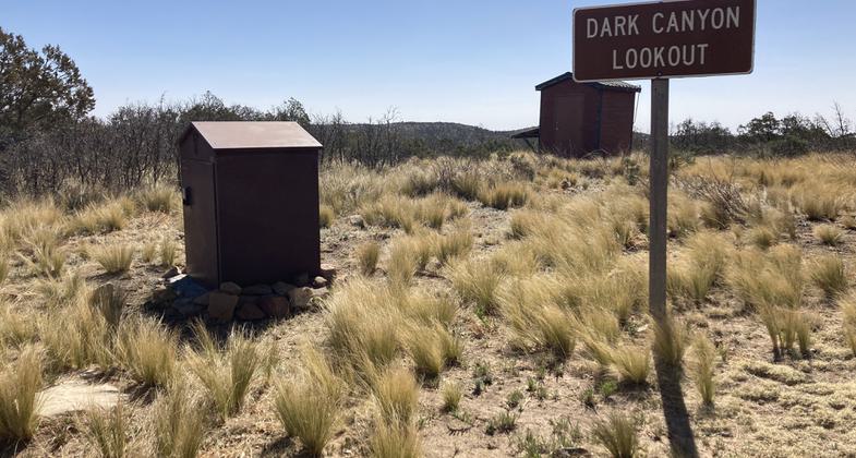
Water Cache Box at Forest Road 201 and Dark Canyon Lookout. Photo by Jennifer Foote.

Water Cache Box at Junction of Forest Road 201 and 307 (near South end of 540). Photo by Jennifer Foote.

Humble beginnings of the GRT as the trail leaves Whites City. Photo by Todd Shelley.
The Fawn Valley Overlook within Carlsbad Caverns National Park gives sweeping views to the north. Photo by Todd Shelley.

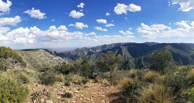
Looking down to the McKittrick Canyon Trail from high above along Wilderness Ridge. Photo by Todd Shelley.

The Notch within South McKittrick Canyon is awe inspiring. Photo by Todd Shelley.

There is little signage in the Carlsbad Caverns backcountry so map reading and route finding skills are a must. Photo by Todd Shelley.
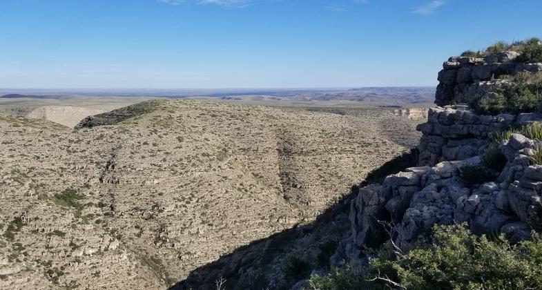
Sweeping views into North McKittrick Canyon from within Lincoln National Forest. Photo by Todd Shelley.

Slaughter Canyon spills out into the Chihuahuan desert. Photo by Todd Shelley.
Location: The trail is located between Guadalupe Peak, Guadalupe Mountains National Park and the boundary of Carlsbad Caverns National Park at White's City, NM and passes through Bureau of Land Management and Lincoln National Forest property.
- States: New Mexico, Texas
- Counties: Hudspeth, Eddy
- Cities/Townships: None; Closest township: White's City, NM
Guadalupe Ridge Trail: An Extreme Trail Experience.
Challenge yourself and experience the extreme hiking trek of the full 100 miles through the newly designated Guadalupe Ridge trail (GRT) which in places can include equestrian and stock, motorized vehicles, and bikes. Thru-hiking takes more than a week to complete with limited resources. Or take a one, two, or three-day excursion for a multiday backpacking trip. The trail traverses the rocky peaks of the highest point in Texas, Guadalupe Peak (8,751'), to the challenging mountainous landscape of the New Mexico Chihuahuan Desert.
The trail starts in Guadalupe Mountains National Park, at the highest point in Texas which is Guadalupe Peak (8751 feet). Some sections of the trail in the Guadalupe Mountains climb and dip over a 60% solid rock grade and are very rugged terrain. Almost 40% of the main trail is double track, and 60% is single track when including the Sitting Bull Falls segment of the trail. The trail travels through the Chihuahuan desert, mixed coniferous forest, and riparian woodlands before exiting the national park to the Lincoln National Forest. The national forest has mixed coniferous forests along with spectacular rocky canyons. An optional loop will take trekkers through Last Chance Canyon and Sitting Bull Falls, a desert oasis with a series of small waterfalls and pools. The trail continues through Carlsbad Caverns National Park and Bureau of Land Management property with stunning views of the rugged and unforgiving Guadalupe Ridge. Trekkers can stop through the Caverns Visitor Center before dropping into White's City, New Mexico, and the end of the Guadalupe Ridge Trail.
Accessibility Information
No text provided.
Reviews
Todd Shelley
The Long Route to the Top of Texas
Thru-hiked the GRT starting at Carlsbad Caverns, skipping the road walk along Walnut Canyon Desert Drive and the climb to the CAVE Visitor Center from Whites City. The trial was very faint in places throughout CAVE, but navigation was easily accomplished by following navigation cairns spaced adequately along the trail. Water is the biggest challenge of the hike and we cached at the Cave Canyon Trailhead, Dark Canyon Lookout Tower and at the end of FS540. The entire trip was filled with sweeping vistas and vast views. Of particular note were the views into Slaughter Canyon in New Mexico and McKittrick Canyon in Texas. We saw zero other hikers along the trail until we reached the Pine Spring Visitor Center in GUMO (on free entry day of all times). Then we met at least 100 other hikers climbing the Peak.
My hiking partner Cameron documented the trip and posted it to YouTube.
https://www.youtube.com/playlist?list=PLGN_qREciD5NcxMiWVwRleGcTuEh_G50R
Allowed Uses:
Bicycling Equestrian Hiking/Walking Motorized vehicles, – ATV/ORV Motorized vehicles, – four-wheel driveOther Activities
- Camping
- Heritage and history
- Wildlife viewing / observation
Public Contact
Melissa BuzzardDepartment of Agriculture, U.S. Forest Service
5203 Buena Vista Drive
Carlsbad, NM 88220
[email protected] • (575) 885-4181
Contact the trail manager for current maps and visiting details.
More Details
- Elevation (low): 3647
- Elevation (high): 8751
- Elevation (cumulative): --
- Part of a Trail System? No
- Surface (primary): Soil
- Surfaces (additional): Rock, boulders, Soil
- Tread Width (average): 18"
- Tread Width (minimum): 18
- Running length (minimum): --
- Tread Grade (average, percent): 20
- Tread Grade (maximum): 60
- Running length (maximum): --
- Cross-slope (average, percent): 0
- Cross-slope (maximum): --
- Running length (maximum): --
- Certified as an NRT
May 16, 2018