Grandstaff Canyon Trail
check with the trail manager for updated details before visiting.
Grandstaff Canyon Trail
Bureau of Land Management
Backcountry Trail
- Length
2.25 miles
- Elevation Gain
--
- Route Type
out & back
- Length
2.25 miles - Elevation Gain
-- - Route Type
out & back
The trail follows a perennial clear stream in a scenic red rock canyon and ends at Morning Glory Natural Bridge, 243 feet long and the sixth-longest natural rock span in the United States.
Morning Glory Natural Bridge. Photo by Bob Wick, BLM
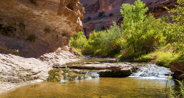
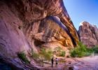
Stream in Grandstaff Canyon
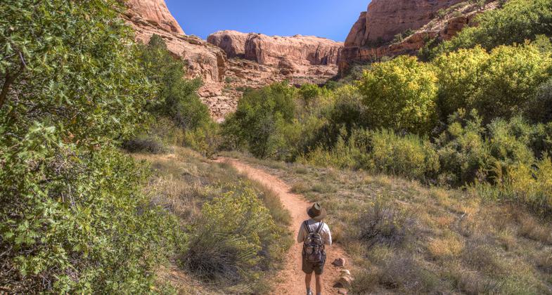
Hiker on trail
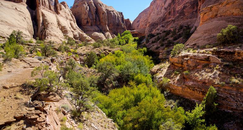
Morning Glory Natural Bridge in distance off Grandstaff Canyon Trail
Location: Off Utah Scenic Byway 128, three miles east of junction with U.S. 191 in Moab, Utah.
- States: Utah
- Counties: Grand
- Cities/Townships: none
The canyon and trail are named after William Grandstaff, an early African American settler of the region. Grandstaff arrived in Utah in 1877 and settled for a short time north of Moab. He was one of the first non-Native American settlers in the area. There is little recorded history of his time in the Moab area, but it is surmised that he ran cattle in the canyon bearing his name. He later moved to the Glenwood Springs, Colorado area, where his grave can be found.
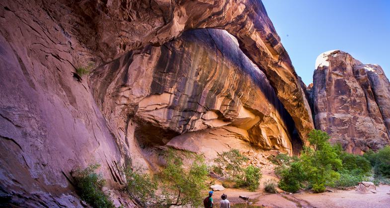
The trail follows a two-mile perennial clear stream along the canyon bottom. The trail is in a classic riparian setting rare in the desert region of Moab. The canyon itself empties into the Colorado River and is directly across from Arches National Park. The trail is surrounded by high sandstone cliffs its entire length. The trail crosses the stream several times, providing opportunities for wading in its clear, shallow waters. The canyon is a popular destination for school groups from Moab as part of the area's environmental education programs. Besides local school groups, educational institutions from across the United States visit the canyon under BLM authorization. It is very popular for hikers with dogs; bags and receptacles for dog waste are provided at the trailhead.
The trail ends at Morning Glory Natural Bridge, 243 feet long and the sixth-longest natural rock span in the United States. This bridge is popular with canyoners, who rappel from the span (accessible by another trail up the canyon from the Bridge). Almost the entire trail lies within the Grandstaff Canyon Wilderness Study Area. The trail is well-marked, and suitable for all ages. Children are attracted to its amphibian life, especially crayfish. A paved parking lot with restrooms is at the trailhead, along with interpretive signs. The trail is easily accessible from the popular tourist destination of Moab, which has ample tourist and recreation infrastructure. Besides the trail itself, the area offers a wide array of recreation activities, not only on BLM lands but also at two adjacent National Parks and one State Park.
The trail's popularity presents several management challenges that the Moab BLM is addressing. The trail is continuously monitored by BLM personnel. Visitor education regarding the proper disposal of dog waste is prominently displayed on the entrance kiosk. BLM park rangers employ the services of volunteer groups at least once per year for ongoing trail maintenance. BLM continues to track visitor experiences through a review of trail register comments. To date, despite the trail's popularity, very few comments have been posted regarding overcrowding on the trail. BLM will continue to monitor visitor experiences, and consider strategies to mitigate crowding should the need arise.
Accessibility Information
No text provided.
Allowed Uses:
Dogs, on leash Hiking/WalkingOther Activities
- Rock climbing
Public Contact
Bill StevensBureau of Land Management
82 E Dogwood
Moab, UT 84532
[email protected] • (435) 259-2100
Contact the trail manager for current maps and visiting details.
More Details
- Elevation (low): 3984
- Elevation (high): 4381
- Elevation (cumulative): --
- Part of a Trail System? No
- Surface (primary): Soil
- Surfaces (additional): Rock, smooth, Sand, Water, calm
- Tread Width (average): 36"
- Tread Width (minimum): 24
- Running length (minimum): --
- Tread Grade (average, percent): 4
- Tread Grade (maximum): 15
- Running length (maximum): --
- Cross-slope (average, percent): 0
- Cross-slope (maximum): --
- Running length (maximum): --
- Certified as an NRT
Oct 23, 2020