Flat Top-Fallingwater Cascades
check with the trail manager for updated details before visiting.
Flat Top-Fallingwater Cascades
National Park Service
Backcountry Trail
- Length
5.4 miles
- Elevation Gain
--
- Route Type
out & back
- Length
5.4 miles - Elevation Gain
-- - Route Type
out & back
This National Recreational Trail is a very popular 1.6 mile loop hike featuring a waterfall.
Location: Along the Blue Ridge Parkway at Peaks of Otter Recreation Area.
- States: Virginia
- Counties: Botetourt, Bedford
Located at milepost 83.1 of the Blue Ridge Parkway, the Fallingwater Cascades Trail is part of the Peaks of Otter Recreational Area. This National Recreational Trail is a very popular 1.6-mile loop hike featuring a waterfall. The trail has a steep section, however, there is only a total elevation gain of just under 400 feet, making this a moderate hike. You have two options for where to start this loop hike. Start either at the Fallingwater Cascades Parking Area at milepost 83.1 or the Flat Top Parking Area at milepost 83.5.
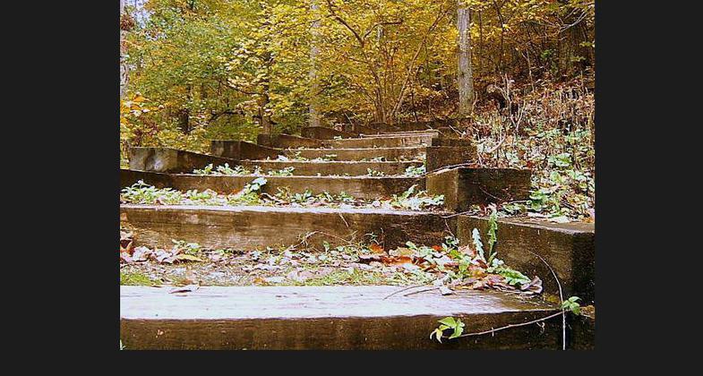
The trail enters Jefferson National Forest soon after leaving the Fallingwater Cascades parking area. From the parking area turn right down the well-worn trail lined with rhododendron. These usually bloom in late May, or early June, making for beautiful scenery. Soon the trail gets very steep and there are some steps. Fallingwater Creek appears as it tumbles down the top of cascades on your left.
At 0.3 miles cross Fallingwater Creek on a footbridge. You are above the cascades and the trail will begin to descend, steeply at times. There are some steps plus a few benches through this section. Pass the base of the cascades and cross the creek on another bridge at 0.6 miles. The cascades aren't spectacular but are certainly worth the hike. You can retrace your steps from here and head back to the parking area for a 1.2-mile hike. This would be 0.4 miles less than the loop.
The trail continues past a bench and ascends gradually as you enter a higher hardwood forest. At 1.0 miles a side trail on your right leads to the Flat Top Parking Area. Past this junction the trail continues its gradual rise to the Fallingwater Cascades Parking Area, reaching the parking area at 1.6 miles.
Accessibility Information
No text provided.
Allowed Uses:
Hiking/WalkingPublic Contact
Blue Ridge Parkway NPS199 Hemphill Knob Road
Asheville, VA 28803
(828) 348-3400
www.nps.gov/blri/index.htm
Contact the trail manager for current maps and visiting details.
More Details
- Elevation (low): --
- Elevation (high): --
- Elevation (cumulative): --
- Part of a Trail System? No
- Surface (primary): --
- Surfaces (additional): --
- Tread Width (average): 0"
- Tread Width (minimum): --
- Running length (minimum): --
- Tread Grade (average, percent): --
- Tread Grade (maximum):
- Running length (maximum): --
- Cross-slope (average, percent): --
- Cross-slope (maximum): --
- Running length (maximum): --
- Certified as an NRT
Apr 12, 1982


