Eagle Falls Trail
This information is a public record of the 1982 NRT application and may be out of date if it has not been updated by a trail manager --
check with the trail manager for updated details before visiting.
check with the trail manager for updated details before visiting.
Eagle Falls Trail
State
Backcountry Trail
- Length
1 mile
- Elevation Gain
--
- Route Type
out & back
- Length
1 mile - Elevation Gain
-- - Route Type
out & back

Location: Cumberland Falls State Park, 7351 HIghway 90 Corbin, KY 40701 (606) 528-4121
- States: Kentucky
- Counties: McCreary
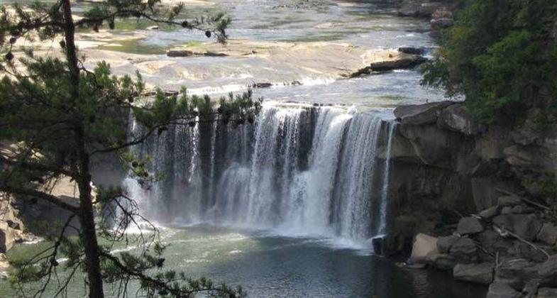
This trail is 1.5 miles and is the only trail leading to Eagle Falls. Hikers follow the cliff line for much of the trail to one of the best views of Cumberland Falls. After crossing a seasonal stream, Trail 9 becomes a loop and a spur will take you to the river. The lower section of the trail may be under water during high water and the latter section of the trail is rugged.
Accessibility Information
No text provided.
Allowed Uses:
Hiking/WalkingPublic Contact
Department of ParksCapital Plaza Tower
Frankfort, KY 40601
Contact the trail manager for current maps and visiting details.
More Details
- Elevation (low): --
- Elevation (high): --
- Elevation (cumulative): --
- Part of a Trail System? No
- Surface (primary): --
- Surfaces (additional): --
- Tread Width (average): 0"
- Tread Width (minimum): --
- Running length (minimum): --
- Tread Grade (average, percent): --
- Tread Grade (maximum):
- Running length (maximum): --
- Cross-slope (average, percent): --
- Cross-slope (maximum): --
- Running length (maximum): --
- Certified as an NRT
Apr 12, 1982