Devil's Den Self-Guided
This information is a public record of the 1978 NRT application and may be out of date if it has not been updated by a trail manager --
check with the trail manager for updated details before visiting.
check with the trail manager for updated details before visiting.
Devil's Den Self-Guided
State
Backcountry Trail
- Length
1.1 miles
- Elevation Gain
--
- Route Type
Loop
- Length
1.1 miles - Elevation Gain
-- - Route Type
Loop
High use, natural surface trail. Well blazed (red diamonds) and signed.

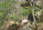
Devil's Den trail in Devil's Den State Park in Arkansas. Photo by Alejandro Forero Cuervo/wiki.

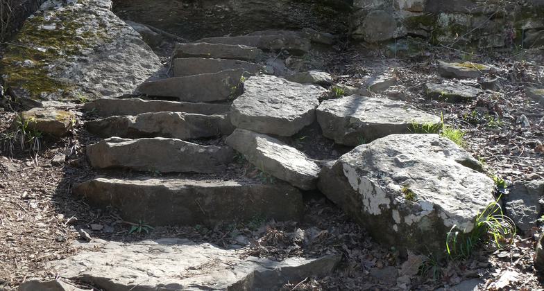
Photo by Steven Parker.

Photo by Steven Parker.

Trail blaze. Photo by Steven Parker.

Devil's Den State Park. Photo by Catherine/wiki.
Location: Devils Den State Park, 15 miles south of Fayetteville on U.S. Highway 71.
- States: Arkansas
- Counties: Washington
The Devil's Den Trail is a natural surface trail just over a mile long. This trail is moderately strenuous due to elevation changes, steps, and uneven surfaces. The trail surface is dirt and rock. Expect mud after it rains. This trail is neither stroller nor disabled accessible (i.e. wheelchairs). There are numerous rock steps. A brochure describing marked locations on the trail is available at the Visitor's Center.
Accessibility Information
No text provided.
Allowed Uses:
Hiking/WalkingPublic Contact
Devil’s Den State Park11333 W Ark Hwy 74
West Fork, AR 72774
[email protected] • (479) 761-3325
www.ArkansasStateParks.com
Contact the trail manager for current maps and visiting details.
More Details
- Elevation (low): 1014
- Elevation (high): 1184
- Elevation (cumulative): --
- Part of a Trail System? No
- Surface (primary): Soil
- Surfaces (additional): --
- Tread Width (average): 0"
- Tread Width (minimum): --
- Running length (minimum): --
- Tread Grade (average, percent): --
- Tread Grade (maximum):
- Running length (maximum): --
- Cross-slope (average, percent): --
- Cross-slope (maximum): --
- Running length (maximum): --
- Certified as an NRT
Mar 7, 1978