Delaware River Water Trail - Middle Delaware Segment
check with the trail manager for updated details before visiting.
Delaware River Water Trail - Middle Delaware Segment
National Park Service
Water Trail (other)
- Length
40.6 miles
- Elevation Gain
--
- Route Type
out & back
- Length
40.6 miles - Elevation Gain
-- - Route Type
out & back
The Delaware River Water Trail follows one of the most remarkable rivers in the nation: so rich in recreational, scenic, historic and natural resources that three-quarters of the non-tidal Delaware River (about 150 miles) is included in the National Wild and Scenic Rivers System.

Bridge remnants on the Middle Delaware. Photo by John Bumberger.

Launch time. Photo by John Bumberger.

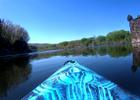
Kayak view. Photo by John Bumberger.

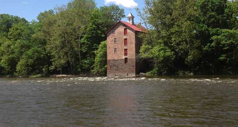
Stover Mill on the Middle Delaware. Photo by John Bumberger.
Location: Connects Port Jervis to E. Stroudsburg in Delaware Water Gap NRA
- States: Pennsylvania
- Counties: Warren, Pike
The variety of outstanding resources visible along the 40.6 miles of water trail within Delaware Water Gap National Recreation Area (DWGNRA) includes two major geological formations at Walpack Bend and the Delaware Water Gap itself; diverse populations of wildlife; unique natural areas and scenic vistas; mountain forests; wetlands; fertile farmland; towns and structures of national importance; shallow riffles and quiet pools; and world-famous trout fishing.
The river lies within a two-hour drive for 20 percent of the nation's population, and eight river access points are available in a 40.6-mile stretch for both motorized and non-motorized users, making the water trail very accessible to large populations. Yet the Delaware is one of the cleanest and most scenic rivers in the northeastern U.S. The DWGNRA section of the water trail retains a wild, natural feeling, largely due to cooperative efforts to protect the river corridor as part of the national park. The Delaware River Water Trail is accessible to a variety of recreational users, including campers, swimmers, anglers, canoeists and kayakers, tubers, and motorboaters, regardless of skill level.
The water trail is served by several commercial liveries, one of which is among the nation's largest. Together with the American Canoe Association, National Canoe Safety Patrol, and National Park Service, the liveries work to support safe, enjoyable use of the river and help to keep it clean. Connections with other land-based trails are significant and include the Appalachian National Scenic Trail, which crosses the Delaware Water Gap and Worthington State Forest, and the Joseph M. McDade Recreational Trail on the western shore of the Delaware River.
Accessibility Information
No text provided.
Allowed Uses:
Boating, motorized Dogs, on leashOther Activities
- Camping
Public Contact
Emie KavertWashington State Forest
HC 62, Box 2
Columbia, NJ 7832
[email protected] • (908) 841-9575
www.state.nj.us/dep/parksandforests/parks/worthington.html
More Details
- Elevation (low): --
- Elevation (high): --
- Elevation (cumulative): --
- Part of a Trail System? No
- National Designations: National Recreation Area; Middle Delaware Scenic
- State Designations: Pennsylvania Water Trail (Pennsylvania Fish & Boat
- Surface (primary): Water, slow moving
- Surfaces (additional): Water, calm
- Tread Width (average): 0"
- Tread Width (minimum): --
- Running length (minimum): --
- Tread Grade (average, percent): --
- Tread Grade (maximum):
- Running length (maximum): --
- Cross-slope (average, percent): --
- Cross-slope (maximum): --
- Running length (maximum): --
- Certified as an NRT
May 31, 2007