DeHart Mountain Trail
check with the trail manager for updated details before visiting.
DeHart Mountain Trail
Private
Backcountry Trail
- Length
5.2 miles
- Elevation Gain
--
- Route Type
out & back
- Length
5.2 miles - Elevation Gain
-- - Route Type
out & back
Location: Dehart Botanical Gardens 11317 Jeb Stuart Hwy (US Hwy 58), Stuart, VA 24171 Patrick County
- States: Virginia
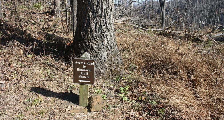
This hiking-only trail has been carefully engineered to connect ancient footpaths, horse and wagon roads, old timber roads, and an isolated pioneer homesite on the north side of DeHart Mountain. Its construction has left some sections in their natural state, created others with scenic overlooks, and built others with contour design switchbacks for comfort and safety. The trail does not make a connection with other trails because of its pristine and isolated environment.
The trail is day-use only and open to the public for hiking and educational purposes. Tours are provided and special interest is given to school children for providing contact with old-growth trees, waterfalls, history, and animal and plant life.
Because the trail has access from U.S. Hwy 58, a major multi-state route, visitors are frequent. Volunteer workers and management programs provide community services and minimize costs.
Accessibility Information
No text provided.
Allowed Uses:
Hiking/WalkingOther Activities
- Wildlife viewing / observation
Public Contact
Lillian BentonDeHart Botanical Gardens
P.O. Box 115
Bunn, NC 27508
[email protected] • (252) 478-7777
Contact the trail manager for current maps and visiting details.
More Details
- Elevation (low): 1510
- Elevation (high): 2650
- Elevation (cumulative): --
- Part of a Trail System? No
- Surface (primary): Soil
- Surfaces (additional): --
- Tread Width (average): 36"
- Tread Width (minimum): --
- Running length (minimum): --
- Tread Grade (average, percent): 7
- Tread Grade (maximum): 9
- Running length (maximum): --
- Cross-slope (average, percent): --
- Cross-slope (maximum): --
- Running length (maximum): --
- Certified as an NRT
Jun 3, 2005