Deer Mountain-John Mountain Trail
check with the trail manager for updated details before visiting.
Deer Mountain-John Mountain Trail
USDA Forest Service
Backcountry Trail
- Length
11 miles
- Elevation Gain
--
- Route Type
out & back
- Length
11 miles - Elevation Gain
-- - Route Type
out & back
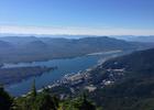
Towering 3,000 feet above the waterfront, the summit of Deer Mountain is one of Ketchikan's most familiar landmarks. Climbing to the top is also the most popular hike out of Ketchikan, since the trailhead is only .5 mile from downtown. Deer Mountain can be hiked in the better part of a day; although spending 2-3 days to hike the trail from Ketchikan to Silvis Lake is not uncommon.
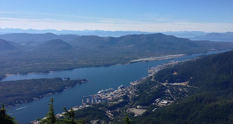
A view of Ketchikan, Alaska looking northwest from the summit of Deer Mountain. Photo by NorthBySouthBaranof.
Location: Tongass National Forest, Misty Fiords Ranger District, At beginning in Ketchikan, connects Blue Lake, Upper Silvis Lake, and the shoreline of George Inlet.
- States: Alaska
- Counties: Ketchikan Gateway
The Deer Mountain National Recreation Trail is 10.7 miles long. This trail begins at the Deer Mountain trailhead and continues to Upper Silvis Lake. The trail is composed of natural tread with brief sections of boardwalk. The trail is steep, with many switchbacks, and gains two thousand feet of elevation in the first two miles of trail. From the Deer Mtn. shelter to Blue Lake shelter, the trail route is marked and some tread does exist. The trail beyond Blue Lake to John Mtn. and Upper Silvis Lake has some markers but very little tread is present. Hikers venturing beyond Blue Lake should be experienced with the use of maps, compasses, and/or GPS as well as have knowledge of the trail route.
June through September are the most popular hiking months in southeast Alaska. Upper elevations are often snow-covered until mid-June, making the going tough without skis or snowshoes. A clear fall day, without bugs and with autumn alpine colors, can be a great time for a trip, providing you are prepared for sudden weather changes.
Accessibility Information
No text provided.
Allowed Uses:
Dogs, on leash Hiking/Walking Snow, cross-country skiing Snow, snowshoeingOther Activities
- Camping
- Fishing
- Snow, snow play general
- Wildlife viewing / observation
Public Contact
Cindy SchelinSoutheast Discovery Center
50 Main Street
Ketchikan, AK 99901
(907) 228-6290
Contact the trail manager for current maps and visiting details.
More Details
- Elevation (low): 300
- Elevation (high): 3238
- Elevation (cumulative): --
- Part of a Trail System? No
- Surface (primary): Boardwalk
- Surfaces (additional): Boardwalk, Rock, crushed
- Tread Width (average): 36"
- Tread Width (minimum): --
- Running length (minimum): --
- Tread Grade (average, percent): --
- Tread Grade (maximum): 60
- Running length (maximum): --
- Cross-slope (average, percent): --
- Cross-slope (maximum): --
- Running length (maximum): --
- Certified as an NRT
Dec 7, 1978