Dedham Water Trail
check with the trail manager for updated details before visiting.
Dedham Water Trail
City, Town, or County
Backcountry Trail
Water Trail (other)
- Length
6 miles
- Elevation Gain
--
- Route Type
Loop
- Length
6 miles - Elevation Gain
-- - Route Type
Loop
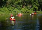
The Dedham Water Trail is 7.2 miles long and follows the lead of organized hiking trails by marking the trail with mile markers and signs at launches and significant historical and ecological locations.

#1 Dolan Center - The Town has canoes and kayaks available. Photo by Jonathan Briggs

Cormorant heading up river @ marker #15. Photo by JJB.
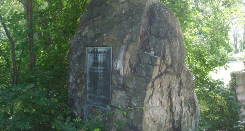
Old Dedham Boat Club plaque @ marker#6. Photo by JJB.

Beaver lodge at marker #13. Photo by JJB.

#13 Sign at Long Ditch Mouth.

Pine Island Reserve - Deer off the point, early morning.

#1 Dolan Center - Grand Opening and ribbon cutting.

#1 Dolan Launch - Canoes and Kayaks were donated.

#2 Great Blue Heron at Motley Pond.

#7 The Keye - This placard is on the Ames St bridge.
Location: The Dedham Water Trail is along the Charles River and located entirely within the Town of Dedham, Massachusetts.
- States: Massachusetts
- Counties: Norfolk
- Cities/Townships: Dedham
Dedham is fortunate to have such a valuable natural and historical resource as the Charles River running through the community. The Charles River flows 80 miles starting at Echo Lake in Hopkinton, through 22 cities and towns in eastern Massachusetts before emptying into Boston Harbor. The Charles River, originally named Massachusetts River, was founded by explorer Captain John Smith who mapped the coast of New England. Dedham's portion of the Charles offers smooth water with a moderate current. The Water Trail is located entirely in Dedham and is made a loop by Long Ditch, located in Cutler Park. The Water Trail follows the lead of organized hiking trails, by marking the trail with mile markers and signs at launches and at significant historical and ecological locations. The goal of the Water Trail is to attract visitors to the Charles and create an educational and lasting experience that would in turn create environmental stewards of the river. There are currently 5 public launch sites along the Water Trail of which several are adjacent to the many acres of Dedham's parks and conservation lands. Some of the things paddlers will encounter, besides the unique flora and fauna that the River supports, are: the landing place of Contentment's (Dedham's) first settlers in 1635; the place of the first cart path over the Charles River; Cutler Park, the largest marsh area on the Charles River; the Castle"Riverdale" at the Noble and Greenough School built for railroad tycoon Albert Nickerson in 1890; Mother Brook, believed to be the first man made canal in the United States and the course for the first water driven, broad powered loom in the world; Powder House, built in 1766 stored military supplies through the period of the American Revolution; as well as several other sites (see interactive map at www.dedhamtrails.com) The start of the Dedham Water Trail and main launch area is located on the grounds of the Dedham Parks & Recreation Building, which also connects to several walking and hiking trails and is the hub for all Town programing. There are many Trail programs offered throughout the year by the Town and in partnership with L.L. Bean Outdoor Adventures. There is also Pathfinders, a handicapped youth and adult paddling program. Through the support of our partners we've also been able to offer free use of kayaks and canoes to families that may not have been able to access this great resource in the past. The Dedham Water Trail received grant funding through the Recreational Trails Program. The Recreational Trails Program is a national program through the Federal Highway Administration (FHWA) and administered on the state level by the Department of Conservation and Recreation. The Water Trail has also received tremendous support from the community with in kind donations from Hebrew Senior Life, DiMella Shaffer Architects, Legacy Place, L.L. Bean, New Balance, Troop 1 Islington, and Bill Hartigan Photography. Financial donations from the following organizations were critical to the completion of this project: the Dedham Land Trust, Dedham Savings, Whole Foods Market, the New England Grassroots Environmental Fund, and a local family foundation. Special thanks to Dedham's Department of Public Works and Parks and Recreation Department.
Accessibility Information
No text provided.
Allowed Uses:
Boating, human-poweredOther Activities
- Fishing
- Ice skating
- Wildlife viewing / observation
Public Contact
Virginia LeClairEnvironmental Dept / Parks & Rec Dept
Town Hall, Bryant Street
Dedham, MA 02026
[email protected] • 7817519213
Contact the trail manager for current maps and visiting details.
More Details
- Elevation (low): --
- Elevation (high): --
- Elevation (cumulative): --
- Part of a Trail System? No
- Surface (primary): Water, slow moving
- Surfaces (additional): Paved, Grass or Vegetation, Rock, crushed, Water, slow moving, Water, calm
- Tread Width (average): 0"
- Tread Width (minimum): 0
- Running length (minimum): --
- Tread Grade (average, percent): --
- Tread Grade (maximum):
- Running length (maximum): --
- Cross-slope (average, percent): 0
- Cross-slope (maximum): --
- Running length (maximum): --
- Certified as an NRT
Jun 2, 2014