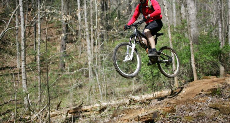
Dark Mountain Trail
check with the trail manager for updated details before visiting.
Dark Mountain Trail
U.S. Corps of Engineers
- Length
7 miles
- Elevation Gain
--
- Route Type
out & back
- Length
7 miles - Elevation Gain
-- - Route Type
out & back
Location: Dark Mountain Park, W. Kerr Scott Reservoir
- States: North Carolina
- Counties: Wilkes
In November of 2002, the International Bicycling Association (IMBA) sponsored a Subaru Trail Care trail design workshop at the park in western North Carolina. The workshop resulted in a Memorandum of Understanding between the Corps of Engineers and the local IMBA chapter, the Brushy Mountain Cyclists.
Following several hundred hours of volunteer work, planning sessions, and after employing sustainable trail-building techniques, the first section was opened officially to the public during Memorial Day weekend of 2004. That weekend also saw the area's first professional mountain bike race, Burn 24, a time trial for world championship events of 24-hour endurance mountain bike competition.
Since completing the seven-mile trail, the Dark Mountain Park multi-use trail system has become a popular destination for hikers, mountain bikers, and nature observers. When completed, the Dark Mountain Trail will connect with the Yadkin River Greenway and the Overmountain Victory National Historic Trail. The trail's ultimate connection to recreational facilities along the Yadkin River Greenway such as the YMCA, Wilkes Community College, and the towns of Wilkesboro and North Wilkesboro, will make the trail a tremendous recreational resource on federal lands managed by the U. S. Army Corps of Engineers.
Accessibility Information
No text provided.
Allowed Uses:
Bicycling Hiking/WalkingOther Activities
- Wildlife viewing / observation
Public Contact
Terry RamseyUS Army Corps of Engineers
499 Reservoir Rd.
Wilkesboro, NC 28697
[email protected] • (336) 921-3750
www.saw.usace.army.mil/wkscott/index.htm
Contact the trail manager for current maps and visiting details.
More Details
- Elevation (low): 1037
- Elevation (high): 1150
- Elevation (cumulative): --
- Part of a Trail System? No
- Surface (primary): Soil
- Surfaces (additional): --
- Tread Width (average): 40"
- Tread Width (minimum): --
- Running length (minimum): --
- Tread Grade (average, percent): 2
- Tread Grade (maximum): 10
- Running length (maximum): --
- Cross-slope (average, percent): --
- Cross-slope (maximum): --
- Running length (maximum): --
- Certified as an NRT
Jun 3, 2005