Dam Mountain
This information is a public record of the 1978 NRT application and may be out of date if it has not been updated by a trail manager --
check with the trail manager for updated details before visiting.
check with the trail manager for updated details before visiting.
Dam Mountain
State
Backcountry Trail
- Length
4.5 miles
- Elevation Gain
--
- Route Type
out & back
- Length
4.5 miles - Elevation Gain
-- - Route Type
out & back
The trail passes through the pine/hardwood forest of the park to the top of Dam Mountain.
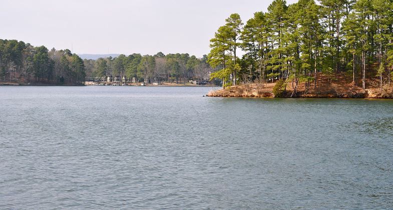

Location: Lake Catherine State Park, 15 miles south of Hot Springs on State Route 7.
- States: Arkansas
The trail begins at waterfall. Offers scenic vistas of Lake Catherine and the surrounding mountains. Spring and fall offer a variety of wildflowers, plants, and animal life. Streams and cascades are great for providing solitude and attracting the keen eye of the photographer.
Accessibility Information
No text provided.
Allowed Uses:
Swimming Dogs, on leash Hiking/WalkingOther Activities
- Wildlife viewing / observation
Public Contact
Lake Catherine State Park1200 Catherine Park Rd.
Hot Springs, AR 71913
(501) 844-4176
Contact the trail manager for current maps and visiting details.
More Details
- Elevation (low): --
- Elevation (high): --
- Elevation (cumulative): --
- Part of a Trail System? No
- Surface (primary): --
- Surfaces (additional): --
- Tread Width (average): 48"
- Tread Width (minimum): --
- Running length (minimum): --
- Tread Grade (average, percent): --
- Tread Grade (maximum):
- Running length (maximum): --
- Cross-slope (average, percent): --
- Cross-slope (maximum): --
- Running length (maximum): --
- Certified as an NRT
Mar 7, 1978