Cutthroat Creek Trail
check with the trail manager for updated details before visiting.
Cutthroat Creek Trail
USDA Forest Service
Backcountry Trail
- Length
5.5 miles
- Elevation Gain
--
- Route Type
out & back
- Length
5.5 miles - Elevation Gain
-- - Route Type
out & back
Easy hike into alpine lake cradled in highballed cirque.
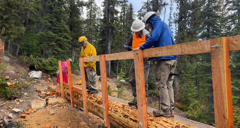
2025 Photo Contest Winner - Trail Work Category. Photo by Allen Jirick - Methow Valley Trails Collaborative

Volunteers install handrailing

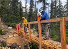
MVTC sta and volunteers pose on their freshly completed single stringer bridge replacement.

2023 NRT Photo Contest Submission
Location: N of Rainy Pass on SR 20 and FS Rd. 3511, connects to Pacific Crest Trail.
- States: Washington
- Counties: Skagit
The trail crosses a bridge over Cutthroat Creek and begins a gentle uphill climb to a trail junction at 1.7 miles. The left trail leads to Cutthroat Lake in 0.25 miles. From the junction the trail gains 1900 feet in the next 3.8 miles to the pass where it meets the Pacific Crest Trail. Mountain goats are often seen near the pass. See beautiful alpine lake views and those who wish for great mountain views will enjoy looking out at the towering rugged peaks from the pass. There are beautiful wildflowers in July and August followed by the spectacular fall gold colors of alpine larches and red colors of huckleberry bushes. Water may be scarce beyond the lake trail junction later in the summer. Be sure to fill water bottles before going onto the pass.
Accessibility Information
No text provided.
Allowed Uses:
Hiking/WalkingPublic Contact
Jim HammerOkanogan National Forest
Methow Valley Ranger District
Winthrop, WA 98862
(509) 996-4017
Contact the trail manager for current maps and visiting details.
More Details
- Elevation (low): --
- Elevation (high): --
- Elevation (cumulative): --
- Part of a Trail System? No
- Surface (primary): --
- Surfaces (additional): --
- Tread Width (average): 24"
- Tread Width (minimum): --
- Running length (minimum): --
- Tread Grade (average, percent): --
- Tread Grade (maximum):
- Running length (maximum): --
- Cross-slope (average, percent): --
- Cross-slope (maximum): --
- Running length (maximum): --
- Certified as an NRT
May 14, 1981