Cross Vermont Trail
check with the trail manager for updated details before visiting.
Cross Vermont Trail
Nonprofit
Frontcountry Trail
Rail Trail
Urban Trail
- Length
90 miles
- Elevation Gain
--
- Route Type
out & back
(1 review)
- Length
90 miles - Elevation Gain
-- - Route Type
out & back
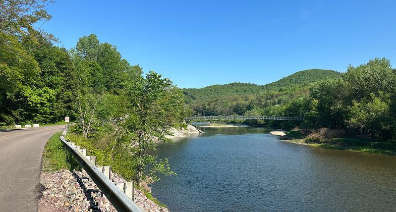
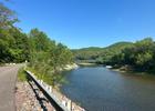
River views. Photo by Janie Walker
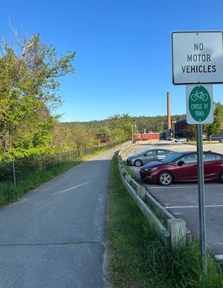
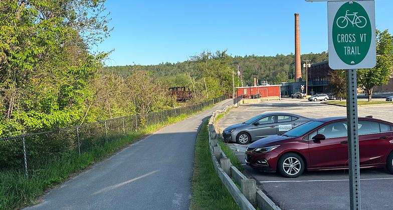
Urban portion

Farmer field

Country road

Along Johnnie Brook Trail

Location: Winsooski & Wells River Valleys in Vermont
- States: Vermont
- Counties: Chittenden, Washington, Caledonia, Orange
The Cross Vermont Trail spans the state from Lake Champlain to the Connecticut River, closely following the Winooski River, through the Green Mountains, and then, crossing the watershed divide in Groton State Forest, the Wells River down to Vermont's border with New Hampshire. The route joins 18 communities by linking village centers, parks, nature preserves, and schools. Currently, the state-wide route includes 30 miles of local trails and 60 miles of scenic roads. The Cross Vermont Trail Association is working to build new sections of trail with the eventual goal of a complete off-road route that will be a safe bicycle and pedestrian alternative to cars, a recreation resource for communities, and a contributor to local economies.
Accessibility Information
No text provided.
Reviews
Janie Walker
Nice series of connecting trails and country roads
I thru-hiked this May 26 - May 31, 2023. This trail is primarily for bicyclists, and I knew that going in. Still, hikers who don’t mind a lot of country road walking would enjoy it. I give this five stars keeping the fact that it is really a biking route in mind, and knowing that there is a very active trail community continually creating ways to get the on-road portions off-road. So as the years go by, I’d expect less and less busy road walking and more and more off-road paths. As it is, the busy road walking is there but does not dominate the experience. It’s mainly country roads and rail trail/bike paths. Note that legal camping is scarce. I made use of hotel rewards points in towns and only camped once, in Groton State Forest (reservations required). For bikers, this won’t be as much of an issue to figure out since you’ll be on trail fewer days. The scenery is usually river, fields, hills/mountains, and small towns. The trail also goes through Montpelier, Waterbury, and of course the southern bits of urban Burlington. Use the maps and turn-by-turn directions on the Cross-VT organization’s website! Otherwise you will likely walk/ride right by at least a couple turns. That website is excellent - all the info you could want about this trail is contained within.
Allowed Uses:
Bicycling Dogs, on leash Equestrian Hiking/Walking Motorized vehicles, snowmobilingOther Activities
- Camping
- Fishing
- Snow, snow play general
Public Contact
Greg WesternCross Vermont Trail Association, Inc.
Central Vermont RPC
Montpelier, VT 05602
[email protected] • (802) 498-0079
www.crossvermont.org
Contact the trail manager for current maps and visiting details.
More Details
- Elevation (low): 350
- Elevation (high): 1388
- Elevation (cumulative): --
- Part of a Trail System? No
- National Designations: Community Millenium
- State Designations: Vermont Trails System
- Surface (primary): Paved
- Surfaces (additional): Rock, crushed, Soil
- Tread Width (average): 127"
- Tread Width (minimum): --
- Running length (minimum): --
- Tread Grade (average, percent): 2
- Tread Grade (maximum): 5
- Running length (maximum): --
- Cross-slope (average, percent): --
- Cross-slope (maximum): --
- Running length (maximum): --
- Certified as an NRT
Jun 4, 2003