Cress Creek Nature Trail
check with the trail manager for updated details before visiting.
Cress Creek Nature Trail
Bureau of Land Management
Backcountry Trail
- Length
1.1 miles
- Elevation Gain
--
- Route Type
out & back
- Length
1.1 miles - Elevation Gain
-- - Route Type
out & back
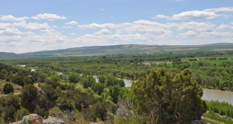
Cress Creek Nature Trail is a self-guided interpretative trail that highlights the unique natural characteristics of eastern Idaho. The 18 interpretative signs discuss topics ranging from the geologic features that can be seen from the trail such as volcanoes, to the vegetation found in the surrounding wet and dry environments.
Cress Creek. Photo by Sarah Wheeler.

Early forest fire education. Photo by Sarah Wheeler.

Future rangers listening to Smokey. Photo by Sarah Wheeler.
Location: Snake River, about 20 miles northeast of Idaho Falls, Idaho
- States: Idaho
- Counties: Bonneville, Jefferson
Cress Creek Nature Trail is a self-guided interpretative trail that highlights the unique natural characteristics of eastern Idaho. The 18 interpretative signs discuss topics ranging from the geologic features that can be seen from the trail such as volcanoes to the vegetation found in the surrounding wet and dry environments.
During a visit to Cress Creek Nature Trail, you may see deer, moose, rabbits, small lizards, and eagles. While traveling through dryer desert environments along the trail, the expansive cottonwood forests are easily viewed below along the South Fork of the Snake River.
The trail attracts many local visitors and is especially popular with school groups (the idea of an interpretive trail was first proposed to the BLM by school teachers from the local town of Ririe). The BLM website has a map, virtual tour, downloadable student quiz with answer key, and more. Interpretive programs are available to school and scout groups subject to availability.
Accessibility Information
No text provided.
Allowed Uses:
Hiking/WalkingPublic Contact
Monica ZimmermanBureau of Land Management
1405 Hollipark Dr.
Idaho Falls, ID 83401
[email protected] • (208) 524-7552
Contact the trail manager for current maps and visiting details.
More Details
- Elevation (low): 5020
- Elevation (high): 5319
- Elevation (cumulative): --
- Part of a Trail System? No
- Surface (primary): Paved
- Surfaces (additional): Rock, crushed
- Tread Width (average): 50"
- Tread Width (minimum): --
- Running length (minimum): --
- Tread Grade (average, percent): 4
- Tread Grade (maximum): 8
- Running length (maximum): --
- Cross-slope (average, percent): --
- Cross-slope (maximum): --
- Running length (maximum): --
- Certified as an NRT
Jun 3, 2005