Crawfords Path
check with the trail manager for updated details before visiting.
Crawfords Path
USDA Forest Service
Backcountry Trail
- Length
2.9 miles
- Elevation Gain
--
- Route Type
out & back
(1 review)
- Length
2.9 miles - Elevation Gain
-- - Route Type
out & back

Hikers on Mt. Pierce along Crawfords Path. Photo by Doug Alderson.

Looking south on Crawford Path from shoulder of Mt Washington (October photo). Photo by Janie Walker.

On Crawford Path in November, heading toward Mt. Washington. Photo by Janie Walker.

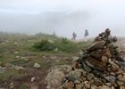
On Crawford Path, past Pierce and heading toward Eisenhower. Photo by Janie Walker.

Crawford Path, below treeline. Photo by Janie Walker.

View of Mount Eisenhower taken from Crawford Path. Photo by Canderson7/wiki.

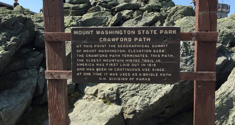
Sign describing the summit of Mount Washington and the Crawford Path in Sargent's Purchase Township, Coos County, NH. Photo by Famartin/wiki.

Location:
- States: New Hampshire
- Counties: Coos
This trail is considered to be the oldest continuously maintained footpath in America. Parts of this trail are dangerous in bad weather, use proper precautions.
Accessibility Information
No text provided.
Reviews
Janie Walker
Crawford Path
I am unsure if the National Recreation Trail portion of Crawford Path is the entire thing (ending on Mt. Washington) or to just beneath Mt. Pierce. The mileage listed suggests it is just to Mt. Pierce. The entire trail is 8.5 miles one way, to Pierce it is about 3 miles one way.
Crawford Path gets 5 stars for the mindblowing, beautiful views that await you at the top, especially if you are going toward Mt. Washington and walking above treeline all day. This trail is a typical White Mountain trail, meaning it is all rocks, boulders, and roots. Once above treeline, if heading toward Washington, the footing gets easier -- but be very, very careful above treeline. People underestimate the Presidentials every year, and every year, many people have to get rescued on these peaks and there are always unfortunately a few deaths. This area is underneath a convergence of three storm systems, which means thunderstorms can form overhead with no warning, even if the forecast calls for clear skies all day. The wind speed is rarely under 30mph above treeline, dense fog often creates white-out conditions, and the temperature can and often does drop quickly. Be prepared with a map and compass, and know your bail-out routes.
Allowed Uses:
Hiking/Walking Snow, snowshoeingOther Activities
- Camping
- Snow, snow play general
Public Contact
Roger CollinsWhite Mountain National Forest
660 Trudeau Rd.
Bethlehem, NH 3574
[email protected] • (603) 869-2626
Contact the trail manager for current maps and visiting details.
More Details
- Elevation (low): 1892
- Elevation (high): 4231
- Elevation (cumulative): --
- Part of a Trail System? No
- Surface (primary): --
- Surfaces (additional): --
- Tread Width (average): 30"
- Tread Width (minimum): --
- Running length (minimum): --
- Tread Grade (average, percent): 15
- Tread Grade (maximum): 26
- Running length (maximum): --
- Cross-slope (average, percent): --
- Cross-slope (maximum): --
- Running length (maximum): --
- Certified as an NRT
May 31, 1994