Crane Lake
check with the trail manager for updated details before visiting.
Crane Lake
USDA Forest Service
Backcountry Trail
- Length
5 miles
- Elevation Gain
--
- Route Type
Loop
(1 review)
- Length
5 miles - Elevation Gain
-- - Route Type
Loop
The Crane Lake Trail is 1.5 miles long. It begins at the trailhead on the Three Lakes Loop Road and ends at the junction with Ideal Cove and Hill Lake Trails.
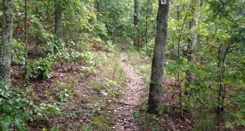
Ozark Trail at Crane Lake. Photo by Don Massey.

The double loop connector passes across a shut-in at the base of the dam outlet. Photo by Donna Kridelbaugh & John Stone.
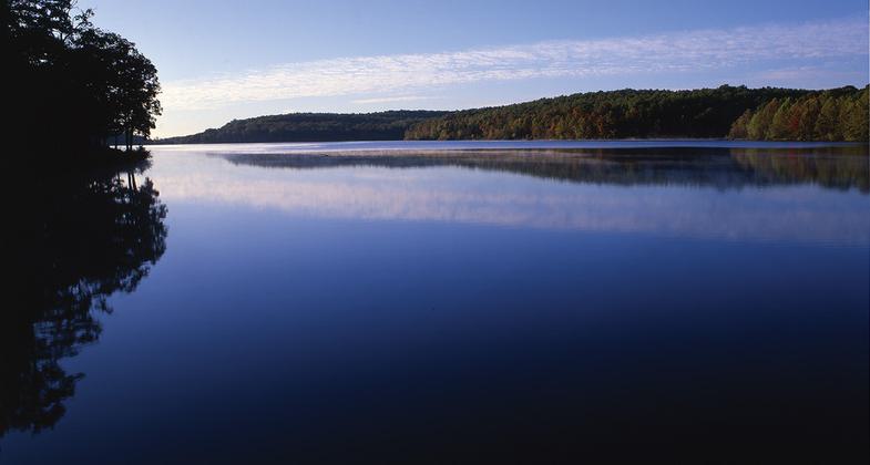
Crane Lake Trail follows part of the Marble Creek section of the Ozark Trail. Photo by Donna Kridelbaugh & John Stone.
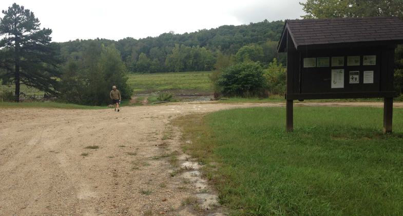
There is ample parking available at the trailhead but no camping is allowed. Photo by Donna Kridelbaugh & John Stone.
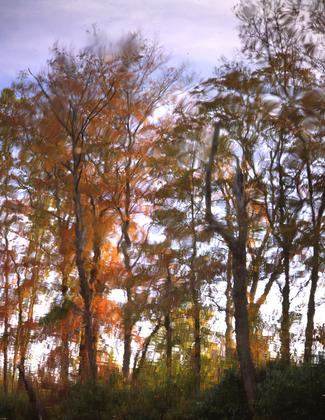
Autumn reflections. Photo by Don Massey.


Location: Mark Twain National Forest, Iron County Road 131.
- States: Missouri
- Counties: Iron
Five-mile, double-loop hiking, and mountain biking trail, with a short segment also open to horses, where it connects with the cross-state Ozark Trail. A portion of the trail also follows part of the Marble Creek Section of the Ozark Trail. The lake loop roughly parallels the shoreline of Crane Lake, while the South Loop passes through a series of glades, shut-ins, old fields, and oak-hickory forests.
Accessibility Information
No text provided.
Reviews
Donna Kridelbaugh
NRT Ambassador Review
We visited Crane Lake Trail in the fall of 2018. It is a double loop trail with a total distance of approximately 5 miles. The referenced north loop circles around Crane Lake, which also is referred to as the lake loop, and is around 3 miles total. There is a short connector that crosses a shut-in just below the dam outlet to form the double loop. The south loop is approximately 2 miles in length. Crane Lake Trail follows part of the Marble Creek section of the Ozark Trail, which also is designated as a National Recreation Trail and more information (e.g., maps) can be found on the Ozark Trail Association website (ozarktrail.com).
At the time of this review, the water level for Crane Lake had been drawn down to allow for evaluation of repairs to the dam. Please note that the connector just below the dam was a precarious water crossing because of the open outlet. Additionally, the southern side of the north/lake loop follows a Forest Service road (FS 2115), which does not make this an enjoyable hike as the road is very wide and muddy. The district plans to decommission this road and try to rehab in the future after repairs to the dam are made.
It is recommended to check on trail conditions and any closures with the U.S. Forest Service district office before heading out on this trail. This project is still ongoing as of Fall 2019 and more information is regularly posted on the Mark Twain National Forest Facebook page as well. If we were to re-visit the area in the near future, we would stick to hiking the Ozark Trail portion of the trail.
Allowed Uses:
Bicycling Boating, human-powered Dogs, on leash Hiking/WalkingOther Activities
- Camping
- Fishing
- Wildlife viewing / observation
Public Contact
Ozark Trail Association406 West High Street
Potosi, MO 63664
(573) 436-0540
www.ozarktrail.com
Contact the trail manager for current maps and visiting details.
More Details
- Elevation (low): 858
- Elevation (high): 933
- Elevation (cumulative): --
- Part of a Trail System? No
- Surface (primary): Soil
- Surfaces (additional): Soil
- Tread Width (average): 21"
- Tread Width (minimum): --
- Running length (minimum): --
- Tread Grade (average, percent): 7
- Tread Grade (maximum): 25
- Running length (maximum): --
- Cross-slope (average, percent): --
- Cross-slope (maximum): --
- Running length (maximum): --
- Certified as an NRT
Jan 31, 1980