Crabtree Cove Trail
check with the trail manager for updated details before visiting.
Crabtree Cove Trail
U.S. Corps of Engineers
Backcountry Trail
Urban Trail
- Length
2.59 miles
- Elevation Gain
--
- Route Type
Loop
- Length
2.59 miles - Elevation Gain
-- - Route Type
Loop
Comprised of three separate loops, the Crabtree Cove Trail spans a total of a little under 3 miles of trail surface. Nestled near the Stockton Lake Dam, this trail is located conveniently just minutes from the town of Stockton and less than an hour's drive from Springfield, MO.

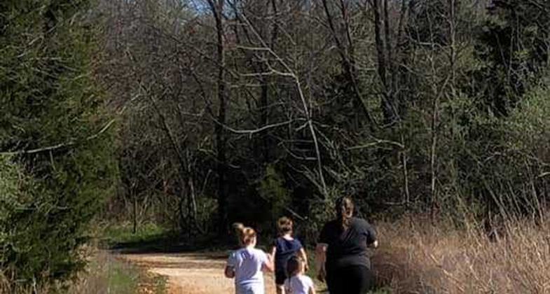
Family of Four. Photo by Jennie Wilson

Photo

Photo

Photo

Photo

Photo

Photo

Photo

Photo

Photo


Location: Located on Stockton Lake in Stockton, Missouri, the Crabtree Cove Trail is conveniently placed on the north side of the lake near the Stockton Lake Dam and just minutes from the town of Stockton.
- States: Missouri
- Counties: Cedar
- Cities/Townships: Stockton, Missouri
While there are several trails offered around the dam area, the Crabtree Cove Trail seems to be the most popular and frequently used by the visiting public. Nestled just off Highway 32, this trail offers easy access to jump off the main road and take a hike through nature. Many residents enjoy the accessibility for hikes, bird watching, picnic lunches, and swimming.
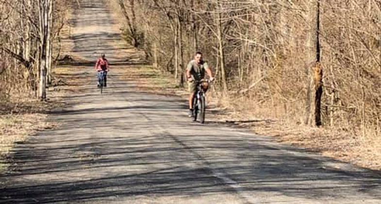
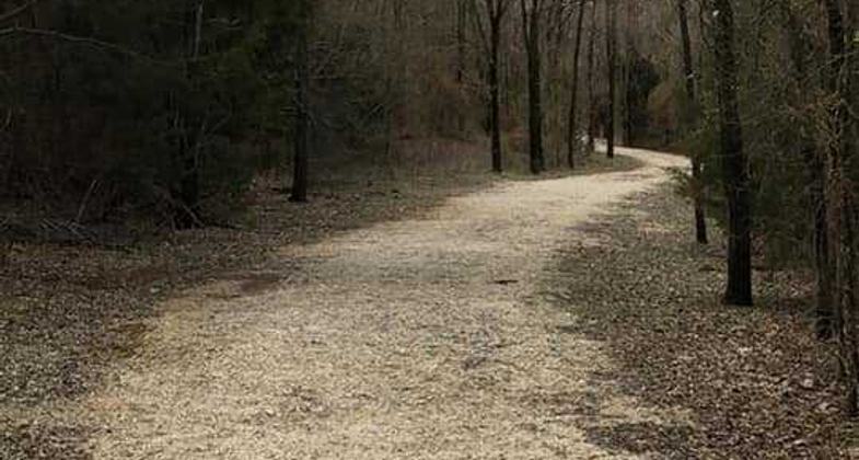
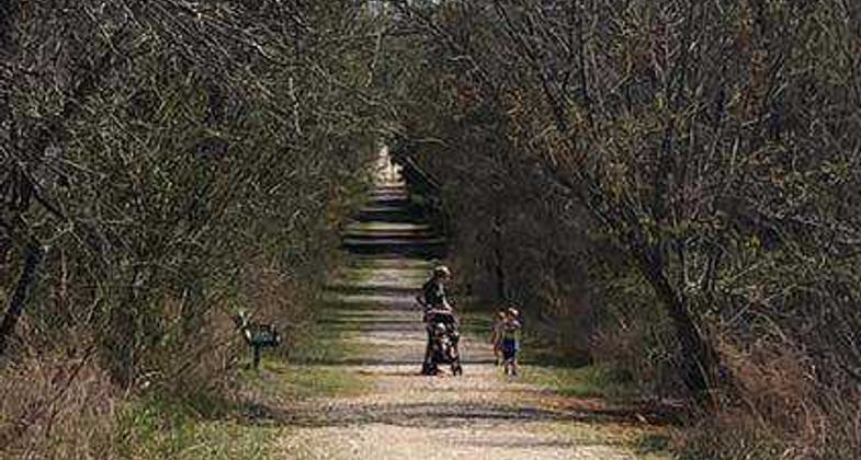
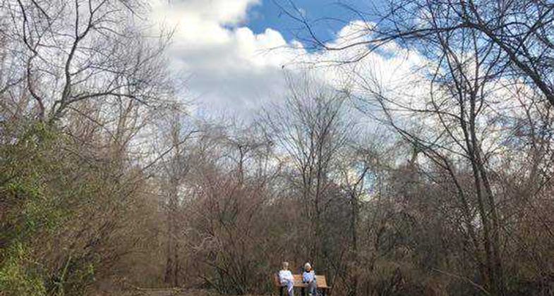
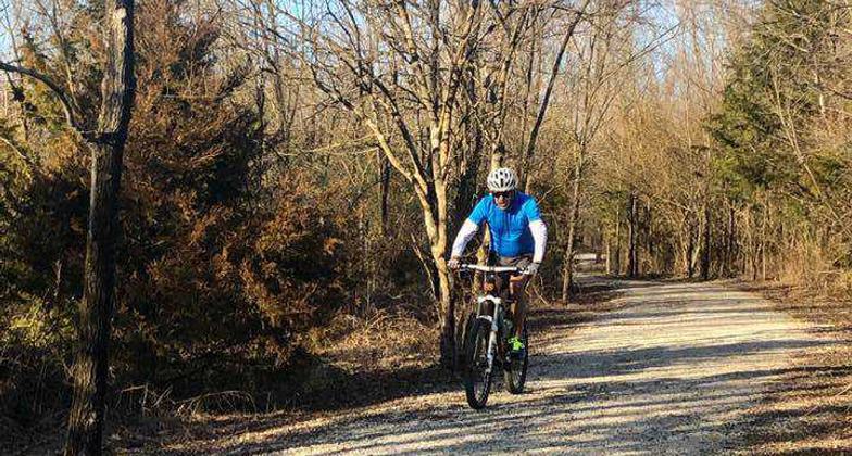
The Crabtree Cove Trail sits on the very East end of the Stockton Lake Dam. Its first trailhead is located at the North end of our east dyke and runs south to our Crabtree Cove Campground. Popular for family strolls, this trail is obviously family-friendly and can be as easy or challenging as you prefer! Hike the main Crabtree Cove Trail or use the two additional loops to dive a little deeper into nature. This trail boasts a restroom on each end and several benches along the way if you wish to sit and take nature in. The Quarry Loop is nestled along the waters' edge in the ever-so-popular Crabtree Quarry. A popular place for family pictures, the Quarry Loop offers many photo opportunities for many species, not just humans! If you are interested in a quieter, less traveled addition, the Overlook Loop of the Crabtree Cove Trail is right up your alley. Also placed conveniently near the shoreline, this loop will keep you on your toes with an abundance of different flora and fauna.
Pets are allowed on all US Army Corps of Engineers-operated trails on Stockton Lake if they are on leashes six feet or less. The trails are routinely patrolled by the Corps of Engineers Park Rangers as well as Cedar County Sheriff's Office deputies, especially in the summer months when we have a dedicated lake deputy. As always, though-- if you see something, say something! Put in place through a partnership with Stockton Trails Initiative Coalition, several trash bag stands can be found along the trail. This allows visitors to bring bags to place in the boxes or take bags out of the box to pick up trash along the trail. Trash cans are located at trailheads and sporadically along the walking paths. Volunteers clean the Crabtree Cove trail during the peak recreation season but as always, Pack Out What You Pack In!!! No motor vehicles are allowed on the Crabtree Cove Trail.
Accessibility Information
No text provided.
Allowed Uses:
Bicycling Dogs, on leash Hiking/WalkingOther Activities
- Fishing
- Wildlife viewing / observation
Public Contact
Gina HillUS Army Corps of Engineers
16435 E Stockton Lake Drive
Stockton, MO 65785
[email protected] • 816-389-3040
Contact the trail manager for current maps and visiting details.
More Details
- Elevation (low): 873
- Elevation (high): 922
- Elevation (cumulative): --
- Part of a Trail System? No
- Surface (primary): Rock, crushed
- Surfaces (additional): Paved, Rock, crushed
- Tread Width (average): 60"
- Tread Width (minimum): 36
- Running length (minimum): --
- Tread Grade (average, percent): 5
- Tread Grade (maximum): 15
- Running length (maximum): --
- Cross-slope (average, percent): 1
- Cross-slope (maximum): --
- Running length (maximum): --
- Certified as an NRT
Jun 3, 2021