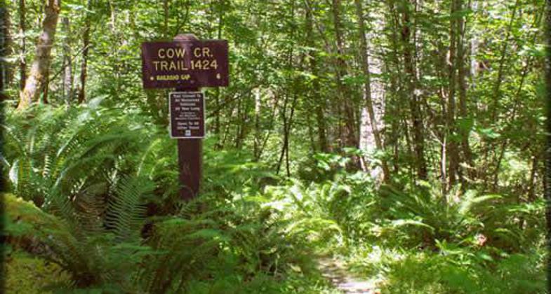
Cow Creek NRT
This information is a public record of the 1981 NRT application and may be out of date if it has not been updated by a trail manager --
check with the trail manager for updated details before visiting.
check with the trail manager for updated details before visiting.
Cow Creek NRT
USDA Forest Service
Backcountry Trail
- Length
6.5 miles
- Elevation Gain
--
- Route Type
out & back
- Length
6.5 miles - Elevation Gain
-- - Route Type
out & back
Cow Creek Trail is located with a 1300-acre, semi-private, non-motorized land allocation on the Umpqua National Forest.
Location: South Fork of Cow Creek
- States: Oregon
- Counties: Douglas, Jackson
The trail follows the South Fork of Cow Creek through an old-growth forest of primarily Douglas Fir and Western Hemlock. Be prepared to ford five stream crossings up to two feet deep in winter. Several types of ferns grow in wet areas along the trail and vine maples display a variety of colors in the fall. Use is low and opportunities for solitude and nature study are abundant.
Accessibility Information
No text provided.
Allowed Uses:
Bicycling Swimming Dogs, on leash Equestrian Hiking/WalkingOther Activities
- Camping
- Wildlife viewing / observation
Public Contact
Umpqua National Forest27812 Tiller Trail Hwy.
Tiller, OR 97484
[email protected] • (541) 825-3102
More Details
- Elevation (low): 2500
- Elevation (high): 4160
- Elevation (cumulative): --
- Part of a Trail System? No
- Surface (primary): Soil
- Surfaces (additional): Soil
- Tread Width (average): 24"
- Tread Width (minimum): --
- Running length (minimum): --
- Tread Grade (average, percent): 5
- Tread Grade (maximum): 15
- Running length (maximum): --
- Cross-slope (average, percent): --
- Cross-slope (maximum): --
- Running length (maximum): --
- Certified as an NRT
May 14, 1981