Cottonwood Trail
This information is a public record of the 1981 NRT application and may be out of date if it has not been updated by a trail manager --
check with the trail manager for updated details before visiting.
check with the trail manager for updated details before visiting.
Cottonwood Trail
U.S. Corps of Engineers
Backcountry Trail
- Length
1.5 miles
- Elevation Gain
--
- Route Type
out & back
- Length
1.5 miles - Elevation Gain
-- - Route Type
out & back
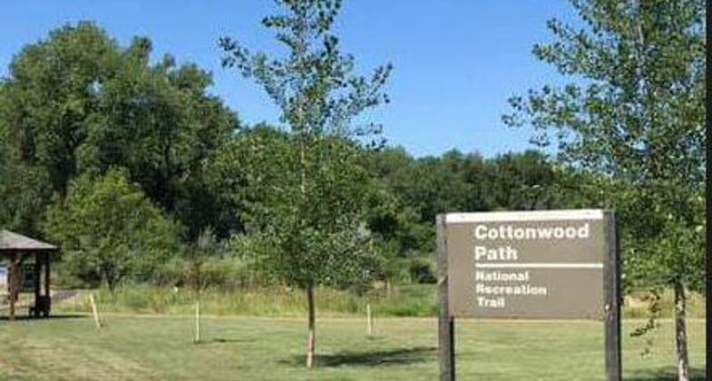
Location: 7 miles N of Pierre, located adjacent to Downstream Recreation Area
- States: South Dakota
- Counties: Stanley
interpretative nature walk in marsh, wetland area.
Accessibility Information
No text provided.
Allowed Uses:
Bicycling Swimming Dogs, on leash Hiking/Walking Snow, cross-country skiing Snow, snowshoeingOther Activities
- Snow, snow play general
- Wildlife viewing / observation
Public Contact
Russell SomsenUS Army Corps of Engineers
28563 Powerhouse Rd.
Pierre, SD 57501
[email protected] • (605) 224-5862
Contact the trail manager for current maps and visiting details.
More Details
- Elevation (low): --
- Elevation (high): --
- Elevation (cumulative): --
- Part of a Trail System? No
- Surface (primary): --
- Surfaces (additional): --
- Tread Width (average): 60"
- Tread Width (minimum): --
- Running length (minimum): --
- Tread Grade (average, percent): --
- Tread Grade (maximum):
- Running length (maximum): --
- Cross-slope (average, percent): --
- Cross-slope (maximum): --
- Running length (maximum): --
- Certified as an NRT
May 4, 1981