Cornelius Creek
check with the trail manager for updated details before visiting.
Cornelius Creek
USDA Forest Service
Backcountry Trail
- Length
2.9 miles
- Elevation Gain
--
- Route Type
out & back
(1 review)
- Length
2.9 miles - Elevation Gain
-- - Route Type
out & back
This trail begins at an elevation of 3300 feet on the Appalachian Trail, 1.5 miles south of FS Road 812 (Parkers Gap Road).
Location: Buchanan VA., east 7 miles on Rt 614.
- States: Virginia
- Counties: Botetourt
This trail begins at an elevation of 3,300 feet on the Appalachian Trail, 1.5 miles south of FS Road 812 (Parkers Gap Road). It descends steadily, following old logging roads. During its 2.9-mile northwesterly route to North Creek, the elevation drops to 1500 feet at its junction with FS Road 59 and Apple Orchard Falls Trail. From the end of the trail, follow FS 59 west for 4.5 miles to junction with Va. Route 614, then three miles to Interstate 81 (Exit 168).
Accessibility Information
No text provided.
Reviews
Joshua Kloehn
Great hike with mixed trail surfaces
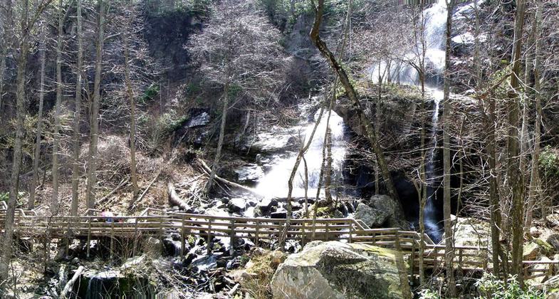
Starting from the AT, you get the rough and steep sections of this trail out of the way early on. I disliked the old logging road section, but as soon as you hit North Creek and follow it downhill as it meanders is this trail's bread and butter. The sights and sounds of the busy creek will keep you entertained. Part of a great loop hike.
Allowed Uses:
Dogs, on leash Hiking/WalkingOther Activities
- Camping
- Fishing
- Wildlife viewing / observation
Public Contact
Dave BenavitchGeorge Washington and Jefferson National Forests
P.O. Box 10
Natural Bridge Station, VA 24579
[email protected] • (540) 291-2188
www.fs.usda.gov/gwj
Contact the trail manager for current maps and visiting details.
More Details
- Elevation (low): 1500
- Elevation (high): 3250
- Elevation (cumulative): --
- Part of a Trail System? No
- Surface (primary): Soil
- Surfaces (additional): Soil
- Tread Width (average): 24"
- Tread Width (minimum): --
- Running length (minimum): --
- Tread Grade (average, percent): 9
- Tread Grade (maximum):
- Running length (maximum): --
- Cross-slope (average, percent): --
- Cross-slope (maximum): --
- Running length (maximum): --
- Certified as an NRT
Jan 11, 1981