Confluence Trail
check with the trail manager for updated details before visiting.
Confluence Trail
National Park Service
Urban Trail
- Length
1.6 miles
- Elevation Gain
--
- Route Type
Loop
- Length
1.6 miles - Elevation Gain
-- - Route Type
Loop
Fort Laramie's Confluence Trail offers a pleasant stroll along the shady banks of two waterways, The North Platte and the Laramie Rivers, as they near their confluence. The resulting riparian area has long offered shelter and valuable resources for people and wildlife for hundreds of years. The two rivers leave the last of the mountains and flow out onto the plains of Eastern Wyoming and down to Nebraska. The riparian band of vegetation offers a wide range of plant and wildlife habitats, much as it has throughout history.

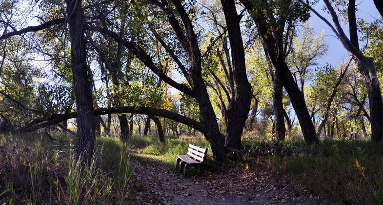
Trail and bench near rivers confluence.
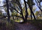
Trail near the Confluence
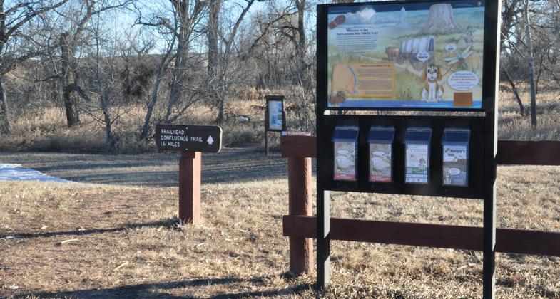
Trailhead
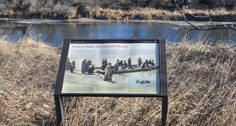
Wayside along trail
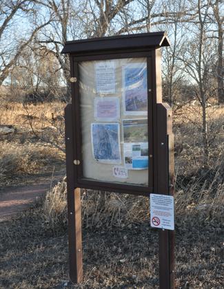
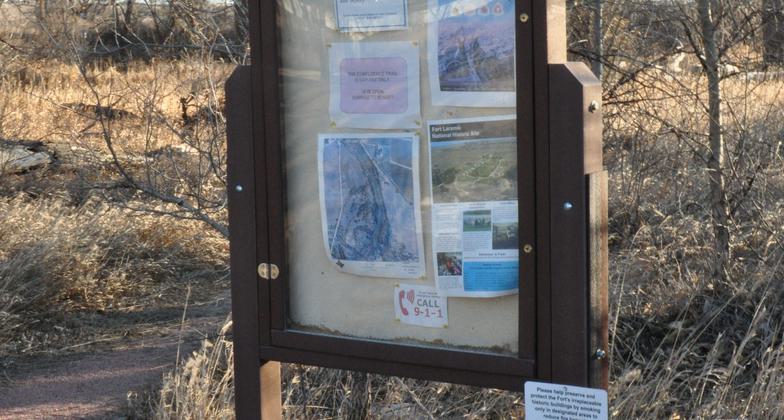
Bulletin board at the trailhead.
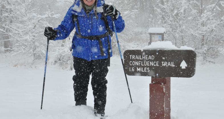
Cross-Country Skiing
Location: In Fort Laramie National Historic Site, near the town of Fort Laramie, Wyoming, at the Historic Army Iron Bridge.
- States: Wyoming
- Counties: Goshen
- Cities/Townships: T26N,R84W, Sec22&27
The Confluence Trail is within the Fort Laramie National Historic Site, where it offers public access for visitors and residents. It is also designated as a Kids in Parks, Track Trail. The presence of two major waterways supports a rich and diverse plant community known as a riparian area. Cottonwoods, Willows, and Ash trees dominate the lush woodlands along the banks of the North Platte and Laramie Rivers. The trail offers an easy stroll through the woods and grassy open areas as you make a loop down one river and up the other. Rivers corridors are geographically important because they offer natural places for wildlife and human shelter, food sources, water, and migration routes.
The area was an ideal location to build the original Fort William whose purpose was to trade with Native Americans. People have been living and moving up and down these rivers for at least 12,000 years. Just as wildlife such as Bison and Beaver have been here for thousands of years.
Before the building of reservoirs on both the Laramie and North Platte, these rivers flooded every year due to the melting snowpack in the higher elevations. Both have their headwaters high in the Colorado Rockies near the continental divide. These watersheds drain thousands of square miles of higher elevation, from the 4190' at the confluence up to over 12,500' near Walden, Colorado. In addition to the annual flooding, ice would wash down the river. These effects kept the channels wide and scoured clear of vegetation, the result being less abundant trees along the river banks. The only places where trees like cottonwoods could reach maturity were in protected areas where the high flows were slowed somewhat and less ice removed the seedlings that were growing in the backwaters much like where the Confluence Trail wanders. Perhaps the forest near the confluence is much the same as it was 300 years ago. Overall, there are many more trees and vegetation taking advantage of the moisture in the river bottoms of today than there were 300 years ago. Consider too, there are no longer large herds of Bison roaming the prairies like there were in the past. Another reason that there were fewer trees along the rivers in the 19 century, is that large horse herds owned by Native Americans and emigrants migrated along the banks. Cottonwood bark stripped from the tree trunks made good winter feed for horses and wood taken for the heating of army buildings.
Today's riparian band along waterways flowing across the prairies is a place of natural diversity. The woodland area still provides a refuge for much the same wildlife and aquatic life as what existed those 300 years ago. Birdwatchers find dozens of bird species, especially in the spring and fall migrations. Predators such as coyotes, bobcats, mountain lions, mink, and weasels are present to hunt for small rodents, squirrels, whitetail and mule deer, and the occasional wapiti. The park's animal species list is over 100 critters long. There are over 325 species of vascular plants as well as a dozen or so reptiles and amphibians. The trail provides access to fishing for game fish in both rivers. A Wyoming fishing license is required.
In addition to the chances of experiencing a new wildlife observation, hikers on the trail can get a sense of the history that took place in this very area. Native Americans lived in this river valley for thousands of years, mountain men traveled up and down the rivers in search of beaver pelts, Emigrants on their way to the goldfields of California and now lives in the west have camped in the shade of cottonwood trees just like the trees you can relax under today.
Accessibility Information
No text provided.
Allowed Uses:
Bicycling Dogs, on leash Hiking/Walking Snow, cross-country skiingOther Activities
- Fishing
- Heritage and history
- Snow, snow play general
- Wildlife viewing / observation
Public Contact
Mark DavisonNational Park Service
965 Grey Rocks Road
Fort Laramie, WY 82212
[email protected] • (307) 837-2221
Contact the trail manager for current maps and visiting details.
More Details
- Elevation (low): 4190
- Elevation (high): 4220
- Elevation (cumulative): --
- Part of a Trail System? No
- National Designations: Kids in Parks Program, Track Trail
- State Designations: None
- Surface (primary): Soil
- Surfaces (additional): Grass or Vegetation, Rock, crushed, Rock, smooth, Sand, Soil
- Tread Width (average): 62"
- Tread Width (minimum): 48
- Running length (minimum): --
- Tread Grade (average, percent): 1
- Tread Grade (maximum): 20
- Running length (maximum): --
- Cross-slope (average, percent): 0
- Cross-slope (maximum): --
- Running length (maximum): --
- Certified as an NRT
Jun 3, 2021