Comal River Water Trail
check with the trail manager for updated details before visiting.
Comal River Water Trail
City, Town, or County
National Water Trail
Water Trail (other)
- Length
1.5 miles
- Elevation Gain
--
- Route Type
out & back
- Length
1.5 miles - Elevation Gain
-- - Route Type
out & back
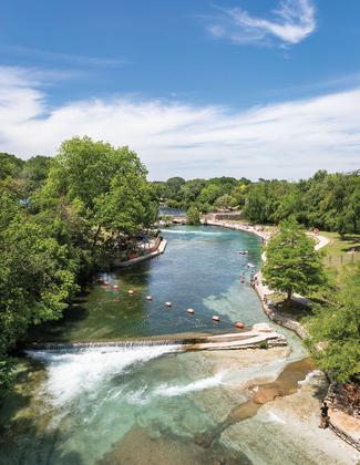
Flowing through the heart of New Braunfels, the Comal River Water Trail is 1.5 miles is recognized for being one of the best tubing rivers in Texas. The cool and clear spring-fed waters hail from the Edwards Aquifer and are home to multiple endangered species. You can find locals and visitors at the river trail year-round, taking advantage of the wide range of recreational opportunities. From tubing, to kayaking, to fishing and scuba diving, the Comal River Water Trail is a special place and leaves a lasting impression on everyone that visits.

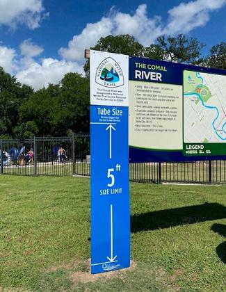
NWT Sign
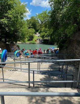
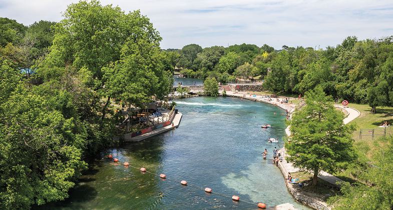
Summer Tubers at Last Exit
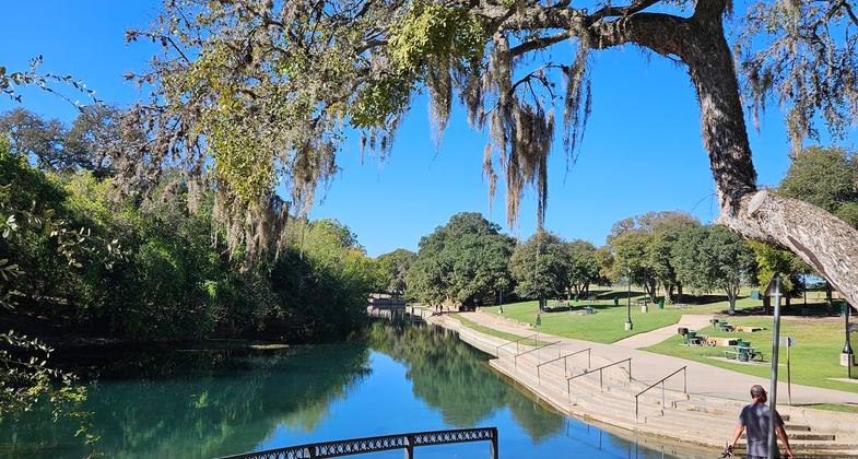
The Last Exit's new landing ramp and stairs
Looking up stream at the tube chute

Local residents sunbathing
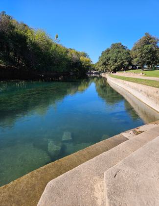
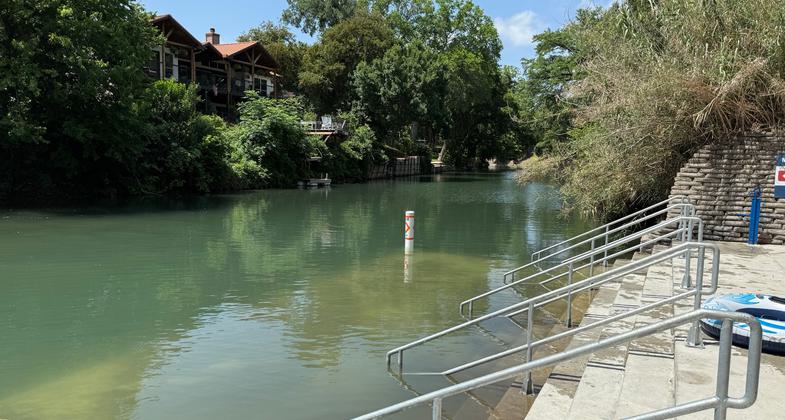
The Comal River Water Trail during off-season

The Comal River Water Trail during off-season


Location: The Comal River Water Trail consists of 1.5 miles of the Comal River that flows through historic, downtown New Braunfels. The trail begins in Hinman Island Park and ends at the Last Public Exit. The average float time is between 2-3 hours in a tube but varies due to river flow.
- States: Texas
- Counties: Comal
- Cities/Townships: New Braunfels
For the safety of guests, the City of New Braunfels closes their river access points when the Comal River is between 500-600 cfs. Check the current Comal River water data.
The Comal River has an extensive rich history in Texas as the center and soul of communities for centuries. The Comal springs and surrounding land were once inhabited by the Tonkawa people and varying indigenous tribes. Later the river was explored and received its present-day name by Spanish explorers, and in 1845, the German Prince Carl of Solms-Braunfels, established the historic town of New Braunfels. The town was able to develop and grow industrially by utilizing the abundant flow of the Comal for powering waterwheels and later for hydroelectricity to generate gristmills, flour mills and textile mills. Today the river is primarily used for recreation and as a haven for four endangered species. Locals enjoy the river year-round, and every summer roughly 300,000 - 400,000 visitors come to experience the beautiful Comal River. The Comal River Water Trail offers 1.5-miles of scenic water excursion through the heart of New Braunfels. With multiple rapids and the famous City Tube Chute, visitors are guaranteed to have a memorable time. The trail is known throughout Texas as one of the best rivers to float, and with the water staying a crisp 70-72 degrees year-round, the trail is a popular destination in the hot summer months. In addition to tubes, the trail also welcomes kayaks, canoes, and paddle boards. Visitors may also fish, snorkel and scuba dive on the trail. It may be the shortest navigable river in Texas, but it offers a fun, unique tubing experience and is suitable for all levels of experience to enjoy.
Accessibility Information
The City of New Braunfels is always striving to make improvements to accessibility across the city. This includes the Comal River, with plans in place to improve accessibility access through the Comal River Improvement Plan. Currently there are some accessible walkways around the Comal River trailhead but no established ADA access down and inside of the Comal River. Improvements to the Last Public Exit were completed in May 2025. These improvements include replacement of the bottom stairs, installation of an underwater landing, and enhanced ADA accessibility. These upgrades were designed to improve safety, ease of river exit, and inclusivity for all users including tubers, kayakers, and paddleboarders. The Last Public Exit as ADA accessible ramps that lead to the water’s edge, with plans in place to make entrance and exit to the river at that location fully accessible in the next few years.
Allowed Uses:
Bicycling Bicycling, electric Swimming Dogs, on leash Hiking/Walking Trail runningOther Activities
- Fishing
- Wildlife viewing / observation
- Other
Public Contact
Katie Johnson, River Operations SpecialistCity of New Braunfels
River and Watershed Division
424 S Castell Ave.
New Braunfels, TX 78130
[email protected] • 830-221-4000
More Details
- Elevation (low): 584
- Elevation (high): 596
- Elevation (cumulative): --
- Part of a Trail System? No
- Surface (primary): Water, slow moving
- Surfaces (additional): Paved, Grass or Vegetation, Water, rapids, Water, swift moving, Water, calm
- Tread Width (average): --"
- Tread Width (minimum): --
- Running length (minimum): --
- Tread Grade (average, percent): --
- Tread Grade (maximum):
- Running length (maximum): --
- Cross-slope (average, percent): --
- Cross-slope (maximum): --
- Running length (maximum): --
- Certified as an NRT
May 31, 2024