Clear Creek NRT
This information is a public record of the 1979 NRT application and may be out of date if it has not been updated by a trail manager --
check with the trail manager for updated details before visiting.
check with the trail manager for updated details before visiting.
Clear Creek NRT
USDA Forest Service
Backcountry Trail
- Length
22.5 miles
- Elevation Gain
--
- Route Type
out & back
- Length
22.5 miles - Elevation Gain
-- - Route Type
out & back
Location: In the Klamath NF, follows Clear Creek S from Youngs Peak. Go W on SR 96 from Happy Camp 10 mi. Turn in on Rd. 15N32.
- States: California
- Counties: Siskiyou
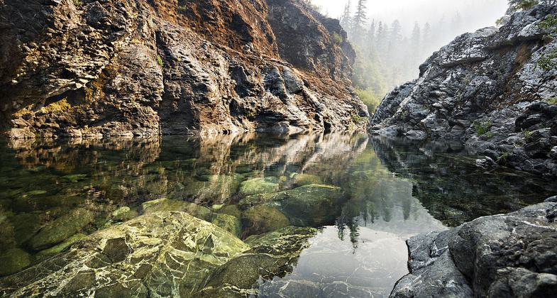
The Clear Creek NRT provides a North-South link through the center of the Siskiyou Wilderness. The trail starts at Youngs Valley to the north and follows along Clear Creek for 22 miles and provides access to great swimming and camping areas.
Accessibility Information
No text provided.
Allowed Uses:
Swimming Dogs, on leash Hiking/WalkingOther Activities
- Camping
- Fishing
Public Contact
Patrick GarrahanHappy Camp Ranger District
P.O. Box 377
Happy Camp, CA 96039
[email protected] • (503) 493-1718
Contact the trail manager for current maps and visiting details.
More Details
- Elevation (low): 3000
- Elevation (high): 5000
- Elevation (cumulative): --
- Part of a Trail System? No
- National Designations: National Forest Wilderness
- Surface (primary): Soil
- Surfaces (additional): Soil
- Tread Width (average): 24"
- Tread Width (minimum): --
- Running length (minimum): --
- Tread Grade (average, percent): 7
- Tread Grade (maximum): 15
- Running length (maximum): --
- Cross-slope (average, percent): --
- Cross-slope (maximum): --
- Running length (maximum): --
- Certified as an NRT
Nov 27, 1979