Cienega Nature Trail
check with the trail manager for updated details before visiting.
Cienega Nature Trail
USDA Forest Service
Backcountry Trail
- Length
0.2 miles
- Elevation Gain
--
- Route Type
Loop
- Length
0.2 miles - Elevation Gain
-- - Route Type
Loop
Beautiful, shady, cool and green are just a few words that recreationists have used to describe the Cienega Group Picnic area.
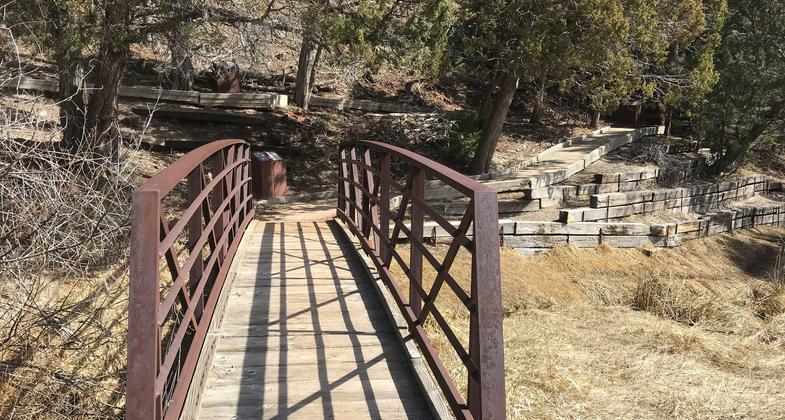
Photo by Pam Riches.

Photo by Pam Riches.
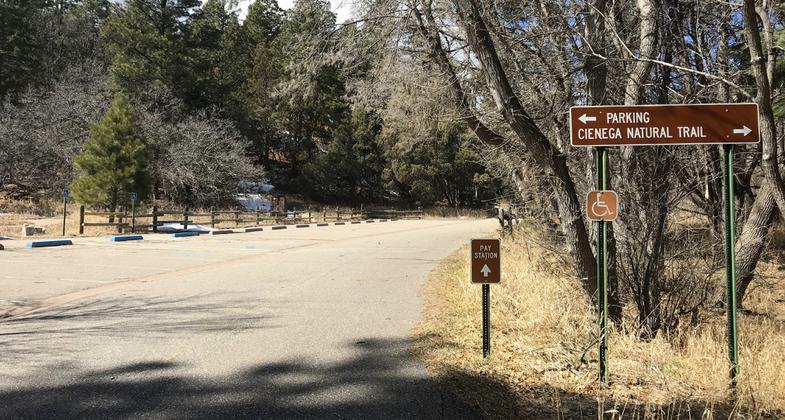
Parking Area. Photo by Pam Riches.

Abe the Abert's Squirrel. Photo by USFS.


Location: In Cibola National Forest at Cienaga Picnic Area, east side of Sandia Mountains.
- States: New Mexico
- Counties: Bernalillo
This is fairly flat, accessible, semi-private, and accommodates up to fifty people. There are grills, bear-proof trash containers, and vault toilets provided, and no shelter other than the surrounding shade trees. A stream, which draws birds and other wildlife, runs through the area.
Cienega sports an accessible interpretive trail/sidewalk that winds around the picnic site and provides a great learning experience for those who take the time to check it out. There is a patio near the beginning of the interpretive trail that is suitable for a wheelchair picnic. All you need is a folding table for everyone to gather around at mealtime.
Accessibility Information
No text provided.
Allowed Uses:
Hiking/WalkingPublic Contact
Cibola National Forest2113 Osuna Rd. NE
Albuquerque, NM 87112
Contact the trail manager for current maps and visiting details.
More Details
- Elevation (low): 7376
- Elevation (high): 7411
- Elevation (cumulative): --
- Part of a Trail System? No
- Surface (primary): Paved
- Surfaces (additional): --
- Tread Width (average): 0"
- Tread Width (minimum): --
- Running length (minimum): --
- Tread Grade (average, percent): --
- Tread Grade (maximum): 10
- Running length (maximum): --
- Cross-slope (average, percent): --
- Cross-slope (maximum): --
- Running length (maximum): --
- Certified as an NRT
Dec 17, 1978