Chupadera Wilderness Trail
check with the trail manager for updated details before visiting.
Chupadera Wilderness Trail
U.S. Fish and Wildlife Service
Backcountry Trail
- Length
9.5 miles
- Elevation Gain
--
- Route Type
out & back
- Length
9.5 miles - Elevation Gain
-- - Route Type
out & back
This long-distance trail offers hikers a wide range of experiences beginning at the trailhead in Chihuahuan Desert Scrub, traversing desert grasslands, and passing through several life zones before ending at the highest point on the 57,191 acre refuge with a 360 degree view of several features of central New Mexico.
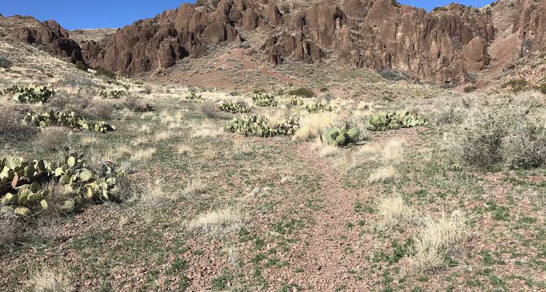
Heading west toward the red canyon. Photo by Pam Riches.

Summit looking east. Photo by Pam Riches.

Tunnel under I-25. Photo by Pam Riches.

Parking Area. Photo by Pam Riches.

Trailhead. Photo by Pam Riches.
Location: Bosque del Apache National Wildlife Refuge, At Bosque del Apache NWR south of Socorro.
- States: New Mexico
- Counties: Socorro
This long-distance trail offers hikers a wide range of experiences beginning at the trailhead in Chihuahuan Desert Scrub, traversing desert grasslands, and passing through several life zones before ending at the highest point on the 57,191-acre refuge with a 360-degree view of several features of central New Mexico. Elephant Butte Reservoir, The Magdalena Mountains, Ladrone Mountains, Sandia Mountains, Manzano Mountains, Oscura Mountains, San Andreas Mountains, and other features are too numerous to be mentioned and can be viewed in the panoramic view. Tracks of javelina, mule deer, rattlesnakes, and an occasional cougar may be found on the wilderness trail. Cactus and other wildflowers bloom in season. The canyon is a special geological formation of ancient volcanic activity. For much of its length, this trail traverses the Chupadera Wilderness area of the Bosque del Apache National Wildlife Refuge.
Accessibility Information
No text provided.
Allowed Uses:
Hiking/WalkingPublic Contact
Bosque del Apache National Wildlife Refuge1001 NM-1
San Antonio, NM 87832
(575) 835-1828
www.fws.gov/refuge/Bosque_del_Apache
Contact the trail manager for current maps and visiting details.
More Details
- Elevation (low): 4741
- Elevation (high): 6242
- Elevation (cumulative): --
- Part of a Trail System? No
- Surface (primary): Rock, crushed
- Surfaces (additional): Sand
- Tread Width (average): 24"
- Tread Width (minimum): --
- Running length (minimum): --
- Tread Grade (average, percent): --
- Tread Grade (maximum): 35
- Running length (maximum): --
- Cross-slope (average, percent): --
- Cross-slope (maximum): --
- Running length (maximum): --
- Certified as an NRT
May 31, 2008