Chinook Trail
check with the trail manager for updated details before visiting.
Chinook Trail
USDA Forest Service
Backcountry Trail
- Length
29 miles
- Elevation Gain
--
- Route Type
out & back
- Length
29 miles - Elevation Gain
-- - Route Type
out & back
The Moulton Falls to Bluff Mountain segment of the Chinook Trail is a twenty-nine mile long non-motorized trail that is the first completed segment of the 300-mile loop proposed around the rim of the Columbia River Gorge.
Location: Yacolt Burn State Forest
- States: Washington
- Counties: Clark
The Moulton Falls to Bluff Mountain segment of the Chinook Trail crosses several jurisdictions. Those segments occurring in Washington Department of Natural Resources and Clark County Washington lands are secured by Recreational easements. Of the 29 miles, only eight miles are situated on Forest Service-managed lands.
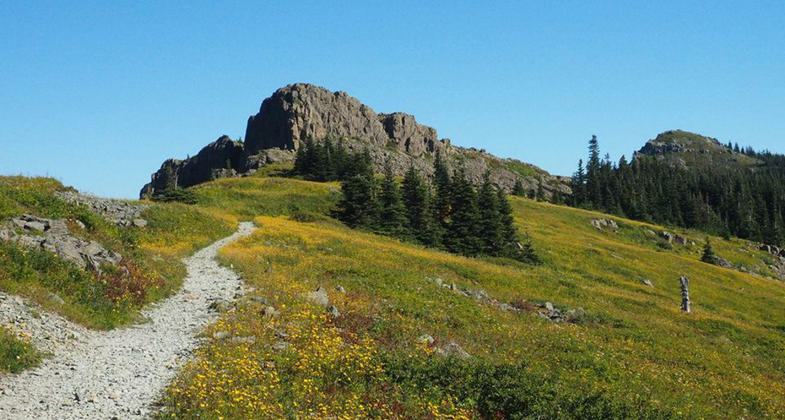
The trail goes from 500' elevation at Lucia Falls to 4390' at Bluff Mountain. The average grade of the trail is 7% with a maximum of 15%. Vegetation ranges from hemlock fir forest in the lower elevations to barren rocky slopes in the higher elevations. Outstanding views of the major volcanic peaks and Portland/Vancouver metropolitan areas are available in the higher open hillsides. The trail passes through a variety of settings, but is basically rural in nature, occurring in a roaded natural semi-primitive area.
Nine trailheads serve the trail along the 29 miles including five with toilets and water at county parks. The trail passes through state and private forest lands with a full range of management activities. Several heritage resource sites occur on National Forest lands in the vicinity of the trail but are not directly affected by the designation.
History:
The Chinook Trail Association was formed in 1988 and received 501c3 (nonprofit) status in 1989. The goal of the CTA is to see the 300-mile Chinook Trail planned and constructed. The founders envisioned the Chinook Trail would loop the Columbia River Gorge, at the rim top, wherever possible. Chinook Trail representatives were invited by the Forest Service to the Wind River Ranger District in 1990 to chart the proposed trail. USFS personnel from Wind River, Mt. Adams, and Mt. Hood Districts as well as Columbia River Gorge National Scenic Area, the Gifford Pinchot, and the Region Six office were in attendance. At the end of the day, the proposed Chinook Trail was a line on the map. The proposed trail is included in the Oregon State Parks Plan for the Columbia River Gorge, and the Interagency Committee for Outdoor Recreation's Trail Plan for the state of Washington.
Accessibility Information
No text provided.
Allowed Uses:
Bicycling Hiking/WalkingOther Activities
- Heritage and history
- Wildlife viewing / observation
Public Contact
Logan ForgeyChinook Trail Association
[email protected]
chinooktrails.org
Contact the trail manager for current maps and visiting details.
More Details
- Elevation (low): --
- Elevation (high): --
- Elevation (cumulative): --
- Part of a Trail System? No
- Surface (primary): Soil
- Surfaces (additional): --
- Tread Width (average): --"
- Tread Width (minimum): --
- Running length (minimum): --
- Tread Grade (average, percent): --
- Tread Grade (maximum):
- Running length (maximum): --
- Cross-slope (average, percent): --
- Cross-slope (maximum): --
- Running length (maximum): --
- Certified as an NRT
Feb 9, 2005