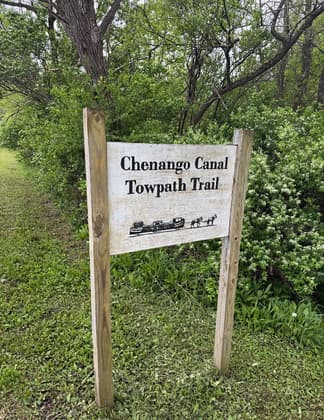
Chenango Canal Towpath Trail
check with the trail manager for updated details before visiting.
Chenango Canal Towpath Trail
Nonprofit
Frontcountry Trail
- Length
6 miles
- Elevation Gain
--
- Route Type
out & back
(3 reviews)
- Length
6 miles - Elevation Gain
-- - Route Type
out & back

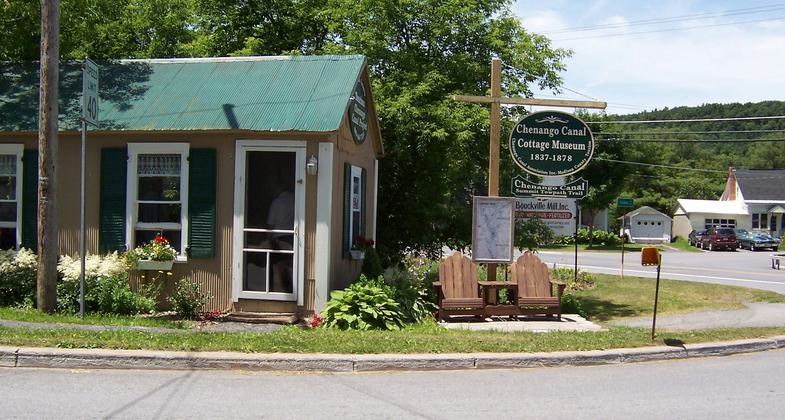
CCA Museum with historic photos and artifacts. Photo by Cottage Museum
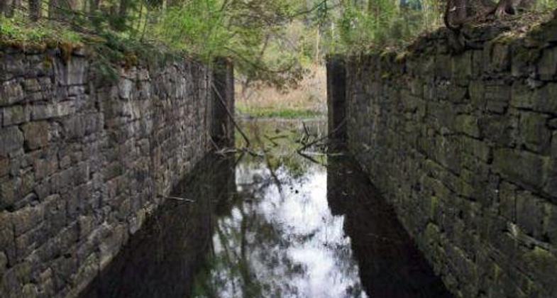
Lock 76 on the Chenango Canal (photo by Dick Gillette)
Chenago Cottage.


Location: From Bouckville to Elisha Payne Airport
- States: New York
- Counties: Madison
Low bridge! Everybody down! That phrase from the famous song about the Erie Canal applied equally to boats traveling the less well-known Chenango Canal, which opened in 1836, that connected the Erie Canal at Utica, NY, with the Susquehanna River at Binghamton, 97 miles to the south.
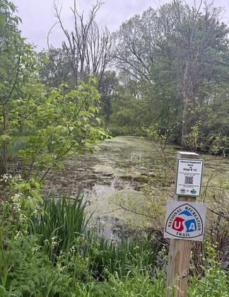
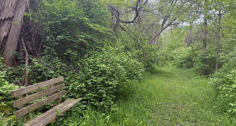
Today, 130 years after it was shut down, just one five-mile-long segment of the original canal, at the height of land (known as "the summit") in rural Madison County remains intact and carrying water. And along that historic stretch of canal, occupying the original towpath once plod by mules pulling canal boats, runs the Chenango Canal Towpath Trail. Easily accessible from U.S. Route 20 in Bouckville, where the Chenango Canal Association maintains a museum/visitor center during the warmer months, the level, 12-foot wide, the unpaved trail is ideal for walking, jogging, horseback riding, bicycling (when the surface is dry), and cross-country skiing. Three geocaching locations also are in place on it.
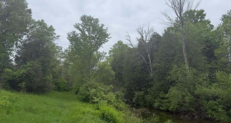
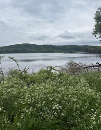
But the trail along the placid canal waters and adjacent Woodman Pond near its southern end invites visitors to tarry, observe the abundant birds and other wildlife, fish for trophy-sized trout, contemplate the marvel of the canal's construction, and even imagine the sights and sounds of boats heading for the locks that would lower them more than 700 feet to the Susquehanna.
The canal itself is a parallel water trail that can be explored by canoe or kayak launched from adjacent/crossing roads. The trail extends five miles southward from the remnants of an aqueduct that once carried the canal over Oriskany Creek (north of Bouckville), where the canal water now falls about four feet into that creek, to the south end of Woodman Pond, the site of the first lock of the descent to Binghamton, where the smaller West Branch Feeder Canal still enters from the west. From there, it follows the abandoned New York Ontario & Western Railroad bed for another mile toward the Village of Hamilton. Work already is underway to extend the trail for another three miles to Hamilton along this rail bed and another short, restorable section of the canal and towpath at the edge of the village.
Accessibility Information
No text provided.
Reviews
Patricia Ellis
Pretty walk by the canal
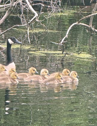
Hiked May 21, 2025. The northernmost couple of miles were narrow and not mowed; I used bug deterrent on my pants and socks to keep the ticks away. Beautiful buttercups were blooming everywhere. The southernmost miles were wider, mowed, and part asphalt. Almost all of it follows the canal, and I saw geese, ducks, deer, a muskrat, and cottontails. It was a pretty hike in the country. I didn’t mind the overgrown bits since the buttercups were so plentiful and pretty (and my bug deterrent worked).
James Berry
Chenango Canal Towpath Trail
Just walked part of this trail the other day with my dog. We both loved it. Yes, I carried a bag for him but he didn't leave his markings. Nonetheless, a delightful jaunt and close to home. Thank you for maintaining it!
Marion Haskins
Wonderful walking near Hamilton NY
This trail is well maintained and a joy to walk. We have walked this trail and just love it.
Allowed Uses:
Dogs, on leash Hiking/WalkingOther Activities
- Fishing
Public Contact
Diane Van SlykePO Box 125
Bouckville, NY 13310
[email protected] • (315) 893-7910
www.trails.chenangocanal.org
Contact the trail manager for current maps and visiting details.
More Details
- Elevation (low): 1340
- Elevation (high): 1350
- Elevation (cumulative): --
- Part of a Trail System? No
- Surface (primary): Grass or Vegetation
- Surfaces (additional): Grass or Vegetation
- Tread Width (average): 127"
- Tread Width (minimum): --
- Running length (minimum): --
- Tread Grade (average, percent): --
- Tread Grade (maximum): 3
- Running length (maximum): --
- Cross-slope (average, percent): --
- Cross-slope (maximum): --
- Running length (maximum): --
- Certified as an NRT
May 25, 2009