Chattahoochee River NRA Water Trail
check with the trail manager for updated details before visiting.
Chattahoochee River NRA Water Trail
National Park Service
National Water Trail
- Length
48 miles
- Elevation Gain
--
- Route Type
out & back
(1 review)
- Length
48 miles - Elevation Gain
-- - Route Type
out & back
A 48-mile water trail along the Chattahoochee River. The water trail is contained within the Chattahoochee River National Recreation Area that includes the river and certain adjoining lands in the State of Georgia from Buford Dam downstream to Peachtree Creek. The river remains a cool temperature year-round, rarely getting warmer than 50 degrees Fahrenheit. The Chattahoochee River is the southernmost trout stream in the US.
Chattahoochee Hidden Gem. Photo by Gwyneth Moody.

Rain or shine!. Photo by Cassie Coker.

Beautiful day on the Chattahoochee River. Photo by Keegan Donegan.


Waterfall Fun. Photo by Gwyneth Moody.

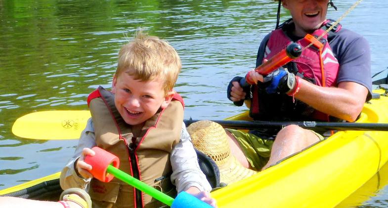
Water Trail Play Date. Photo by Gwyneth Moody.

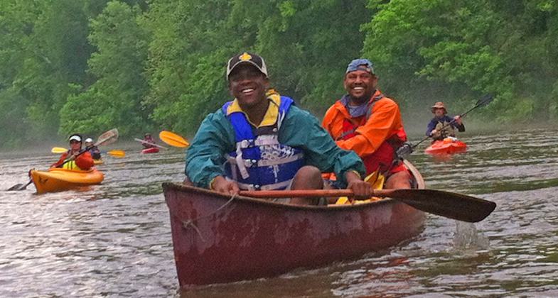
Paddle Georgia 2014. Photo by Gwyneth Moody.


Location: The Chattahoochee River National Recreation Area offers 48 miles of river trail available for raft, canoe, kayak, and motorboat use year round. The trail begins below Buford dam in Forsyth County to the take out at Powers Island/Paces Mill, metro Atlanta,
- States: Georgia
- Counties: Cobb, DeKalb, Forsyth, Fulton, Gwinnett
- Cities/Townships: Atlanta, Roswell, Duluth, Buford
The 48 miles of the Chattahoochee River National Recreation Area is available for raft, canoe, kayak, motor boat, and other small boat use year-round. Jet skis are not permitted at any time. The river remains a cool temperature year-round, rarely getting warmer than 50 degrees Fahrenheit. The river within the park is open for boating from 30 minutes before sunrise until 30 minutes after sunset. Night boating is not permitted in the park.
The river offers excellent opportunities for leisurely paddling a raft, canoe, or kayak to observe wildlife and wildflowers, do some fishing, or simply relaxing recreation.
On days when Buford Dam is not releasing water, the river below the dam is calm flat water with occasional class I/II shoals or rapids.
Even if you don't have your own boat to use, there is equipment available for rental. The Chattahoochee River National Recreation Area does not rent boats, however, there are several authorized outfitters that rent canoes, kayaks, rafts, and tubes for day use on the river.
The entire 48-mile-long corridor runs along the Brevard Fault Zone, which forms the Chattahoochee River channel. It forms, in part, the dividing line between two physiographic provinces: the Appalachian Mountains and the Piedmont Plateau. The mixed habitat types within the old and stable Chattahoochee River channel form a biological link with the Appalachian Mountains. This has resulted in high biodiversity within the adjacent park.
The park provides a scenic river corridor with opportunities for natural solitude and seclusion within relatively undisturbed forests, wetlands, bluffs, ravines, and open water areas.
To provide the public with information about the NRA, the park provides visitor contact stations staffed by rangers, a website, and a Chattahoochee River Guide that provides access to locations and natural and cultural resource information. Signage is present at trailheads, mile markers are visible on the river, and geographic signage is on bridges and crossings.
Flow rates and conditions and water quality status are provided through several partnerships that are available on different websites for public information.
Accessibility Information
No text provided.
Reviews
Don Pendergrast
Jewel in Atlanta
The Chattahoochee runs through Atlanta, and as a National Recreation River it is a remarkable place of relative wildness adjacent to the hustle and bustle of a major growing city. Any section provides a high quality river experience.
Allowed Uses:
Boating, motorized Boating, human-powered SwimmingOther Activities
- Fishing
- Wildlife viewing / observation
Public Contact
Ann HoniousChattahoochee River National Recreation Area
1978 Island Ford Parkway
Sandy Springs, GA 30350
[email protected] • (678) 538-1200
More Details
- Elevation (low): --
- Elevation (high): --
- Elevation (cumulative): --
- Part of a Trail System? No
- National Designations: National Recreation Area
- State Designations: GA Metropolitan River Protection Act (GA 12-5-440)
- Surface (primary): Water, slow moving
- Surfaces (additional): --
- Tread Width (average): 0"
- Tread Width (minimum): 0
- Running length (minimum): --
- Tread Grade (average, percent): --
- Tread Grade (maximum):
- Running length (maximum): --
- Cross-slope (average, percent): 0
- Cross-slope (maximum): --
- Running length (maximum): --
- Certified as an NRT
May 21, 2012