Central Arizona Project (CAP)Trail
check with the trail manager for updated details before visiting.
Central Arizona Project (CAP)Trail
City, Town, or County
- Length
8 miles
- Elevation Gain
--
- Route Type
out & back
- Length
8 miles - Elevation Gain
-- - Route Type
out & back
The CAP Trail is a regional trail that passes through both rural and urban areas. It is therefore both an urban trail/bikeway and a primitive, natural-surface shared-use trail.

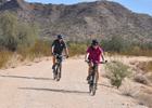
Cyclists enjoying the new segment of the CAP NRT. Photo by Charles Hofer.

Cyclists enjoying the new segment of the CAP NRT. Photo by Charles Hofer.

Family enjoying the new segment of the CAP. Photo by Charles Hofer.
Location: Eastern Pima County, AZ, west and northwest of the City of Tucson (Pima County segment); east of Interstate 10.
- States: Arizona
- Counties: Pima, Maricopa, Pinal, La Paz
As construction of the CAP began in 1973, the United States Bureau of Reclamation anticipated the development of a multi-use recreational trail along the entire length of the canal. Wherever possible, Reclamation acquired sufficient land and inset the fence 10 ft. to 20 ft from the property boundary to allow for a trail to be developed. Emphasis is focused on urban areas, particularly in those areas where the trail could be developed in conjunction with adjacent development.
In rural areas, the trail has been (and will be) constructed as a compacted earthen trail. In more urbanized areas, such as the Town of Marana and the western fringes of the City of Tucson, it will be constructed to the county's Divided Urban Pathway standard, which includes a 12-foot paved path and a nine-foot meandering natural surface trail.
Accessibility Information
No text provided.
Allowed Uses:
Hiking/WalkingPublic Contact
Sherrie BarfieldPima County Natural Resources, Parks & Recreatio
3500 W. River Rd.
Tucson, AZ 85741
[email protected] • (520) 877-6270
Contact the trail manager for current maps and visiting details.
More Details
- Elevation (low): --
- Elevation (high): --
- Elevation (cumulative): --
- Part of a Trail System? No
- State Designations: Arizona State Trail System and State Trails Plan
- Surface (primary): Paved
- Surfaces (additional): Paved
- Tread Width (average): 60"
- Tread Width (minimum): --
- Running length (minimum): --
- Tread Grade (average, percent): 5
- Tread Grade (maximum): 5
- Running length (maximum): --
- Cross-slope (average, percent): --
- Cross-slope (maximum): --
- Running length (maximum): --
- Certified as an NRT
Jun 4, 2003

